Old Maps of Middlebourne, West Virginia for Metal Detecting
Plan your next treasure hunt with 28 historic maps of Middlebourne. Find old homesites, ghost towns, trails, and gathering spots that may be lost to time — perfect for identifying promising metal detecting locations.
- Locate forgotten sites: Uncover places like long-lost settlements, abandoned rail lines, or gathering spots.
- Plan better hunts: Use map overlays combined with LiDAR or satellite views to narrow in on historically rich areas.
- Made for detectorists: Thousands of hobbyists use these maps to discover relics, coins, and hidden history.
Use these historic maps to boost your research and find new opportunities beneath the surface of Middlebourne.
Middlebourne, WV maps
(28)- 1905 Map of West Union
 1905 West Union1905 Print · USGSDoddridge and Tyler Counties come to life at the turn of the century as the railroad and river define the local economy. Genealogists can trace family footprints near Josephs Mills, The Jug, and the early post offices at Little PO and Centerville Alma PO.2 unique versions available
 - 1906 Map of New Martinsville
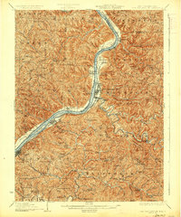
 1906 New Martinsville1906 Print · USGSThe Ohio River valley at the turn of the century shows a landscape of busy rail lines and riverside towns. You can trace the Baltimore and Ohio railroad through Sistersville or locate early industrial sites like Winders Mill and Porters Falls.2 unique versions available
 - 1924 Map of New Martinsville, 1956 Print
 1924 New Martinsville1956 Print · USGSThe Ohio River valley in the early twenties reveals a landscape of busy rail corridors and riverfront towns. Genealogists can locate family names and rural landmarks from Winders Mill to dozens of country schoolhouses like Democracy School and Wayne School.2 unique versions available
 - 1924 Map of West Union, 1961 Print
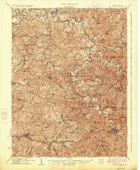
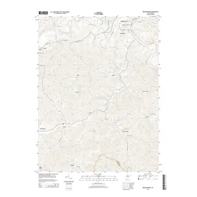
 1924 West Union1961 Print · USGSThe hills of Tyler and Doddridge Counties are shown here during the mid-twenties, centered on the winding Middle Island Creek and the busy rail corridor. Genealogists can trace family landmarks like Mole Hill, Josephs Mills, and dozens of local schools from Rising Sun to Chestnut Grove.
 - 1926 Map of New Martinsville
 1926 New Martinsville1926 Print · USGSThe Ohio River valley in the mid-1920s reveals a bustling corridor of rail and river commerce connecting New Martinsville and Sistersville. Genealogists can trace hundreds of rural landmarks, from the County Infirmary to isolated hill schools like Rothlisberger School and Sugar Valley School.2 unique versions available
 - 1926 Map of West Union
 1926 West Union1926 Print · USGSDoddridge and Tyler counties are captured here in the mid-1920s, showing a landscape of ridge-top farms and creek-bottom settlements. You can trace the Baltimore and Ohio rail line or locate ancestral sites like Josephs Mills, Mole Hill, and Rising Sun School.3 unique versions available
 - 1949 Map of Clarksburg
 1949 Clarksburg1949 Print · USGSThe upper Ohio River valley and the industrial heart of West Virginia come into focus during this post-war period. Genealogists and researchers can trace the rail corridors of the Baltimore and Ohio and locate centers like Fairmont, Grafton, and Waynesburg.
 - 1956 Map of Clarksburg, 1966 Print
 1956 Clarksburg1966 Print · USGSThe Ohio River valley and the industrial heart of West Virginia are seen here in the mid-1950s as rail and river commerce thrived. Researchers can trace historic transport lines like the Baltimore and Ohio RR and locate ancestral homes in Clarksburg, Moundsville, or Parkersburg.2 unique versions available
 - 1960 Map of Paden City, 1961 Print
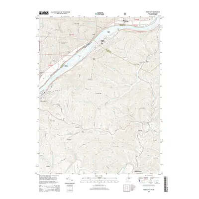
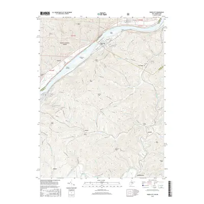
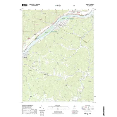
 1960 Paden City1961 Print · USGSThe Ohio River valley thrives in the early sixties as a hub of industry and rail. Genealogists can trace family roots at Kidwell Ch, Stender Cem, and the riverfront communities of Paden City and Sistersville.4 unique versions available
 - 1960 Map of Middlebourne, 1962 Print
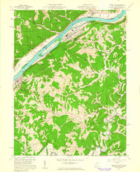
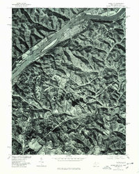
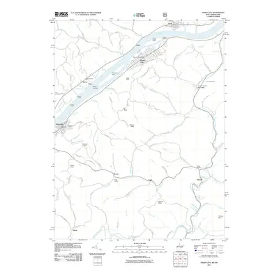
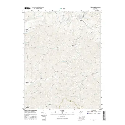
 1960 Middlebourne1962 Print · USGSThe Tyler County hillsides and the sharp oxbows of Middle Island Creek are captured here in the early sixties. Genealogists can trace family roots through numerous upland burial sites like Archers Chapel Cem and the settlement at Bearsville.2 unique versions available
 - 1961 Map of Clarksburg
 1961 Clarksburg1961 Print · USGSThe mid-century industrial and river landscapes of West Virginia and Ohio are detailed here, centered on the Ohio River. Researchers can trace the Baltimore and Ohio rail lines connecting towns like Parkersburg, Clarksburg, and Monongah.
 - 1976 Map of Paden City, 1979 Print
 1976 Paden City1979 Print · USGSThe riverfront between West Virginia and Ohio is captured here during the mid-seventies, showing the density of Paden City along the banks. Genealogists and historians can trace property lines and river access near Sardis and Middle Island Creek.
 - 1976 Map of Middlebourne, 1979 Print
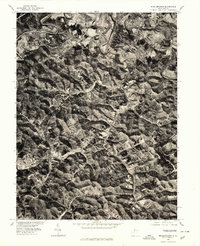 1976 Middlebourne1979 Print · USGSMiddlebourne and the surrounding Tyler County hills appear in sharp photographic detail during the mid-seventies. Local researchers can trace the course of Middle Island Creek and examine the layout of Middlebourne and Wick at this specific moment in time.
 - 1982 Map of Clarksburg, 1983 Print
 1982 Clarksburg1983 Print · USGSNorth Central West Virginia in the early eighties reveals a landscape deeply connected to its coal and gas resources. Genealogists and researchers can trace family landmarks and historical settlements from Clarksburg to Buckhannon, or locate sites like Quiet Dell and Watters Smith Memorial State Park.
 - 1984 Map of Moundsville
 1984 Moundsville1984 Print · USGSThe Ohio River valley and the Appalachian interior meet in the mid-eighties as a hub of rail and river commerce. Genealogists and historians can trace the development of river towns like New Martinsville, inland hubs like Waynesburg, and the path of the B & O RR.
 - 1988 Map of Clarksburg, 1989 Print
 1988 Clarksburg1989 Print · USGSThe central Appalachians are documented in detail during the late eighties, showing the industrial and river-based economies of West Virginia, Ohio, and Pennsylvania. Researchers can trace historic rail routes like the B & O RR and locate river towns from St Marys to Parkersburg.
 - 1994 Map of Paden City, 1998 Print
 1994 Paden City1998 Print · USGSThe Ohio River valley and its industrial rail corridor are captured here during the 1990s as the region balanced manufacturing and conservation. Researchers can trace family history through sites like Locust Grove Cem, Paden Fork Chapel, and the riverside town of Sistersville.
 - 2002 Map of Paden City, 2006 Print
 2002 Paden City2006 Print · USGSThe Ohio River valley and its surrounding ridges come into focus here at the start of the 2000s, showing the intersection of river-bound industry and deep-hollow settlements. Genealogists can trace family sites at Van Camp Cem, Locust Grove Ch, and the riverside town of Sistersville.
 - 2011 Map of Middlebourne, 2011 Print
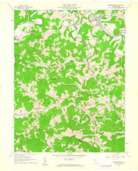
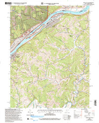
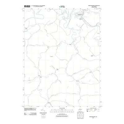 2011 Middlebourne2011 Print · USGSCovers Middlebourne, including Locke, McKim, and other nearby areas
 - 2011 Map of Paden City, 2011 Print
 2011 Paden City2011 Print · USGSCovers Middlebourne, including Sistersville, Van Camp, and other nearby areas
 - 2014 Map of Middlebourne, 2014 Print
 2014 Middlebourne2014 Print · USGSCovers Middlebourne, including Locke, McKim, and other nearby areas
 - 2014 Map of Paden City, 2014 Print
 2014 Paden City2014 Print · USGSCovers Middlebourne, including Sistersville, Van Camp, and other nearby areas
 - 2016 Map of Paden City, 2016 Print
 2016 Paden City2016 Print · USGSCovers Middlebourne, including Sistersville, Van Camp, and other nearby areas
 - 2016 Map of Middlebourne, 2016 Print
 2016 Middlebourne2016 Print · USGSCovers Middlebourne, including Locke, McKim, and other nearby areas
 - 2019 Map of Paden City, 2019 Print
 2019 Paden City2019 Print · USGSCovers Middlebourne, including Sistersville, Van Camp, and other nearby areas
Showing maps 1-25 of 28
Top cities near Middlebourne
- New Martinsville historical maps
- Grandview historical maps
- Sistersville historical maps
- Pennsboro historical maps
- New Matamoras historical maps
- West Union historical maps
See more
Frequently asked questions
- What are the different types of historical maps available for Middlebourne?
- What is the oldest map of Middlebourne?
- Where can I purchase historical maps of Middlebourne for my home or office?
- Where can I download high-res historical maps of Middlebourne?
- Are there historical topographic maps available for Middlebourne?
- Is there historical aerial imagery available for Middlebourne?
- Where are historical maps of Middlebourne sourced from?