Old Maps of Sunnyside, West Virginia for Genealogy
Trace your family roots with 15 historic maps of Sunnyside. These high-res maps reveal old neighborhoods, homesites, landmarks, and streets — helping you uncover where your ancestors lived and how the area evolved over time.
- Explore historic neighborhoods: Identify where your relatives may have lived in the 1800s or 1900s.
- Compare maps over time: Trace the changes in streets, buildings, and landmarks for multi-generational research.
- Perfect for genealogy & ancestry research: Used by family historians and researchers to map out lineage and migration.
These maps are an incredible resource for exploring your personal connection to Sunnyside's past.
Sunnyside, WV maps
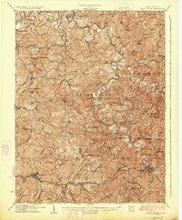
(15)- 1905 Map of West Union
 1905 West Union1905 Print · USGSDoddridge and Tyler Counties come to life at the turn of the century as the railroad and river define the local economy. Genealogists can trace family footprints near Josephs Mills, The Jug, and the early post offices at Little PO and Centerville Alma PO.2 unique versions available
 - 1924 Map of West Union, 1961 Print
 1924 West Union1961 Print · USGSThe hills of Tyler and Doddridge Counties are shown here during the mid-twenties, centered on the winding Middle Island Creek and the busy rail corridor. Genealogists can trace family landmarks like Mole Hill, Josephs Mills, and dozens of local schools from Rising Sun to Chestnut Grove.
 - 1926 Map of West Union
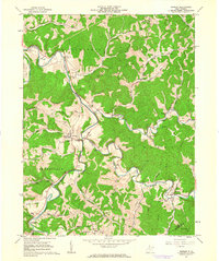
 1926 West Union1926 Print · USGSDoddridge and Tyler counties are captured here in the mid-1920s, showing a landscape of ridge-top farms and creek-bottom settlements. You can trace the Baltimore and Ohio rail line or locate ancestral sites like Josephs Mills, Mole Hill, and Rising Sun School.3 unique versions available
 - 1949 Map of Clarksburg
 1949 Clarksburg1949 Print · USGSThe upper Ohio River valley and the industrial heart of West Virginia come into focus during this post-war period. Genealogists and researchers can trace the rail corridors of the Baltimore and Ohio and locate centers like Fairmont, Grafton, and Waynesburg.
 - 1956 Map of Clarksburg, 1966 Print
 1956 Clarksburg1966 Print · USGSThe Ohio River valley and the industrial heart of West Virginia are seen here in the mid-1950s as rail and river commerce thrived. Researchers can trace historic transport lines like the Baltimore and Ohio RR and locate ancestral homes in Clarksburg, Moundsville, or Parkersburg.2 unique versions available
 - 1961 Map of Clarksburg
 1961 Clarksburg1961 Print · USGSThe mid-century industrial and river landscapes of West Virginia and Ohio are detailed here, centered on the Ohio River. Researchers can trace the Baltimore and Ohio rail lines connecting towns like Parkersburg, Clarksburg, and Monongah.
 - 1961 Map of Shirley, 1963 Print
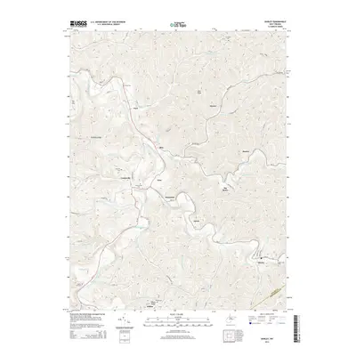
 1961 Shirley1963 Print · USGSTyler County’s winding river valleys are documented here in the early sixties, showing the rural life and energy infrastructure of the period. Researchers can trace family sites from Centerville to Shirley, finding details like Riggs Chapel, Underwood Cem, and local gas wells.3 unique versions available
 - 1976 Map of Shirley, 1979 Print
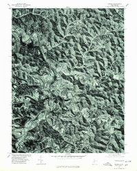 1976 Shirley1979 Print · USGSMid-1970s Tyler County is captured in this detailed orthophoto study of the West Virginia landscape. Genealogists and local historians can trace the rural layouts of Centerville and Shirley along the winding banks of Middle Island Creek.
 - 1982 Map of Clarksburg, 1983 Print
 1982 Clarksburg1983 Print · USGSNorth Central West Virginia in the early eighties reveals a landscape deeply connected to its coal and gas resources. Genealogists and researchers can trace family landmarks and historical settlements from Clarksburg to Buckhannon, or locate sites like Quiet Dell and Watters Smith Memorial State Park.
 - 1988 Map of Clarksburg, 1989 Print
 1988 Clarksburg1989 Print · USGSThe central Appalachians are documented in detail during the late eighties, showing the industrial and river-based economies of West Virginia, Ohio, and Pennsylvania. Researchers can trace historic rail routes like the B & O RR and locate river towns from St Marys to Parkersburg.
 - 2011 Map of Shirley, 2011 Print
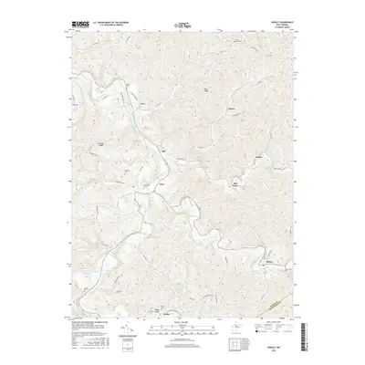
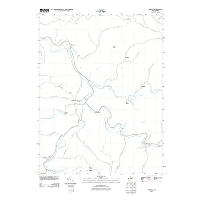 2011 Shirley2011 Print · USGSCovers Sunnyside, including Frew, Tyler, and other nearby areas
 - 2014 Map of Shirley, 2014 Print
 2014 Shirley2014 Print · USGSCovers Sunnyside, including Frew, Tyler, and other nearby areas
 - 2016 Map of Shirley, 2016 Print
 2016 Shirley2016 Print · USGSCovers Sunnyside, including Frew, Tyler, and other nearby areas
 - 2019 Map of Shirley, 2019 Print
 2019 Shirley2019 Print · USGSCovers Sunnyside, including Frew, Tyler, and other nearby areas
 - 2023 Map of Shirley, 2023 Print
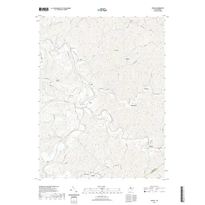
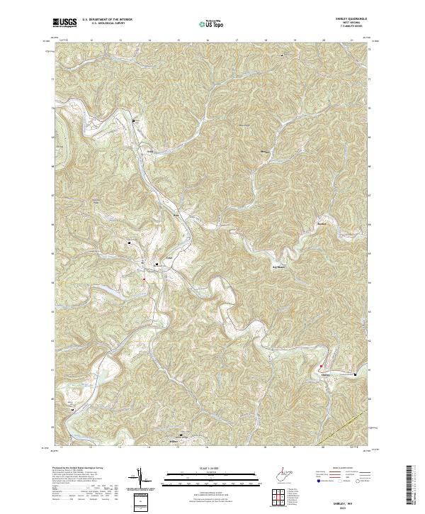 2023 Shirley2023 Print · USGSThe rural valleys of Tyler County are shown in great detail during this contemporary era, as the landscape remains defined by its winding creeks and ridge-top roads. Researchers can trace ancestral locations through several documented burial grounds like Beechwood Cem and Mount Nebo Cem, or locate landmarks such as Big Moses and The Jug.
End of results
Showing maps 1-15 of 15
Top cities near Sunnyside
- New Martinsville historical maps
- Harrisville historical maps
- Sistersville historical maps
- Pennsboro historical maps
- Middlebourne historical maps
- West Union historical maps
See more
Frequently asked questions
- What are the different types of historical maps available for Sunnyside?
- What is the oldest map of Sunnyside?
- Where can I purchase historical maps of Sunnyside for my home or office?
- Where can I download high-res historical maps of Sunnyside?
- Are there historical topographic maps available for Sunnyside?
- Is there historical aerial imagery available for Sunnyside?
- Where are historical maps of Sunnyside sourced from?