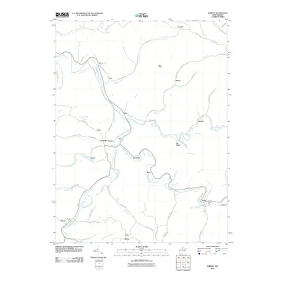
2011 Map of Shirley
USGS Topo · Published 2011About this map
Middle Island Creek and McElroy Creek wind through this part of Tyler County, defining a landscape shaped by narrow valleys and numerous small settlements. Small villages such as Shirley, Centerville, Tyler, and Wilbur are connected by a network of winding county roads that follow the natural contours of the creek beds. The presence of the Shirley Post Office near Doe Run and several family-named burial grounds, including Pierpont Cemetery and Smith Cemetery, indicates a long-settled rural community with deep genealogical roots.
Find a feature on this map
75 named features on this map. Tap any name to fly to it.
Don’t see what you’re looking for? This feature index may not catch every label — zoom into the map to look around manually.
Map Details
Editions of this 2011 Shirley Map
This is the sole edition of this map. No revisions or reprints were ever made.
Other maps of this area

1903 · Littleton
USGS Topo · 1:62,500

1905 · Centerpoint
USGS Topo · 1:62,500

1905 · West Union
USGS Topo · 1:62,500

1905 · Littleton
USGS Topo · 1:62,500

1906 · New Martinsville
USGS Topo · 1:62,500

1924 · New Martinsville
USGS Topo · 1:62,500

1924 · Centerpoint
USGS Topo · 1:62,500

1924 · Littleton
USGS Topo · 1:62,500

1924 · West Union
USGS Topo · 1:62,500

1925 · Centerpoint
USGS Topo · 1:62,500