1900s (20th Century) Maps of Webster County, West Virginia
Explore 56 historic maps of Webster County from the 1900s (20th Century). These maps offer a rare glimpse into what life looked like during the 1900s — showing old roads, neighborhoods, homes, and landmarks that have changed or disappeared over time.
Whether you're researching your family's past, planning a metal detecting trip, or studying how Webster County's landscape evolved across the 1900s, these high-resolution maps are a powerful tool for exploring the history of this region.
- Focus on a specific era: All maps on this page are from the 1900s, giving you a focused view of this time period.
- See what’s changed: Compare century-old streets, trails, and buildings to today's modern landscape using overlays and satellite layers.
- Research with precision: Use these maps for genealogy, historical research, land use analysis, or educational projects.
- View, download, or print: Maps are fully viewable online in high resolution, and can be downloaded or printed for your own records.
Start exploring Webster County's history through authentic maps from the 1900s. This is your window into the past.
Webster County, WV maps
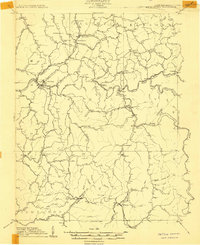
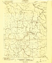
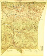
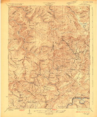
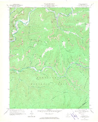
(56)- 1901 Map of Nicholas
 1901 Nicholas1901 Print · USGSCentral West Virginia's river valleys and high ridges are shown here at the turn of the century as the timber industry expanded. Genealogists can trace family landmarks and river crossings like Camden on Gauley, Wainville P.O., and Bays Ferry Ford.3 unique versions available
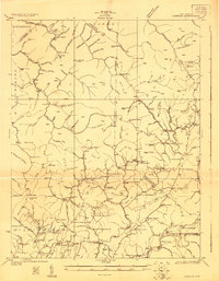
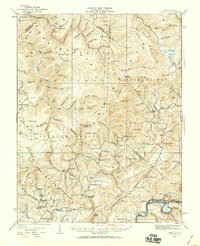
 - 1908 Map of Sutton
 1908 Sutton1908 Print · USGSSutton and the surrounding river valleys are captured at the height of the early twentieth-century rail era. Genealogists and historians can trace defunct mountain post offices and rail stops like Hyer PO, Tesla, and Bakers Run PO along the Baltimore and Ohio Railroad.2 unique versions available
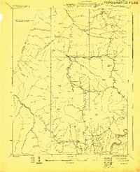
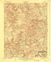
 - 1910 Map of Sutton Special
 1910 Sutton Special1910 Print · USGSCentral West Virginia at the end of the first decade of the 1900s shows a landscape transformed by river-valley railroads. Genealogists can trace family roots through hillside settlements like Flatwoods and Centralia or locate early post offices at Gillespie Hyer PO and Bakers Run Levi PO.3 unique versions available
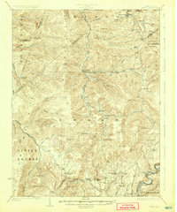
 - 1913 Map of Hacker Valley
 1913 Hacker Valley1913 Print · USGSWest Virginia's high-country settlements come to life in this early twentieth-century survey of the rugged Elk River headwaters. Researchers can trace the original locations of rural landmarks like Buckwheat Church, Windy Gap School, and the remote Salt Lick Settlement.2 unique versions available
 - 1913 Map of Pickens
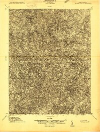
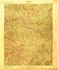
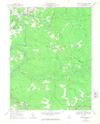
 1913 Pickens1913 Print · USGSRandolph and Webster counties are shown here just before the Great War, during a peak era for mountain logging and rail expansion. Researchers can trace the routes of the Pickens and Hacker Valley RR and find local landmarks like Palace Valley, Lewis School, and Big Laurel Thicket.4 unique versions available
 - 1915 Map of Webster Springs
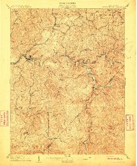
 1915 Webster Springs1915 Print · USGSWebster County at the start of the Great War was a landscape of high ridges and deep river valleys. Genealogists and historians can trace old homesteads and mountain schoolhouses like Redoak School and Cherry Falls School along the banks of the Elk River.3 unique versions available
 - 1915 Map of Cowen
 1915 Cowen1915 Print · USGSCentral West Virginia's timber and coal corridors are captured here during a period of rapid development. Trace ancestral roots at Marcus PO or Woodbine PO, and locate long-lost rural sites like the Cottle Glade School and Myspi Church.3 unique versions available
 - 1915 Map of Hacker Valley
 1915 Hacker Valley1915 Print · USGSThe high ridges of Webster and Lewis counties are captured here in the years before the Great War, showing a landscape of isolated mountain settlements and rail-driven timber hubs. Genealogists can trace family footprints at Salisbury Sta Removal PO, Cleveland, and nearly a dozen rural schoolhouses like Snuffville School.4 unique versions available
 - 1915 Map of Pickens
 1915 Pickens1915 Print · USGSWest Virginia's highland timber country comes into focus during the early twentieth century as logging railroads began to penetrate the deep hollows. Trace the history of mountain settlements and schools like Helvetia, Pickens, and the Haslebacher School amidst the ridges of Beech Mountain.4 unique versions available
 - 1917 Map of Cowen
 1917 Cowen1917 Print · USGSThe central West Virginia highlands are shown here just after the peak of the early industrial era, when rail lines and timber camps dominated the river valleys. Genealogists can locate dozens of country schoolhouses like Reynolds School and trace long-lost post offices at Halo Sta Marcus PO or Cranberry Woodbine PO.3 unique versions available
 - 1918 Map of Webster Springs
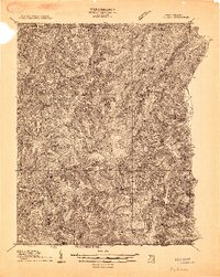
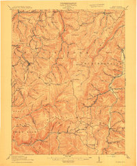
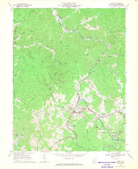
 1918 Webster Springs1918 Print · USGSThe West Virginia highlands are shown in detail during the height of the early twentieth-century timber boom. Researchers can trace historic transport lines like the Virginia and West Virginia RR and locate early community centers like Webster Springs (Addison) and St. Michael School.4 unique versions available
 - 1923 Map of Lobelia
 1923 Lobelia1923 Print · USGSGreenbrier and Pocahontas Counties are shown in the early 1920s as mountain farming and timber harvesting shaped the landscape. Researchers can trace dozens of rural institutions, from Ellis Chapel and Band of Hope Church to remote schools like West Droop School.2 unique versions available
 - 1923 Map of Mingo
 1923 Mingo1923 Print · USGSThe West Virginia highlands are shown in detail during the early twenties, highlighting the region's timber-driven economy and remote mountain enclaves. Genealogists can locate family-named schools and churches like Hannah School, Marys Chapel, and West Union Church along the winding Lumber RR.2 unique versions available
 - 1925 Map of Mingo
 1925 Mingo1925 Print · USGSPocahontas County at the headwaters of the Greenbrier is seen here in the mid-twenties, a landscape of high ridges and isolated mountain valleys. Researchers can locate dozens of early rural schools like Yewglade School and churches such as Marys Chapel or Poage Chapel.4 unique versions available
 - 1925 Map of Lobelia
 1925 Lobelia1925 Print · USGSThe mountains and wetlands of Greenbrier County are captured here in the mid-1920s, showing a landscape of high ridges and rural valley settlements. Trace old family sites and mountain outposts like Lobelia, Trout Valley, and the Cranberry Glades.2 unique versions available
 - 1935 Map of Lobelia, 1959 Print
 1935 Lobelia1959 Print · USGSThe Greenbrier County backcountry is shown in the mid-1930s, just as the regional forest service infrastructure was expanding. Genealogists and historians can trace numerous rural schoolhouses and churches, from Beulah Church to the Baldwin School and the remote Trout PO.2 unique versions available
 - 1939 Map of Lobelia
 1939 Lobelia1939 Print · USGSGreenbrier and Pocahontas counties appear here in the years before the war, characterized by high mountain plateaus and a dense network of rural schoolhouses. Researchers can trace family roots through sites like Rockcamp Cem, Bethel Church, and the Trout Valley Trout Post Office.2 unique versions available
 - 1954 Map of Charleston
 1954 Charleston1954 Print · USGSWest Virginia’s industrial heart and mountain highlands are captured here during the mid-fifties, centered on the capital city. Researchers can trace historic river-and-rail corridors along the Kanawha River and locate remote peaks within the Monongahela National Forest.
 - 1957 Map of Charleston, 1966 Print
 1957 Charleston1966 Print · USGSMid-century West Virginia unfolds along the industrial Kanawha River valley and into the high Allegheny Mountains. Genealogists and historians can trace the vital rail lines of the Chesapeake and Ohio and locate riverside settlements from Saint Albans to Buckhannon.3 unique versions available
 - 1958 Map of Charleston
 1958 Charleston1958 Print · USGSMid-century West Virginia is defined here by the industrial corridor of the Kanawha River and the high ridges of the Allegheny Mountains. Researchers can trace the rail networks of the New York Central or locate remote highland communities like Pickens and Hillsboro.
 - 1961 Map of Charleston
 1961 Charleston1961 Print · USGSWest Virginia's capital region and the highlands to the east are shown in detail during the early sixties. Genealogists and historians can trace rail networks like the Baltimore and Ohio RR and find early state parks such as Watoga State Park.
 - 1966 Map of Tioga
 1966 Tioga1966 Print · USGSThe coal and timber country of Nicholas County is documented here during the mid-1960s as industrial rail lines moved through the hollows. Researchers can trace the Baltimore and Ohio rail route past Tioga to find local landmarks like Walnut Grove Chapel and the Boggs Cem.3 unique versions available
 - 1966 Map of Bergoo, 1970 Print
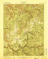
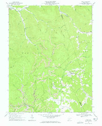
 1966 Bergoo1970 Print · USGSThe coal and timber country of Webster County is shown here in the mid-1960s, a landscape defined by deep valleys and high-ridge extraction. Researchers can trace the rail networks of the Baltimore and Ohio through Jerryville and locate specific sites like Pleasant Grove Ch.2 unique versions available
 - 1966 Map of Camden on Gauley, 1970 Print
 1966 Camden on Gauley1970 Print · USGSThe mid-sixties saw the Nicholas and Webster County line defined by the river-and-rail economies of the Gauley River. Genealogists can locate family landmarks like Anderson Sch and Williams Cem, while tracing industrial sites like the Strip Mine Tipple.3 unique versions available
 - 1966 Map of Cowen, 1970 Print
 1966 Cowen1970 Print · USGSMid-century Webster County life centers on the rail-to-river network during a time of industrial shifts and forest conservation. Researchers can trace the Baltimore and Ohio line through Cowen or locate family sites like Handschumacher Cem and Halo Ch.2 unique versions available
Showing maps 1-25 of 56
Top cities of Webster County
Frequently asked questions
- What are the different types of historical maps available for Webster County?
- What is the oldest map of Webster County?
- Where can I purchase historical maps of Webster County for my home or office?
- Where can I download high-res historical maps of Webster County?
- Are there historical topographic maps available for Webster County?
- Is there historical aerial imagery available for Webster County?
- Where are historical maps of Webster County sourced from?