1960s Maps of Webster County, West Virginia
Explore 16 historic maps of Webster County from the 1960s. These maps offer a rare glimpse into what life looked like during the 1960s — showing old roads, neighborhoods, homes, and landmarks that have changed or disappeared over time.
Whether you're researching your family's past, planning a metal detecting trip, or studying how Webster County's landscape evolved across the 1960s, these high-resolution maps are a powerful tool for exploring the history of this region.
- Focus on a specific era: All maps on this page are from the 1960s, giving you a focused view of this time period.
- See what’s changed: Compare century-old streets, trails, and buildings to today's modern landscape using overlays and satellite layers.
- Research with precision: Use these maps for genealogy, historical research, land use analysis, or educational projects.
- View, download, or print: Maps are fully viewable online in high resolution, and can be downloaded or printed for your own records.
Start exploring Webster County's history through authentic maps from the 1960s. This is your window into the past.
Webster County, WV maps
(16)- 1961 Map of Charleston
 1961 Charleston1961 Print · USGSWest Virginia's capital region and the highlands to the east are shown in detail during the early sixties. Genealogists and historians can trace rail networks like the Baltimore and Ohio RR and find early state parks such as Watoga State Park.
 - 1966 Map of Tioga
 1966 Tioga1966 Print · USGSThe coal and timber country of Nicholas County is documented here during the mid-1960s as industrial rail lines moved through the hollows. Researchers can trace the Baltimore and Ohio rail route past Tioga to find local landmarks like Walnut Grove Chapel and the Boggs Cem.3 unique versions available
 - 1966 Map of Bergoo, 1970 Print
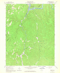
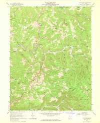
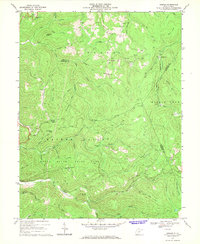
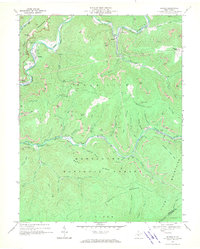 1966 Bergoo1970 Print · USGSThe coal and timber country of Webster County is shown here in the mid-1960s, a landscape defined by deep valleys and high-ridge extraction. Researchers can trace the rail networks of the Baltimore and Ohio through Jerryville and locate specific sites like Pleasant Grove Ch.2 unique versions available
 - 1966 Map of Camden on Gauley, 1970 Print
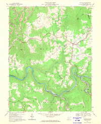
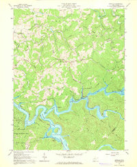
 1966 Camden on Gauley1970 Print · USGSThe mid-sixties saw the Nicholas and Webster County line defined by the river-and-rail economies of the Gauley River. Genealogists can locate family landmarks like Anderson Sch and Williams Cem, while tracing industrial sites like the Strip Mine Tipple.3 unique versions available
 - 1966 Map of Cowen, 1970 Print
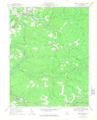
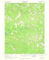
 1966 Cowen1970 Print · USGSMid-century Webster County life centers on the rail-to-river network during a time of industrial shifts and forest conservation. Researchers can trace the Baltimore and Ohio line through Cowen or locate family sites like Handschumacher Cem and Halo Ch.2 unique versions available
 - 1966 Map of Webster Springs, 1970 Print
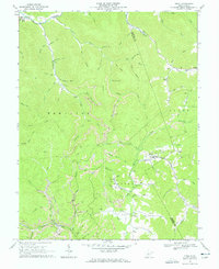
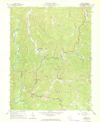
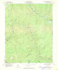
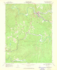 1966 Webster Springs1970 Print · USGSWebster County in the mid-1960s was a rugged network of riverfront settlements and mountain coal operations. Genealogists and historians can trace the Baltimore and Ohio rail lines and locate landmarks like Camp Caesar, Skidmore Crossing, and Pleasant Ridge Ch.2 unique versions available
 - 1966 Map of Craigsville, 1970 Print
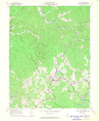
 1966 Craigsville1970 Print · USGSNicholas County settlements and coal works are captured here in the mid-1960s as the Gauley River valley transitioned. Genealogists and researchers can trace family-named sites like Mullens Cem, explore the Baltimore and Ohio rail line, and locate the old Beaver Sch.2 unique versions available
 - 1967 Map of Hacker Valley, 1968 Print
 1967 Hacker Valley1968 Print · USGSHacker Valley and the surrounding Webster County hills appear in the late 1960s just as the Sutton Lake project influenced the drainage. Local historians can trace family locations near Chestnut Grove Ch, the settlement of Cleveland, and landmarks like Courthouse Rock.2 unique versions available
 - 1967 Map of Erbacon, 1968 Print
 1967 Erbacon1968 Print · USGSThe Elk River valley in the late sixties reveals a landscape of isolated mountain settlements and winding rail lines. Researchers can trace the Baltimore and Ohio railroad corridor through Erbacon and Prestonia, or locate landmarks like the Cleveland Sch and Centralia Cem.2 unique versions available
 - 1967 Map of Skelt, 1968 Print
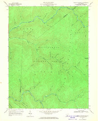
 1967 Skelt1968 Print · USGSThe high country of Webster County is captured here in the late sixties, showing a landscape of timber and coal near the Holly River. Researchers can trace old family sites and mountain routes through Skelt, Bernardstown, and Point Mountain Ch.2 unique versions available
 - 1967 Map of Newville, 1968 Print
 1967 Newville1968 Print · USGSThe rising waters of the Elk River valley take center stage in the late 1960s as the newly created Sutton Lake transforms the Braxton County landscape. Researchers can trace family sites like Hammer Cem and Kniceley Cem or locate old community centers like Stone Run Ch.3 unique versions available
 - 1967 Map of Diana, 1968 Print
 1967 Diana1968 Print · USGSThe high ridges of Webster County are captured here in the late sixties, showing the isolated mountain communities of Diana and Hacker Valley. Genealogists and hikers can trace historical sites like Clifton Ford Cem, Mt Zion Ch, and the many runs feeding the Right Fork Holly River.3 unique versions available
 - 1967 Map of Little Birch, 1968 Print
 1967 Little Birch1968 Print · USGSBraxton and Nicholas counties are captured here in the late sixties, showing a landscape of winding river valleys and narrow ridges. Researchers can trace rural life through sites like Crites Mtn Sch, Tesla, and several historic cemeteries.2 unique versions available
 - 1967 Map of Goshen, 1969 Print
 1967 Goshen1969 Print · USGSUpshur, Webster, and Randolph counties meet in this 1960s survey of the high Allegheny Plateau, where timber and gas extraction shaped the mountain landscape. Researchers can locate remote family burial sites like Gregory Cem, the Pleasant Hill Ch, and the waterfalls of Holly River State Park.3 unique versions available
 - 1967 Map of Webster Springs SE, 1970 Print
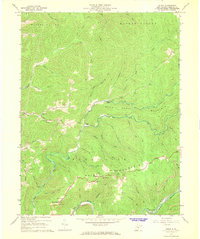
 1967 Webster Springs SE1970 Print · USGSThe high wilderness of the Allegheny Mountains in the late sixties is mapped here in detail across the Webster and Pocahontas county line. Hikers and historians can trace the remote waterways of Hell For Certain Branch and find early backcountry landmarks like the Tumbling Rock Camping Shelter.3 unique versions available
 - 1967 Map of Webster Springs SW, 1970 Print
 1967 Webster Springs SW1970 Print · USGSWest Virginia's high forest country comes alive in this late 1960s survey of the river forks and mountain ridges. Researchers can trace historic access points and landmarks like the Mills Mtn Ch, Red Oak Knob lookout, and the Cranberry Campground.3 unique versions available
End of results
Showing maps 1-16 of 16
Top cities of Webster County
Frequently asked questions
- What are the different types of historical maps available for Webster County?
- What is the oldest map of Webster County?
- Where can I purchase historical maps of Webster County for my home or office?
- Where can I download high-res historical maps of Webster County?
- Are there historical topographic maps available for Webster County?
- Is there historical aerial imagery available for Webster County?
- Where are historical maps of Webster County sourced from?