Old Maps of Dorrtown, West Virginia for Academic Research
Study the evolution of Dorrtown with 16 high-resolution historic maps. Whether you're teaching, researching, or modeling changes in land use, these maps provide essential visual documentation of urban, environmental, and geographic change.
- Analyze long-term change: Track patterns in development, transportation, and natural features.
- Ideal for environmental or urban studies: Support academic projects with primary historical map data.
- Use in the classroom or lab: Educators and researchers rely on these maps to bring historical context to life.
These maps are a powerful tool for teaching, research, and visualizing how Dorrtown has changed over the decades.
Dorrtown, WV maps
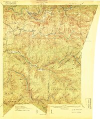
(16)- 1891 Map of Huntersville
 1891 Huntersville1891 Print · USGSPocahontas County in the 1890s is a land of steep ridges and early river settlements before the arrival of modern highways. Researchers can trace ancestral locations along the Greenbrier River, identifying early sites like Hillsboro Academy P.O. and Marlinton.
 - 1894 Map of Huntersville
 1894 Huntersville1894 Print · USGSPocahontas and Webster counties are captured in the late nineteenth century as a network of mountain settlements and river headwaters. Researchers can trace old mountain homesteads and community sites like Hillsboro Academy, Hunter Place, and Aylmer.5 unique versions available
 - 1915 Map of Webster Springs
 1915 Webster Springs1915 Print · USGSWebster County at the start of the Great War was a landscape of high ridges and deep river valleys. Genealogists and historians can trace old homesteads and mountain schoolhouses like Redoak School and Cherry Falls School along the banks of the Elk River.3 unique versions available
 - 1918 Map of Webster Springs
 1918 Webster Springs1918 Print · USGSThe West Virginia highlands are shown in detail during the height of the early twentieth-century timber boom. Researchers can trace historic transport lines like the Virginia and West Virginia RR and locate early community centers like Webster Springs (Addison) and St. Michael School.4 unique versions available
 - 1954 Map of Charleston
 1954 Charleston1954 Print · USGSWest Virginia’s industrial heart and mountain highlands are captured here during the mid-fifties, centered on the capital city. Researchers can trace historic river-and-rail corridors along the Kanawha River and locate remote peaks within the Monongahela National Forest.
 - 1957 Map of Charleston, 1966 Print
 1957 Charleston1966 Print · USGSMid-century West Virginia unfolds along the industrial Kanawha River valley and into the high Allegheny Mountains. Genealogists and historians can trace the vital rail lines of the Chesapeake and Ohio and locate riverside settlements from Saint Albans to Buckhannon.3 unique versions available
 - 1958 Map of Charleston
 1958 Charleston1958 Print · USGSMid-century West Virginia is defined here by the industrial corridor of the Kanawha River and the high ridges of the Allegheny Mountains. Researchers can trace the rail networks of the New York Central or locate remote highland communities like Pickens and Hillsboro.
 - 1961 Map of Charleston
 1961 Charleston1961 Print · USGSWest Virginia's capital region and the highlands to the east are shown in detail during the early sixties. Genealogists and historians can trace rail networks like the Baltimore and Ohio RR and find early state parks such as Watoga State Park.
 - 1966 Map of Webster Springs, 1970 Print
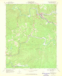 1966 Webster Springs1970 Print · USGSWebster County in the mid-1960s was a rugged network of riverfront settlements and mountain coal operations. Genealogists and historians can trace the Baltimore and Ohio rail lines and locate landmarks like Camp Caesar, Skidmore Crossing, and Pleasant Ridge Ch.2 unique versions available
 - 1979 Map of Marlinton, 1982 Print
 1979 Marlinton1982 Print · USGSThe West Virginia highlands are shown in detail during the late seventies, featuring the dense rail networks and mountain towns of the Allegheny range. Researchers can trace family roots through sites like Buckeye Cem, Mount Nebo Ch, and the lumber and coal hubs of Richwood and Rainelle.
 - 1995 Map of Webster Springs, 1998 Print
 1995 Webster Springs1998 Print · USGSWebster Springs and the surrounding mountain ridges are shown during the mid-1990s as the regional coal and timber industries continued to shape the land. Researchers can locate family landmarks like Lynch Point Cemetery, the Skidmore Crossing on the Elk, and the grounds of Camp Caesar.
 - 2011 Map of Webster Springs, 2011 Print
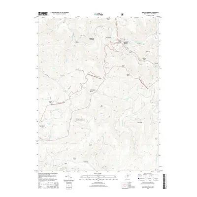
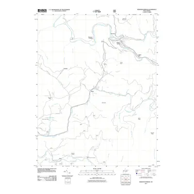 2011 Webster Springs2011 Print · USGSCovers Dorrtown, including Webster Springs, Addison (Webster Springs), and other nearby areas
 - 2014 Map of Webster Springs, 2014 Print
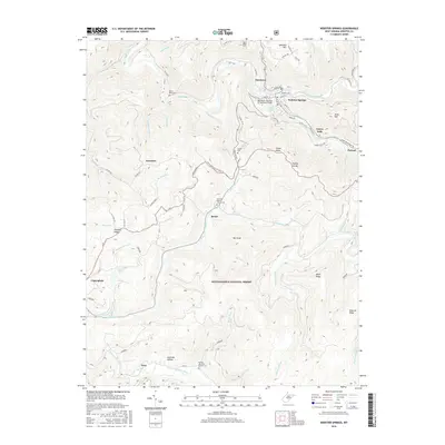
 2014 Webster Springs2014 Print · USGSCovers Dorrtown, including Webster Springs, Addison (Webster Springs), and other nearby areas
 - 2016 Map of Webster Springs, 2016 Print
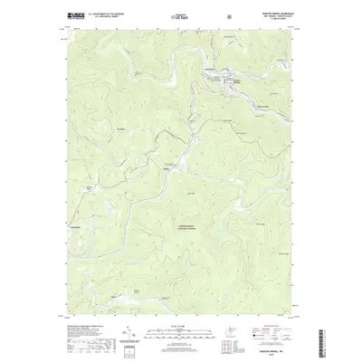
 2016 Webster Springs2016 Print · USGSCovers Dorrtown, including Webster Springs, Addison (Webster Springs), and other nearby areas
 - 2019 Map of Webster Springs, 2019 Print
 2019 Webster Springs2019 Print · USGSCovers Dorrtown, including Webster Springs, Addison (Webster Springs), and other nearby areas
 - 2023 Map of Webster Springs, 2023 Print
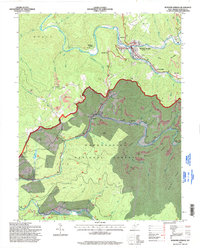
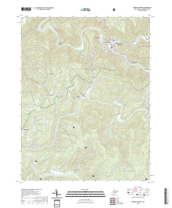 2023 Webster Springs2023 Print · USGSWebster County in the 2020s remains a landscape defined by its high ridges and the winding valleys of the Elk and Gauley rivers. Genealogists can trace family connections at Sand Run Baptist Church and Lynch Point Cem, or locate landmarks like the Webster County Courthouse.
End of results
Showing maps 1-16 of 16
Top cities near Dorrtown
- Addison (Webster Springs) historical maps
- Webster Springs historical maps
- Cowen historical maps
- Pickens historical maps
Frequently asked questions
- What are the different types of historical maps available for Dorrtown?
- What is the oldest map of Dorrtown?
- Where can I purchase historical maps of Dorrtown for my home or office?
- Where can I download high-res historical maps of Dorrtown?
- Are there historical topographic maps available for Dorrtown?
- Is there historical aerial imagery available for Dorrtown?
- Where are historical maps of Dorrtown sourced from?