Old Maps of Wetzel County, West Virginia for Hiking & Exploration
Hike through history with 112 historic maps of Wetzel County. Explore old trails, ghost towns, and forgotten backroads — perfect for outdoor adventurers and local explorers.
- Rediscover forgotten places: Map out old mining camps, roads, and footpaths that no longer exist on modern maps.
- Layer with modern tools: Combine with LiDAR or satellite views to plan hikes through historical terrain.
- Made for exploration: Popular among hikers, overlanders, and local history lovers.
Use these maps to find adventure and explore the hidden past of Wetzel County.
Wetzel County, WV maps
(112)- 1902 Map of Clarksburg
 1902 Clarksburg1902 Print · USGSNorth-central West Virginia at the opening of the twentieth century was a bustling network of river-towns and turnpikes. Genealogists can trace family roots through coal-and-rail hubs like Shinnston and Lumberport or rural landmarks such as Sturms Mill and Pinnickinnick Mt.3 unique versions available
 - 1903 Map of Littleton
 1903 Littleton1903 Print · USGSThe West Virginia and Pennsylvania borderlands appear here at the turn of the century, marked by deep ridges and creek-side settlements. Trace the path of the B. and O. R. R. as it connects Littleton to outlying hamlets like Wileyville and Burchfield.
 - 1905 Map of Mannington
 1905 Mannington1905 Print · USGSThe West Virginia-Pennsylvania borderlands are captured here at the start of the twentieth century, showing a landscape defined by deep ridges and rail-side commerce. Genealogists can trace family roots through locations like Hundred Church, Wadestown, and Brave P.O. along the state line.2 unique versions available
 - 1905 Map of Centerpoint
 1905 Centerpoint1905 Print · USGSWest Virginia's heartland at the peak of the railroad era is meticulously charted here, revealing a dense network of ridge-top settlements and valley post offices. Trace the paths of the Baltimore and Ohio RR through Salem and locate lost landmarks like Eagle Mills, Jockeycamp, and Big Battle.3 unique versions available
 - 1905 Map of Littleton
 1905 Littleton1905 Print · USGSWetzel County and the surrounding borderlands appear here in the early twentieth century, showing a landscape defined by steep ridges and rail corridors. Researchers can trace the B and O RR through Littleton or find small settlements like Saint Joseph and Silver Hill.2 unique versions available
 - 1906 Map of New Martinsville
 1906 New Martinsville1906 Print · USGSThe Ohio River valley at the turn of the century shows a landscape of busy rail lines and riverside towns. You can trace the Baltimore and Ohio railroad through Sistersville or locate early industrial sites like Winders Mill and Porters Falls.2 unique versions available
 - 1910 Map of Clarksburg, 1920 Print
 1910 Clarksburg1920 Print · USGSClay County at the dawn of the twentieth century was a landscape of river-bend railroads and high mountain hollows. Genealogists can trace family footprints through rural post offices like Angeline PO, valley schools such as Triplett School, and rail stops at Dundon and Clay Courthouse Station.
 - 1923 Map of Mannington, 1956 Print
 1923 Mannington1956 Print · USGSMannington and the surrounding hollows of Marion and Monongalia counties appear here in the early twenties as a dense network of rural life. Genealogists can trace family footprints through numerous small landmarks like Blackshire Chapel, Efaw Knob, and Glover Gap.
 - 1923 Map of Clarksburg, 1959 Print
 1923 Clarksburg1959 Print · USGSHarrison and Marion counties appear in the 1920s as a landscape of coal mines and mountain schoolhouses. Trace family roots at Bethel Church or Annabelle, and locate old industrial sites like Cook Mine and Straus Mill along the rivers.
 - 1924 Map of New Martinsville, 1956 Print
 1924 New Martinsville1956 Print · USGSThe Ohio River valley in the early twenties reveals a landscape of busy rail corridors and riverfront towns. Genealogists can locate family names and rural landmarks from Winders Mill to dozens of country schoolhouses like Democracy School and Wayne School.2 unique versions available
 - 1924 Map of Centerpoint, 1957 Print
 1924 Centerpoint1957 Print · USGSDoddridge and Harrison counties are shown here in the mid-1920s, when small-town life revolved around the railroad and local schoolhouses. Genealogists can locate family homesteads near landmarks like Alvy P O Stringtown, Smithton Smithburg Sta, and Fairview Church.2 unique versions available
 - 1924 Map of Littleton, 1957 Print
 1924 Littleton1957 Print · USGSWetzel County at the height of the rail era shows a landscape densely packed with small-town life and rural industry. Genealogists can trace family names and locations at Scheidler Run Church, Otter Den School, and along the Baltimore and Ohio line.
 - 1925 Map of Clarksburg
 1925 Clarksburg1925 Print · USGSHarrison County in the mid-twenties is a bustling corridor of coal mining and rail activity centered on the West Fork River. Genealogists can trace family roots through dozens of named rural schools like Lower Davisson Run School or locate vanished industrial sites like Ocean Mine and Sturms Mill.3 unique versions available
 - 1925 Map of Centerpoint
 1925 Centerpoint1925 Print · USGSDoddridge and Harrison counties are shown here in the mid-1920s, highlighting a landscape of deep hollows and ridge-top farms. Researchers can trace the Baltimore and Ohio rail line through Salem or find small rural landmarks like Victory Church and Lima PO.4 unique versions available
 - 1926 Map of Littleton
 1926 Littleton1926 Print · USGSWetzel County in the mid-twenties is a landscape of high ridges and deep hollows where community life centered on countless rural schools and churches. Trace family roots and vanished landmarks from Saint Joseph down to Smithfield, including Higgins Chapel and Antioch School.2 unique versions available
 - 1926 Map of New Martinsville
 1926 New Martinsville1926 Print · USGSThe Ohio River valley in the mid-1920s reveals a bustling corridor of rail and river commerce connecting New Martinsville and Sistersville. Genealogists can trace hundreds of rural landmarks, from the County Infirmary to isolated hill schools like Rothlisberger School and Sugar Valley School.2 unique versions available
 - 1926 Map of Mannington
 1926 Mannington1926 Print · USGSNorthern West Virginia and the Pennsylvania borderlands are shown here in the 1920s during a period of steady rural growth. Genealogists can trace family names through dozens of upland sites like Saint Cloud, Glover Gap, and the uniquely named The Little Red Church.2 unique versions available
 - 1949 Map of Clarksburg
 1949 Clarksburg1949 Print · USGSThe upper Ohio River valley and the industrial heart of West Virginia come into focus during this post-war period. Genealogists and researchers can trace the rail corridors of the Baltimore and Ohio and locate centers like Fairmont, Grafton, and Waynesburg.
 - 1956 Map of Clarksburg, 1966 Print
 1956 Clarksburg1966 Print · USGSThe Ohio River valley and the industrial heart of West Virginia are seen here in the mid-1950s as rail and river commerce thrived. Researchers can trace historic transport lines like the Baltimore and Ohio RR and locate ancestral homes in Clarksburg, Moundsville, or Parkersburg.2 unique versions available
 - 1958 Map of Hundred, 1960 Print
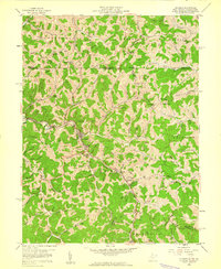 1958 Hundred1960 Print · USGSWetzel County ridge country is captured in the late fifties as the BALTIMORE AND OHIO railroad follows Fish Creek through the hills. Researchers can locate family landmarks such as the Stottlemire Sch, Cusicks Crossing, and the Old Harmony Cemetery.3 unique versions available
 - 1960 Map of Paden City, 1961 Print
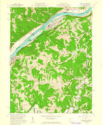 1960 Paden City1961 Print · USGSThe Ohio River valley thrives in the early sixties as a hub of industry and rail. Genealogists can trace family roots at Kidwell Ch, Stender Cem, and the riverfront communities of Paden City and Sistersville.4 unique versions available
 - 1960 Map of Glover Gap, 1962 Print
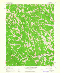 1960 Glover Gap1962 Print · USGSMarion and Wetzel Counties are shown at the start of the 1960s, a landscape defined by natural gas extraction and hillside family cemeteries. Trace genealogical roots and rural life at Glover Gap Sch, the Baltimore and Ohio rail line, and Seven Pines.3 unique versions available
 - 1960 Map of Round Bottom, 1962 Print
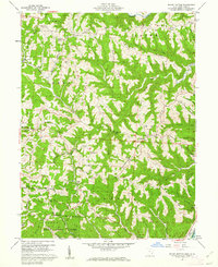 1960 Round Bottom1962 Print · USGSThe Ohio River hills of Monroe County are shown here in the early sixties, a landscape of ridge-top farms and river towns. Researchers can trace family history through sites like Winklers Mill, Emma Grove Cem, and the interior settlement of Round Bottom.4 unique versions available
 - 1960 Map of Big Run, 1962 Print
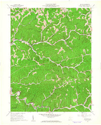 1960 Big Run1962 Print · USGSWetzel County in the early sixties is shown as a bustling energy landscape of wells and ridges. Researchers can locate family landmarks like Stocking Cem, follow the Baltimore and Ohio rail line, or trace the rural settlements of Smithfield and Big Run.2 unique versions available
 - 1960 Map of Wileyville, 1962 Print
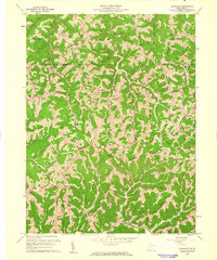 1960 Wileyville1962 Print · USGSNorthern West Virginia hill country is shown here at the start of the sixties, defined by its steep ridge-and-hollow topography. Genealogists can trace family roots through remote landmarks like Saint Joseph Ch, Grandview Sch, and the Wileyville Cem.2 unique versions available
Showing maps 1-25 of 112
Top cities of Wetzel County
- New Martinsville historical maps
- Pine Grove historical maps
- Hundred historical maps
- Littleton historical maps
- Smithfield historical maps
Frequently asked questions
- What are the different types of historical maps available for Wetzel County?
- What is the oldest map of Wetzel County?
- Where can I purchase historical maps of Wetzel County for my home or office?
- Where can I download high-res historical maps of Wetzel County?
- Are there historical topographic maps available for Wetzel County?
- Is there historical aerial imagery available for Wetzel County?
- Where are historical maps of Wetzel County sourced from?