2020s Maps of Parkersburg, West Virginia
Explore 2 historic maps of Parkersburg from the 2020s. These maps offer a rare glimpse into what life looked like during the 2020s — showing old roads, neighborhoods, homes, and landmarks that have changed or disappeared over time.
Whether you're researching your family's past, planning a metal detecting trip, or studying how Parkersburg's landscape evolved across the 2020s, these high-resolution maps are a powerful tool for exploring the history of this region.
- Focus on a specific era: All maps on this page are from the 2020s, giving you a focused view of this time period.
- See what’s changed: Compare century-old streets, trails, and buildings to today's modern landscape using overlays and satellite layers.
- Research with precision: Use these maps for genealogy, historical research, land use analysis, or educational projects.
- View, download, or print: Maps are fully viewable online in high resolution, and can be downloaded or printed for your own records.
Start exploring Parkersburg's history through authentic maps from the 2020s. This is your window into the past.
Parkersburg, WV maps
(2)- 2023 Map of Parkersburg, 2023 Print
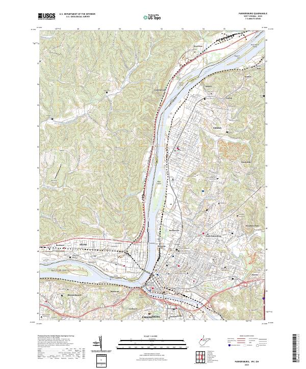 2023 Parkersburg2023 Print · USGSThe riverfront communities of West Virginia and Ohio converge at the mid-century mark in this detailed survey. Genealogists can trace family names at Spencer Cem, Ogden Cem, and Rockland Cem, while the industrial history of Parkersburg is visible along the CSX TRANSPORTATION lines.
 - 2023 Map of South Parkersburg, 2023 Print
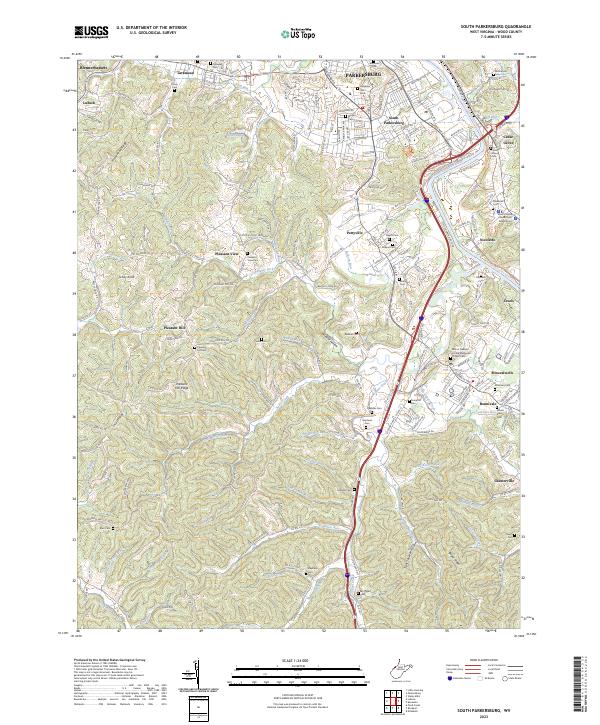 2023 South Parkersburg2023 Print · USGSWood County at the start of the 2020s shows the suburban expansion and rural heritage of the Parkersburg area. Researchers can trace family history through dozens of landmarks like Cedar Grove Cem, Ruble Cem, and the Mount Pleasant United Methodist Church.
End of results
Showing maps 1-2 of 2
Top cities near Parkersburg
- Marietta historical maps
- Vienna historical maps
- Belpre historical maps
- Blennerhassett historical maps
- Williamstown historical maps
- Dunham historical maps
See more
Top neighborhoods of Parkersburg
- South Parkersburg historical maps
- North Parkersburg historical maps
- Riverside historical maps
- Tavennersville historical maps
- Fairview Heights historical maps
- Lauckport historical maps
See more
Frequently asked questions
- What are the different types of historical maps available for Parkersburg?
- What is the oldest map of Parkersburg?
- Where can I purchase historical maps of Parkersburg for my home or office?
- Where can I download high-res historical maps of Parkersburg?
- Are there historical topographic maps available for Parkersburg?
- Is there historical aerial imagery available for Parkersburg?
- Where are historical maps of Parkersburg sourced from?