Old Maps of Parkersburg, West Virginia
Explore 14 old maps of Parkersburg, spanning from 1902 to today. These high-resolution historic maps reveal how streets, neighborhoods, landmarks, and natural features evolved over time — perfect for genealogy, metal detecting, research, and local history exploration.
What you can do with these maps:
- See how Parkersburg changed over time: Compare historical maps to modern-day views to trace roads, homesites, rail lines & more.
- View detailed metadata: Each map includes creators, publishers, year, scale, and archive source.
- Overlay maps with satellite & LiDAR: Visualize the past alongside modern tools to explore terrain & human change.
- Trusted historical sources: Maps sourced from the USGS, Library of Congress, and other archives.
- Access maps your way: View online, download high-res files, or order prints for personal or research use.
Start exploring old maps of Parkersburg to uncover forgotten places, hidden landmarks, and the deep history beneath your feet.
Parkersburg, WV maps
(14)- 1902 Map of Parkersburg
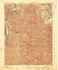
 1902 Parkersburg1902 Print · USGSCovers Parkersburg, including Vienna, Belpre, and other nearby areas
 - 1904 Map of Parkersburg
 1904 Parkersburg1904 Print · USGSCovers Parkersburg, including Vienna, Belpre, and other nearby areas5 unique versions available
 - 1906 Map of Belleville
 1906 Belleville1906 Print · USGSCovers Parkersburg, including Jerrys Run, Wadeville, and other nearby areas2 unique versions available
 - 1924 Map of Belleville, 1954 Print
 1924 Belleville1954 Print · USGSCovers Parkersburg, including Jerrys Run, Wadeville, and other nearby areas
 - 1926 Map of Belleville
 1926 Belleville1926 Print · USGSCovers Parkersburg, including Jerrys Run, Wadeville, and other nearby areas2 unique versions available
 - 1949 Map of Clarksburg
 1949 Clarksburg1949 Print · USGSCovers Parkersburg, including Zanesville, Fairmont, and other nearby areas
 - 1956 Map of Clarksburg, 1966 Print
 1956 Clarksburg1966 Print · USGSCovers Parkersburg, including Zanesville, Fairmont, and other nearby areas2 unique versions available
 - 1957 Map of Parkersburg, 1958 Print
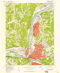 1957 Parkersburg1958 Print · USGSCovers Parkersburg, including Vienna, Belpre, and other nearby areas
 - 1961 Map of Clarksburg
 1961 Clarksburg1961 Print · USGSCovers Parkersburg, including Zanesville, Fairmont, and other nearby areas
 - 1961 Map of South Parkersburg, 1963 Print
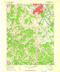 1961 South Parkersburg1963 Print · USGSCovers Parkersburg, including Bonnivale, Pleasant Hill, and other nearby areas3 unique versions available
 - 1969 Map of Parkersburg, 1971 Print
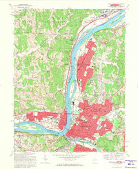 1969 Parkersburg1971 Print · USGSCovers Parkersburg, including Vienna, Belpre, and other nearby areas5 unique versions available
 - 1981 Map of Parkersburg, 1984 Print
 1981 Parkersburg1984 Print · USGSCovers Parkersburg, including Marietta, Vienna, and other nearby areas
 - 1988 Map of Clarksburg, 1989 Print
 1988 Clarksburg1989 Print · USGSCovers Parkersburg, including Zanesville, Fairmont, and other nearby areas
 - 1994 Map of Parkersburg, 1998 Print
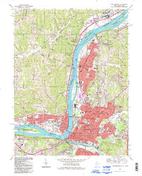 1994 Parkersburg1998 Print · USGSCovers Parkersburg, including Vienna, Belpre, and other nearby areas
End of results
Showing maps 1-14 of 14
Top cities near Parkersburg
- Marietta historical maps
- Vienna historical maps
- Belpre historical maps
- Blennerhassett historical maps
- Williamstown historical maps
- Dunham historical maps
See more
Top neighborhoods of Parkersburg
- North Parkersburg historical maps
- South Parkersburg historical maps
- Riverside historical maps
- Tavennersville historical maps
- Fairview Heights historical maps
- Fairway Acres historical maps
See more
Frequently asked questions
- What are the different types of historical maps available for Parkersburg?
- What is the oldest map of Parkersburg?
- Where can I purchase historical maps of Parkersburg for my home or office?
- Where can I download high-res historical maps of Parkersburg?
- Are there historical topographic maps available for Parkersburg?
- Is there historical aerial imagery available for Parkersburg?
- Where are historical maps of Parkersburg sourced from?