Old Maps of Iowa County, Wisconsin
Explore 51 old maps of Iowa County, spanning from 1902 to today. These high-resolution historic maps reveal how streets, neighborhoods, landmarks, and natural features evolved over time — perfect for genealogy, metal detecting, research, and local history exploration.
What you can do with these maps:
- See how Iowa County changed over time: Compare historical maps to modern-day views to trace roads, homesites, rail lines & more.
- View detailed metadata: Each map includes creators, publishers, year, scale, and archive source.
- Overlay maps with satellite & LiDAR: Visualize the past alongside modern tools to explore terrain & human change.
- Trusted historical sources: Maps sourced from the USGS, Library of Congress, and other archives.
- Access maps your way: View online, download high-res files, or order prints for personal or research use.
Start exploring old maps of Iowa County to uncover forgotten places, hidden landmarks, and the deep history beneath your feet.
Iowa County, WI maps
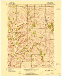
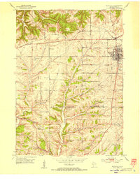
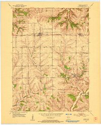
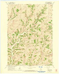
(51)- 1902 Map of Mineral Point
 1902 Mineral Point1902 Print · USGSCovers Iowa County, including Platteville, Dodgeville, and other nearby areas4 unique versions available
 - 1905 Map of Richland Center
 1905 Richland Center1905 Print · USGSCovers Iowa County, including Richland Center, Spring Green, and other nearby areas2 unique versions available
 - 1920 Map of Blue Mounds, 1959 Print
 1920 Blue Mounds1959 Print · USGSCovers Iowa County, including Mount Horeb, Black Earth, and other nearby areas
 - 1922 Map of Blue Mounds
 1922 Blue Mounds1922 Print · USGSCovers Iowa County, including Mount Horeb, Black Earth, and other nearby areas3 unique versions available
 - 1923 Map of Blanchardville
 1923 Blanchardville1923 Print · USGSCovers Iowa County, including Mount Horeb, Barneveld, and other nearby areas2 unique versions available
 - 1952 Map of Rewey, 1954 Print
 1952 Rewey1954 Print · USGSCovers Iowa County, including Platteville, Mifflin, and other nearby areas3 unique versions available
 - 1952 Map of Montfort, 1954 Print
 1952 Montfort1954 Print · USGSCovers Iowa County, including Mifflin, Montfort, and other nearby areas2 unique versions available
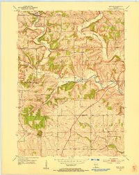
 - 1952 Map of Mineral Point, 1954 Print
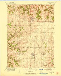
 1952 Mineral Point1954 Print · USGSCovers Iowa County, including Mineral Point, Kendall, and other nearby areas3 unique versions available
 - 1952 Map of Dodgeville, 1954 Print
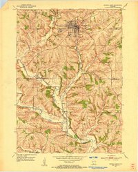
 1952 Dodgeville1954 Print · USGSCovers Iowa County, including Dodgeville, Mineral Point, and other nearby areas3 unique versions available
 - 1952 Map of Linden, 1954 Print
 1952 Linden1954 Print · USGSCovers Iowa County, including Mifflin, Linden, and other nearby areas
 - 1952 Map of Mifflin, 1954 Print
 1952 Mifflin1954 Print · USGSCovers Iowa County, including Mifflin, Kendall, and other nearby areas2 unique versions available
 - 1954 Map of Rockford
 1954 Rockford1954 Print · USGSCovers Iowa County, including Milwaukee, Madison, and other nearby areas
 - 1955 Map of Rockford
 1955 Rockford1955 Print · USGSCovers Iowa County, including Milwaukee, Madison, and other nearby areas
 - 1957 Map of Madison, 1967 Print
 1957 Madison1967 Print · USGSCovers Iowa County, including Milwaukee, Madison, and other nearby areas3 unique versions available
 - 1958 Map of Rockford, 1974 Print
 1958 Rockford1974 Print · USGSCovers Iowa County, including Milwaukee, Madison, and other nearby areas4 unique versions available
 - 1958 Map of La Crosse, 1979 Print
 1958 La Crosse1979 Print · USGSCovers Iowa County, including La Crosse, Winona, and other nearby areas2 unique versions available
 - 1959 Map of Dubuque, 1982 Print
 1959 Dubuque1982 Print · USGSCovers Iowa County, including Cedar Rapids, Dubuque, and other nearby areas
 - 1960 Map of Madison
 1960 Madison1960 Print · USGSCovers Iowa County, including Milwaukee, Madison, and other nearby areas2 unique versions available
 - 1960 Map of Muscoda, 1962 Print
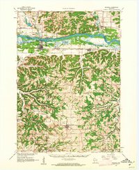 1960 Muscoda1962 Print · USGSCovers Iowa County, including Muscoda, Highland, and other nearby areas
 - 1960 Map of Spring Green, 1962 Print
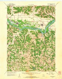 1960 Spring Green1962 Print · USGSCovers Iowa County, including Spring Green, Lone Rock, and other nearby areas2 unique versions available
 - 1961 Map of Dubuque
 1961 Dubuque1961 Print · USGSCovers Iowa County, including Cedar Rapids, Dubuque, and other nearby areas
 - 1961 Map of La Crosse
 1961 La Crosse1961 Print · USGSCovers Iowa County, including La Crosse, Winona, and other nearby areas
 - 1962 Map of Dubuque
 1962 Dubuque1962 Print · USGSCovers Iowa County, including Cedar Rapids, Dubuque, and other nearby areas2 unique versions available
 - 1962 Map of Blanchardville, 1964 Print
 1962 Blanchardville1964 Print · USGSCovers Iowa County, including Mount Horeb, Barneveld, and other nearby areas
 - 1962 Map of Daleyville, 1964 Print
 1962 Daleyville1964 Print · USGSCovers Iowa County, including Mount Horeb, Forward, and other nearby areas
Showing maps 1-25 of 51
Top cities of Iowa County
- Dodgeville historical maps
- Mineral Point historical maps
- Barneveld historical maps
- Highland historical maps
- Arena historical maps
- Ridgeway historical maps
See more
Frequently asked questions
- What are the different types of historical maps available for Iowa County?
- What is the oldest map of Iowa County?
- Where can I purchase historical maps of Iowa County for my home or office?
- Where can I download high-res historical maps of Iowa County?
- Are there historical topographic maps available for Iowa County?
- Is there historical aerial imagery available for Iowa County?
- Where are historical maps of Iowa County sourced from?