Old Maps of Ashland, Wisconsin for Genealogy
Trace your family roots with 18 historic maps of Ashland. These high-res maps reveal old neighborhoods, homesites, landmarks, and streets — helping you uncover where your ancestors lived and how the area evolved over time.
- Explore historic neighborhoods: Identify where your relatives may have lived in the 1800s or 1900s.
- Compare maps over time: Trace the changes in streets, buildings, and landmarks for multi-generational research.
- Perfect for genealogy & ancestry research: Used by family historians and researchers to map out lineage and migration.
These maps are an incredible resource for exploring your personal connection to Ashland's past.
Ashland, WI maps
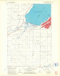
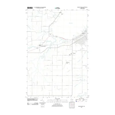
(18)- 1942 Map of Ashland
 1942 Ashland1942 Print · USGSThe South Shore of Lake Superior comes alive in the early 1940s, showing the bustling rail hubs and maritime ports of Chequamegon Bay. Genealogists and historians can trace local family roots through sites like Northland College, St Agnes Cem, and Ondassagon Sch.
 - 1947 Map of Ashland
 1947 Ashland1947 Print · USGSCoastal Wisconsin thrived on the shores of Lake Superior in the late 1940s, balancing industrial power with small-town education. Genealogists can trace family roots through numerous country schools like Olson Sch and local sites like St Agnes Cem.
 - 1953 Map of Ashland, 1964 Print
 1953 Ashland1964 Print · USGSNorthern Wisconsin's lakefront and timberlands are seen here in the mid-1950s, showing the intersection of industrial rail lines and vast wilderness. Genealogists and historians can trace the Soo Line through rail towns like Mellen or locate family roots in the Apostle Islands and Bad River Indian Reservation.3 unique versions available
 - 1958 Map of Ashland
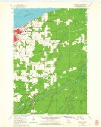
 1958 Ashland1958 Print · USGSCoastal Wisconsin and the Michigan borderlands meet here in the late fifties, dominated by the timbered expanses and iron-rich ranges. Genealogists can trace family footprints in settlements like Odanah and Montreal, or locate landmarks such as the Coast Guard Station and Agricultural Experiment Station.
 - 1964 Map of Ashland West, 1965 Print
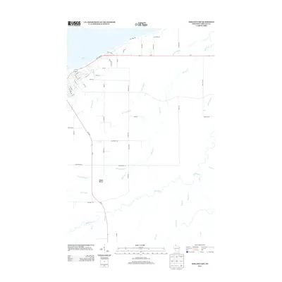
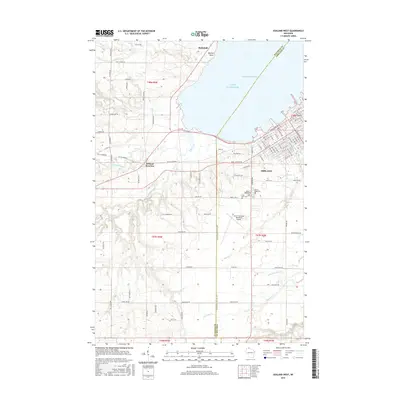
 1964 Ashland West1965 Print · USGSThe Lake Superior shoreline at the mid-century shows the city of Ashland as a vital rail and educational center. Researchers can trace the legacy of the Chicago and North Western lines, local schools like Ondassagon Sch, and the grounds of the University of Wisconsin Experiment Station.4 unique versions available
 - 1964 Map of Ashland East, 1965 Print
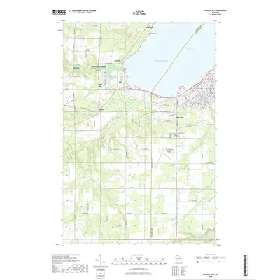
 1964 Ashland East1965 Print · USGSAshland and its lakefront surroundings are captured in the mid-1960s as the city expanded toward the Bad River Indian Reservation. Researchers can trace the mid-century campuses of Northland College and the County Teachers College or locate the old Drive-in Theater.2 unique versions available
 - 1964 Map of Ashland, 1965 Print
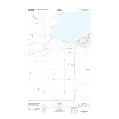
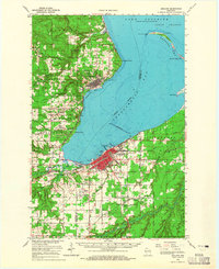 1964 Ashland1965 Print · USGSChequamegon Bay was a bustling hub of maritime and rail transport in the mid-sixties. Researchers can trace the extensive rail lines at Ashland Junction, find local heritage sites like Northland College, and locate family names at St Agnes Cem.2 unique versions available
 - 1989 Map of Ashland
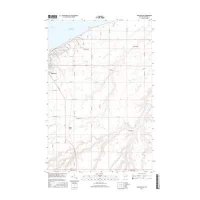
 1989 Ashland1989 Print · USGSCoastal Wisconsin and Michigan at the end of the 1980s show a landscape of deep-water bays, island preserves, and industrial timber towns. Researchers can trace the rail lines of the Soo Line and identify landmarks from Big Bay State Park to the Bad River Indian Reservation.
 - 2010 Map of Ashland East, 2010 Print
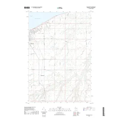
 2010 Ashland East2010 Print · USGSCovers Ashland, including White River, White River, and other nearby areas
 - 2010 Map of Ashland West, 2010 Print
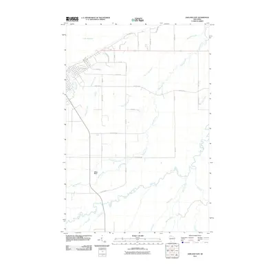
 2010 Ashland West2010 Print · USGSCovers Ashland, including Kelly, Ashland Junction, and other nearby areas
 - 2013 Map of Ashland West, 2013 Print
 2013 Ashland West2013 Print · USGSCovers Ashland, including Kelly, Ashland Junction, and other nearby areas
 - 2013 Map of Ashland East, 2013 Print
 2013 Ashland East2013 Print · USGSCovers Ashland, including White River, White River, and other nearby areas
 - 2015 Map of Ashland East, 2015 Print
 2015 Ashland East2015 Print · USGSCovers Ashland, including White River, White River, and other nearby areas
 - 2015 Map of Ashland West, 2015 Print
 2015 Ashland West2015 Print · USGSCovers Ashland, including Kelly, Ashland Junction, and other nearby areas
 - 2018 Map of Ashland East, 2018 Print
 2018 Ashland East2018 Print · USGSCovers Ashland, including White River, White River, and other nearby areas
 - 2018 Map of Ashland West, 2018 Print
 2018 Ashland West2018 Print · USGSCovers Ashland, including Kelly, Ashland Junction, and other nearby areas
 - 2022 Map of Ashland East, 2022 Print
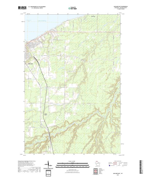 2022 Ashland East2022 Print · USGSThe Wisconsin shoreline of Lake Superior comes alive in this contemporary view of the port city and its surrounding marshlands. Genealogists and local historians can trace family properties and landmarks near the White River, Bayfront, and Chequamegon Bay.
 - 2022 Map of Ashland West, 2022 Print
 2022 Ashland West2022 Print · USGSCoastal Wisconsin at the edge of Lake Superior reveals a landscape of protected wetlands and civic hubs. Researchers can trace the layout of Ashland alongside the Whittlesey Creek National Wildlife Refuge and Mount Hope Cem.
End of results
Showing maps 1-18 of 18
Top cities near Ashland
- Washburn historical maps
- Sanborn historical maps
- White River historical maps
- New Odanah historical maps
- Marengo historical maps
- La Pointe historical maps
See more
Top neighborhoods of Ashland
- Ellis/Northland historical maps
- Chapple MacArthur historical maps
- Downtown historical maps
- SoDo East historical maps
- SoDo West historical maps
- Eastlake historical maps
See more
Frequently asked questions
- What are the different types of historical maps available for Ashland?
- What is the oldest map of Ashland?
- Where can I purchase historical maps of Ashland for my home or office?
- Where can I download high-res historical maps of Ashland?
- Are there historical topographic maps available for Ashland?
- Is there historical aerial imagery available for Ashland?
- Where are historical maps of Ashland sourced from?