2020s Maps of Vance Creek, Wisconsin
Explore 4 historic maps of Vance Creek from the 2020s. These maps offer a rare glimpse into what life looked like during the 2020s — showing old roads, neighborhoods, homes, and landmarks that have changed or disappeared over time.
Whether you're researching your family's past, planning a metal detecting trip, or studying how Vance Creek's landscape evolved across the 2020s, these high-resolution maps are a powerful tool for exploring the history of this region.
- Focus on a specific era: All maps on this page are from the 2020s, giving you a focused view of this time period.
- See what’s changed: Compare century-old streets, trails, and buildings to today's modern landscape using overlays and satellite layers.
- Research with precision: Use these maps for genealogy, historical research, land use analysis, or educational projects.
- View, download, or print: Maps are fully viewable online in high resolution, and can be downloaded or printed for your own records.
Start exploring Vance Creek's history through authentic maps from the 2020s. This is your window into the past.
Vance Creek, WI maps
(4)- 2022 Map of Connorsville, 2022 Print
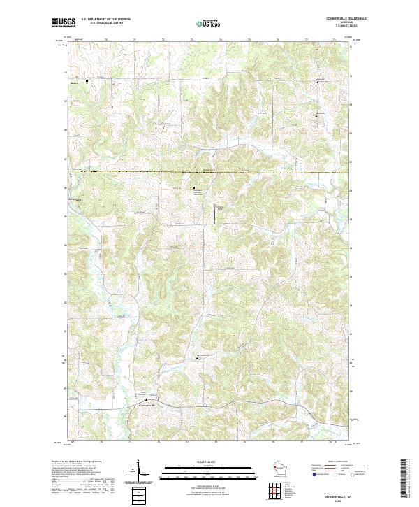 2022 Connorsville2022 Print · USGSDunn and Barron counties meet in this western Wisconsin landscape as it appeared in the early 2020s, characterized by small rural settlements and river tributaries. Genealogists can trace family sites at Grace Lutheran Cem, New Haven Cem, and the small community of Connorsville.
 - 2022 Map of Arland, 2022 Print
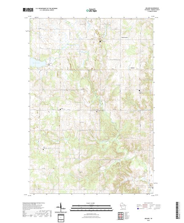 2022 Arland2022 Print · USGSBarron County is shown here in its modern agricultural character, defined by winding glacial creeks and small rural settlements. Genealogists can trace family roots through several local burial grounds, including Bethany Cem, Sunset Cem, and Peace Cem.
 - 2022 Map of Graytown, 2022 Print
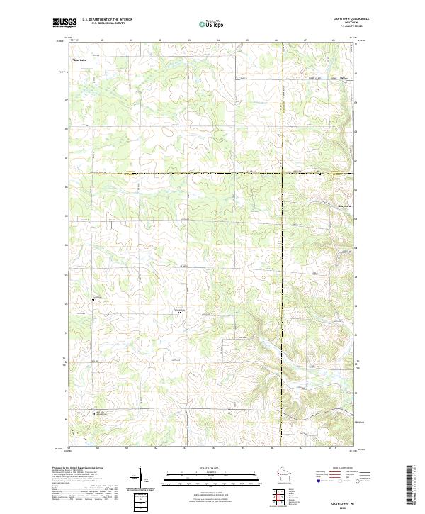 2022 Graytown2022 Print · USGSWisconsin's rural borderland where four counties meet is captured here in a moment of modern agricultural life. Researchers can trace family roots at the Graytown Cem or Saint John Lutheran Cem and locate the early settlements of Graytown and Reeve.
 - 2022 Map of Clayton, 2022 Print
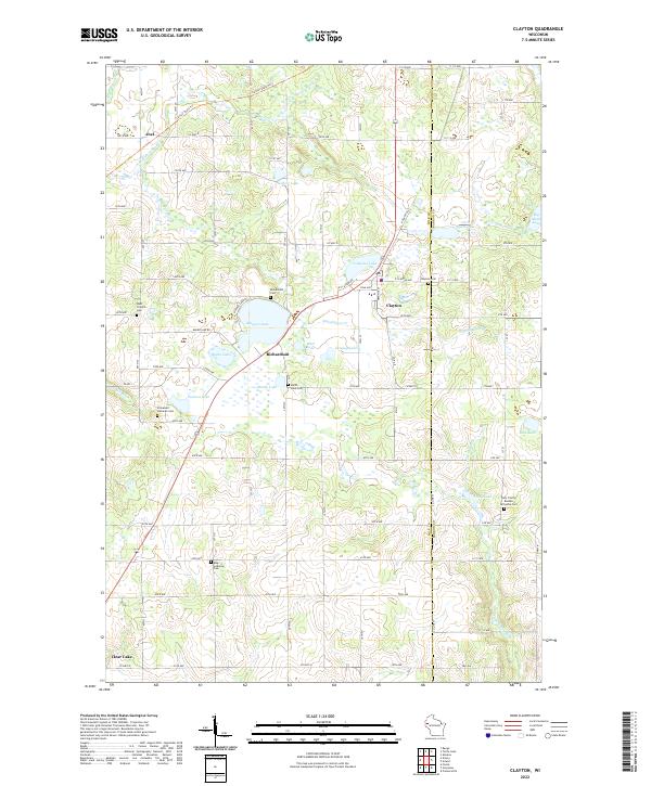 2022 Clayton2022 Print · USGSNorthwestern Wisconsin’s lake country is captured here in recent detail, focusing on the villages of Clayton and Richardson. Genealogists can trace family roots through numerous local sites like Moe Lutheran Cem and Immanuel Lutheran Cem.
End of results
Showing maps 1-4 of 4
Top cities near Vance Creek
- Barron historical maps
- Tainter historical maps
- Glenwood City historical maps
- Town of Black Brook historical maps
- Clear Lake historical maps
- Boyceville historical maps
See more
Top neighborhoods of Vance Creek
Frequently asked questions
- What are the different types of historical maps available for Vance Creek?
- What is the oldest map of Vance Creek?
- Where can I purchase historical maps of Vance Creek for my home or office?
- Where can I download high-res historical maps of Vance Creek?
- Are there historical topographic maps available for Vance Creek?
- Is there historical aerial imagery available for Vance Creek?
- Where are historical maps of Vance Creek sourced from?