Old Maps of Bayfield, Wisconsin for Metal Detecting
Plan your next treasure hunt with 52 historic maps of Bayfield. Find old homesites, ghost towns, trails, and gathering spots that may be lost to time — perfect for identifying promising metal detecting locations.
- Locate forgotten sites: Uncover places like long-lost settlements, abandoned rail lines, or gathering spots.
- Plan better hunts: Use map overlays combined with LiDAR or satellite views to narrow in on historically rich areas.
- Made for detectorists: Thousands of hobbyists use these maps to discover relics, coins, and hidden history.
Use these historic maps to boost your research and find new opportunities beneath the surface of Bayfield.
Bayfield, WI maps
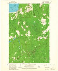
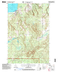
(52)- 1941 Map of Bayfield
 1941 Bayfield1941 Print · USGSThe Apostle Islands and the Bayfield Peninsula are shown in the early 1940s, highlighting the intersection of indigenous lands and maritime industry. Trace ancestral roots at Red Cliff and La Pointe, or locate long-standing landmarks like the Raspberry LH and Sand Bay Sch.
 - 1944 Map of Cornucopia, 1952 Print
 1944 Cornucopia1952 Print · USGSThe Lake Superior shoreline near Cornucopia is shown here during the 1940s as a hub for coastal settlement and forest access. Genealogists can locate family landmarks like St Anthony Ch, Settlement Sch, and the docks of Cornucopia.
 - 1946 Map of Cornucopia
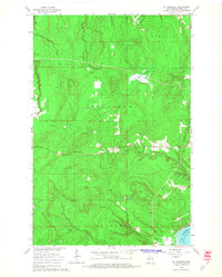
 1946 Cornucopia1946 Print · USGSThe northern reaches of Bayfield County are captured here in the mid-1940s, highlighting the coastal community of Cornucopia. Researchers can trace old rural landmarks like the Settlement Sch, St Anthony Ch, and the numerous inlets of Bark Bay.
 - 1946 Map of Bayfield
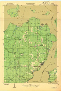 1946 Bayfield1946 Print · USGSThe Bayfield Peninsula and the Apostle Islands are shown here at the start of the 1940s, highlighting a rugged maritime and reservation landscape. Genealogists can locate family landmarks like Sunny Side, the Sanitarium at Pureair, and the Raspberry LH.
 - 1953 Map of Ashland, 1964 Print
 1953 Ashland1964 Print · USGSNorthern Wisconsin's lakefront and timberlands are seen here in the mid-1950s, showing the intersection of industrial rail lines and vast wilderness. Genealogists and historians can trace the Soo Line through rail towns like Mellen or locate family roots in the Apostle Islands and Bad River Indian Reservation.3 unique versions available
 - 1954 Map of Two Harbors, 1964 Print
 1954 Two Harbors1964 Print · USGSThe Minnesota North Shore and Superior National Forest are shown here in the mid-fifties, just as the taconite industry was reshaping the coast. Genealogists and historians can trace the rail lines of the Duluth Missabe and Iron Range or locate remote outposts like Sawbill Landing and Section Thirty.2 unique versions available
 - 1957 Map of Two Harbors
 1957 Two Harbors1957 Print · USGSMinnesota's North Shore and the Arrowhead region are shown here in the mid-fifties as the taconite industry and cold war defense shaped the landscape. Researchers can trace the Duluth Missabe and Iron Range railroad, locate the Split Rock Light, and explore the iron-mining era at Taconite.
 - 1958 Map of Ashland
 1958 Ashland1958 Print · USGSCoastal Wisconsin and the Michigan borderlands meet here in the late fifties, dominated by the timbered expanses and iron-rich ranges. Genealogists can trace family footprints in settlements like Odanah and Montreal, or locate landmarks such as the Coast Guard Station and Agricultural Experiment Station.
 - 1958 Map of Two Harbors
 1958 Two Harbors1958 Print · USGSThe North Shore and Arrowhead region of Minnesota are captured in the 1950s as iron ore shipping and wilderness preservation shaped the land. Researchers can trace the Duluth Missabe and Iron Range RR, find maritime landmarks like Split Rock Light, and locate remote settlements from Babbitt to Grand Marais.
 - 1964 Map of Two Harbors
 1964 Two Harbors1964 Print · USGSThe North Shore of Lake Superior is captured here during the mid-1950s, a time of significant industrial mining growth and emerging tourism. Genealogists and historians can trace the rail lines of the Duluth Missabe and Iron Range and locate landmarks like Split Rock Light and the U S Air Force Radar Station.
 - 1964 Map of Squaw Bay, 1965 Print
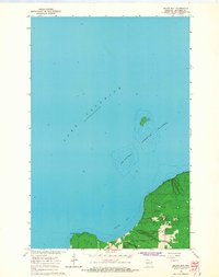 1964 Squaw Bay1965 Print · USGSCoastal Bayfield County comes into focus in the mid-1960s, showing the intersection of the mainland woods and the great lake. You can trace the rocky perimeter of Eagle Island and explore the depths near Squaw Bay and Squaw Point.2 unique versions available
 - 1964 Map of Sand Island, 1965 Print
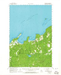
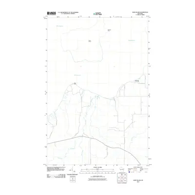
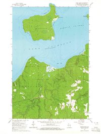 1964 Sand Island1965 Print · USGSBayfield County's northern coast and the Apostle Islands come into focus during the mid-sixties, showing the intersection of tribal lands and maritime navigation. You can trace the trails and lighthouse on Sand Island or locate resources like the Gravel Pits near the Raspberry River.2 unique versions available
 - 1964 Map of Bayfield, 1965 Print
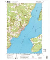
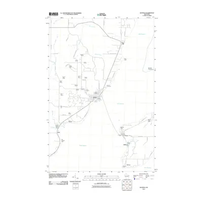
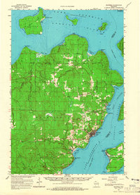 1964 Bayfield1965 Print · USGSThe Bayfield Peninsula and Apostle Islands are captured in the mid-1960s, showing the intersection of tribal lands and Lake Superior maritime life. Researchers can trace the Chicago and North Western rail line and locate landmarks like the Bayfield State Fish Hatchery and Calvary Cem.
 - 1964 Map of Cornucopia, 1965 Print
 1964 Cornucopia1965 Print · USGSThe Lake Superior shoreline at the height of the mid-sixties reveals the remote settlement of Cornucopia and its maritime connection to Siskiwit Bay. Researchers can trace the rural footprint of Bell township through sites like the Bell Cem and St Anthony Ch.3 unique versions available
 - 1964 Map of Mt. Ashwabay, 1965 Print
 1964 Mt. Ashwabay1965 Print · USGSThe Bayfield Peninsula highlands in the mid-1960s reveal a landscape defined by forest-shrouded peaks and Lake Superior drainage. Local researchers can trace the headwaters of the Little Sioux River and Sand River, or locate industrial sites like the Gravel Pit near Mt Ashwabay.2 unique versions available
 - 1964 Map of Cornucopia, 1965 Print
 1964 Cornucopia1965 Print · USGSThe Bayfield County shoreline meets the Apostle Islands in the mid-1960s, showing the quiet transition from working lakefront to deep forest. Local historians can trace the foundations of Cornucopia and locate rural landmarks like St Anthony Ch and Herbster Cem.
 - 1964 Map of Bayfield, 1976 Print
 1964 Bayfield1976 Print · USGSBayfield and the Apostle Islands appear in the mid-1960s just as the region's maritime and forest identities were being preserved. Trace the local history of La Pointe on Madeline Island or locate family sites at Evergreen Cem and Calvary Cem.2 unique versions available
 - 1978 Map of Outer Island
 1978 Outer Island1978 Print · USGSThe Apostle Islands archipelago and the vast expanse of Lake Superior are shown in the late seventies. Researchers can trace maritime landmarks like the Outer Island Light, explore island terrain from Bear Island to Cat Island, and locate the old Landing Strip.
 - 1980 Map of Port Wing
 1980 Port Wing1980 Print · USGSThe Lake Superior shoreline and the deep forests of Bayfield and Douglas counties are captured here in the early eighties. Genealogists and historians can trace the rail lines through Iron River or locate the lakeside landings at Cornucopia and Port Wing.
 - 1989 Map of Ashland
 1989 Ashland1989 Print · USGSCoastal Wisconsin and Michigan at the end of the 1980s show a landscape of deep-water bays, island preserves, and industrial timber towns. Researchers can trace the rail lines of the Soo Line and identify landmarks from Big Bay State Park to the Bad River Indian Reservation.
 - 1990 Map of Outer Island, 1991 Print
 1990 Outer Island1991 Print · USGSThe northern Apostle Islands and the Lake Superior shoreline are captured here in the early 1990s. Researchers can trace remote maritime landmarks like the Outer Island Light and Devils Island or explore the coastal boundary of the Finland State Forest.
 - 2005 Map of Cornucopia, 2006 Print
 2005 Cornucopia2006 Print · USGSCornucopia and the rugged shores of the Bayfield Peninsula are captured here in the early twenty-first century. Genealogists and historians can locate the Bell Cem, St Anthony Ch, and old harbor landmarks along Siskiwit Bay.
 - 2010 Map of Sand Island, 2010 Print
 2010 Sand Island2010 Print · USGSCovers Bayfield, including Russell, Sand Bay, and other nearby areas
 - 2010 Map of Bayfield, 2010 Print
 2010 Bayfield2010 Print · USGSCovers Bayfield, including La Pointe, Bayview, and other nearby areas
 - 2010 Map of Mount Ashwabay, 2010 Print
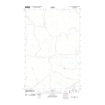 2010 Mount Ashwabay2010 Print · USGSCovers Bayfield, including Bayview, Russell, and other nearby areas
Showing maps 1-25 of 52
Top cities near Bayfield
Top neighborhoods of Bayfield
- Pureair historical maps
- Salmo historical maps
- Belanger Settlement historical maps
- Deerfield Estates historical maps
- Fire Hill historical maps
- Waterford on the Bay historical maps
See more
Frequently asked questions
- What are the different types of historical maps available for Bayfield?
- What is the oldest map of Bayfield?
- Where can I purchase historical maps of Bayfield for my home or office?
- Where can I download high-res historical maps of Bayfield?
- Are there historical topographic maps available for Bayfield?
- Is there historical aerial imagery available for Bayfield?
- Where are historical maps of Bayfield sourced from?