2000-2009 Maps of Bell, Wisconsin
Explore 4 historic maps of Bell from 2000-2009. These maps offer a rare glimpse into what life looked like during the 2000s — showing old roads, neighborhoods, homes, and landmarks that have changed or disappeared over time.
Whether you're researching your family's past, planning a metal detecting trip, or studying how Bell's landscape evolved across the 2000s, these high-resolution maps are a powerful tool for exploring the history of this region.
- Focus on a specific era: All maps on this page are from the 2000s, giving you a focused view of this time period.
- See what’s changed: Compare century-old streets, trails, and buildings to today's modern landscape using overlays and satellite layers.
- Research with precision: Use these maps for genealogy, historical research, land use analysis, or educational projects.
- View, download, or print: Maps are fully viewable online in high resolution, and can be downloaded or printed for your own records.
Start exploring Bell's history through authentic maps from the 2000s. This is your window into the past.
Bell, WI maps
(4)- 2005 Map of Bark Bay, 2006 Print
 2005 Bark Bay2006 Print · USGSThe Lake Superior shoreline near Clover and Bell is captured here in the early 2000s, showing the intersection of coastal topography and national forest land. Researchers can locate Herbster Cem, trace the course of the Cranberry River, or explore the geography of Bark Point.
 - 2005 Map of Moquah NW, 2006 Print
 2005 Moquah NW2006 Print · USGSBayfield County’s forest landscape is preserved here as it appeared in the early 2000s, showing the intersection of managed timberlands and glacial water systems. Trace the isolated waters of Sunken Camp Lakes or the ecological borders of the Moquah Barrens Area.
 - 2005 Map of Cornucopia, 2006 Print
 2005 Cornucopia2006 Print · USGSCornucopia and the rugged shores of the Bayfield Peninsula are captured here in the early twenty-first century. Genealogists and historians can locate the Bell Cem, St Anthony Ch, and old harbor landmarks along Siskiwit Bay.
 - 2005 Map of Mount Valhalla, 2006 Print
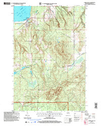
 2005 Mount Valhalla2006 Print · USGSBayfield County at the turn of the millennium is seen here as a managed forest landscape defined by the Chequamegon Nicolet National Forest. You can trace recreational sites like Birch Grove and landmarks such as Mount Valhalla and the Washburn Lookout.
End of results
Showing maps 1-4 of 4
Top cities near Bell
Top neighborhoods of Bell
Frequently asked questions
- What are the different types of historical maps available for Bell?
- What is the oldest map of Bell?
- Where can I purchase historical maps of Bell for my home or office?
- Where can I download high-res historical maps of Bell?
- Are there historical topographic maps available for Bell?
- Is there historical aerial imagery available for Bell?
- Where are historical maps of Bell sourced from?