1900s (20th Century) Maps of Russell, Wisconsin
Explore 10 historic maps of Russell from the 1900s (20th Century). These maps offer a rare glimpse into what life looked like during the 1900s — showing old roads, neighborhoods, homes, and landmarks that have changed or disappeared over time.
Whether you're researching your family's past, planning a metal detecting trip, or studying how Russell's landscape evolved across the 1900s, these high-resolution maps are a powerful tool for exploring the history of this region.
- Focus on a specific era: All maps on this page are from the 1900s, giving you a focused view of this time period.
- See what’s changed: Compare century-old streets, trails, and buildings to today's modern landscape using overlays and satellite layers.
- Research with precision: Use these maps for genealogy, historical research, land use analysis, or educational projects.
- View, download, or print: Maps are fully viewable online in high resolution, and can be downloaded or printed for your own records.
Start exploring Russell's history through authentic maps from the 1900s. This is your window into the past.
Russell, WI maps
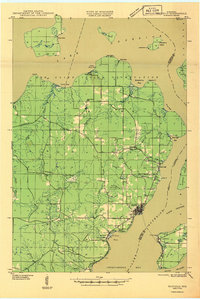
(10)- 1941 Map of Bayfield
 1941 Bayfield1941 Print · USGSThe Apostle Islands and the Bayfield Peninsula are shown in the early 1940s, highlighting the intersection of indigenous lands and maritime industry. Trace ancestral roots at Red Cliff and La Pointe, or locate long-standing landmarks like the Raspberry LH and Sand Bay Sch.
 - 1946 Map of Bayfield
 1946 Bayfield1946 Print · USGSThe Bayfield Peninsula and the Apostle Islands are shown here at the start of the 1940s, highlighting a rugged maritime and reservation landscape. Genealogists can locate family landmarks like Sunny Side, the Sanitarium at Pureair, and the Raspberry LH.
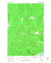
 - 1953 Map of Ashland, 1964 Print
 1953 Ashland1964 Print · USGSNorthern Wisconsin's lakefront and timberlands are seen here in the mid-1950s, showing the intersection of industrial rail lines and vast wilderness. Genealogists and historians can trace the Soo Line through rail towns like Mellen or locate family roots in the Apostle Islands and Bad River Indian Reservation.3 unique versions available
 - 1958 Map of Ashland
 1958 Ashland1958 Print · USGSCoastal Wisconsin and the Michigan borderlands meet here in the late fifties, dominated by the timbered expanses and iron-rich ranges. Genealogists can trace family footprints in settlements like Odanah and Montreal, or locate landmarks such as the Coast Guard Station and Agricultural Experiment Station.
 - 1964 Map of Sand Island, 1965 Print
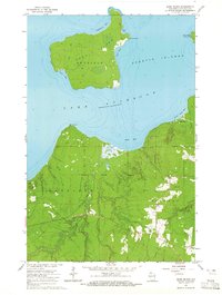 1964 Sand Island1965 Print · USGSBayfield County's northern coast and the Apostle Islands come into focus during the mid-sixties, showing the intersection of tribal lands and maritime navigation. You can trace the trails and lighthouse on Sand Island or locate resources like the Gravel Pits near the Raspberry River.2 unique versions available
 - 1964 Map of Bayfield, 1965 Print
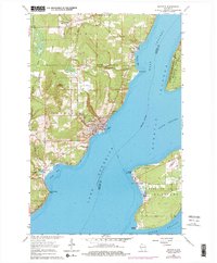
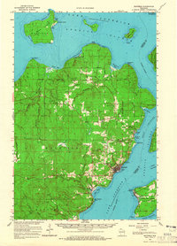 1964 Bayfield1965 Print · USGSThe Bayfield Peninsula and Apostle Islands are captured in the mid-1960s, showing the intersection of tribal lands and Lake Superior maritime life. Researchers can trace the Chicago and North Western rail line and locate landmarks like the Bayfield State Fish Hatchery and Calvary Cem.
 - 1964 Map of York Island, 1965 Print
 1964 York Island1965 Print · USGSThe Bayfield Peninsula and the Apostle Islands appear here in the mid-1960s, showing a landscape defined by tribal lands and maritime navigation. Trace the borders of the Red Cliff Indian Reservation and locate landmarks like the Light on Raspberry Island.
 - 1964 Map of Mt. Ashwabay, 1965 Print
 1964 Mt. Ashwabay1965 Print · USGSThe Bayfield Peninsula highlands in the mid-1960s reveal a landscape defined by forest-shrouded peaks and Lake Superior drainage. Local researchers can trace the headwaters of the Little Sioux River and Sand River, or locate industrial sites like the Gravel Pit near Mt Ashwabay.2 unique versions available
 - 1964 Map of Bayfield, 1976 Print
 1964 Bayfield1976 Print · USGSBayfield and the Apostle Islands appear in the mid-1960s just as the region's maritime and forest identities were being preserved. Trace the local history of La Pointe on Madeline Island or locate family sites at Evergreen Cem and Calvary Cem.2 unique versions available
 - 1989 Map of Ashland
 1989 Ashland1989 Print · USGSCoastal Wisconsin and Michigan at the end of the 1980s show a landscape of deep-water bays, island preserves, and industrial timber towns. Researchers can trace the rail lines of the Soo Line and identify landmarks from Big Bay State Park to the Bad River Indian Reservation.
End of results
Showing maps 1-10 of 10
Top cities near Russell
Top neighborhoods of Russell
Frequently asked questions
- What are the different types of historical maps available for Russell?
- What is the oldest map of Russell?
- Where can I purchase historical maps of Russell for my home or office?
- Where can I download high-res historical maps of Russell?
- Are there historical topographic maps available for Russell?
- Is there historical aerial imagery available for Russell?
- Where are historical maps of Russell sourced from?