1970s Maps of Maxville, Wisconsin
Explore 2 historic maps of Maxville from the 1970s. These maps offer a rare glimpse into what life looked like during the 1970s — showing old roads, neighborhoods, homes, and landmarks that have changed or disappeared over time.
Whether you're researching your family's past, planning a metal detecting trip, or studying how Maxville's landscape evolved across the 1970s, these high-resolution maps are a powerful tool for exploring the history of this region.
- Focus on a specific era: All maps on this page are from the 1970s, giving you a focused view of this time period.
- See what’s changed: Compare century-old streets, trails, and buildings to today's modern landscape using overlays and satellite layers.
- Research with precision: Use these maps for genealogy, historical research, land use analysis, or educational projects.
- View, download, or print: Maps are fully viewable online in high resolution, and can be downloaded or printed for your own records.
Start exploring Maxville's history through authentic maps from the 1970s. This is your window into the past.
Maxville, WI maps
(2)- 1972 Map of Ella, 1975 Print
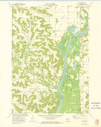 1972 Ella1975 Print · USGSThe river bluffs and bottomlands of the Chippewa River valley are captured here in the early seventies, showing a landscape defined by water and rail. Genealogists and local historians can locate Little Plum Church, Maxville Cemetery, and the remote heights of Goatback.
 - 1972 Map of Durand South, 1975 Print
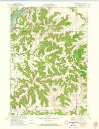 1972 Durand South1975 Print · USGSThe river and rail corridor of the Chippewa River meets the rugged bluff country of Buffalo County during the early 1970s. Researchers can trace the path of the Chicago Milwaukee St Paul and Pacific RR or locate family sites at St Mary Cem and North Branch Cem.2 unique versions available
End of results
Showing maps 1-2 of 2
Top cities near Maxville
- Wabasha historical maps
- Red Cedar historical maps
- Durand historical maps
- Elmwood historical maps
- Eau Galle historical maps
- Pepin historical maps
See more
Top neighborhoods of Maxville
Frequently asked questions
- What are the different types of historical maps available for Maxville?
- What is the oldest map of Maxville?
- Where can I purchase historical maps of Maxville for my home or office?
- Where can I download high-res historical maps of Maxville?
- Are there historical topographic maps available for Maxville?
- Is there historical aerial imagery available for Maxville?
- Where are historical maps of Maxville sourced from?