2020s Maps of Daniels, Wisconsin
Explore 4 historic maps of Daniels from the 2020s. These maps offer a rare glimpse into what life looked like during the 2020s — showing old roads, neighborhoods, homes, and landmarks that have changed or disappeared over time.
Whether you're researching your family's past, planning a metal detecting trip, or studying how Daniels's landscape evolved across the 2020s, these high-resolution maps are a powerful tool for exploring the history of this region.
- Focus on a specific era: All maps on this page are from the 2020s, giving you a focused view of this time period.
- See what’s changed: Compare century-old streets, trails, and buildings to today's modern landscape using overlays and satellite layers.
- Research with precision: Use these maps for genealogy, historical research, land use analysis, or educational projects.
- View, download, or print: Maps are fully viewable online in high resolution, and can be downloaded or printed for your own records.
Start exploring Daniels's history through authentic maps from the 2020s. This is your window into the past.
Daniels, WI maps
(4)- 2022 Map of Falun, 2022 Print
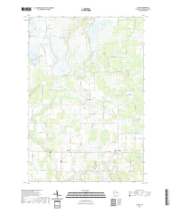 2022 Falun2022 Print · USGSThe rural landscape of Burnett County is captured here in the early twenty-first century, showing the small communities of Falun and Alpha. Genealogists and local historians can trace legacy sites like Falun Settlers Cem and the North Fork Flowage.
 - 2022 Map of Frederic, 2022 Print
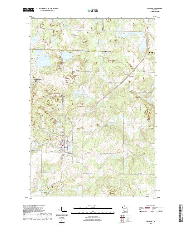 2022 Frederic2022 Print · USGSFrederic and the surrounding lake country of Polk and Burnett Counties are shown here in 2022. Researchers can locate the West Sweden Cem and trace the paths of the Trade River and Wood River through the timber and farm plots.
 - 2022 Map of Trade Lake, 2022 Print
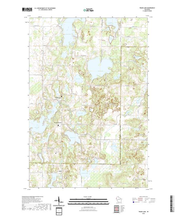 2022 Trade Lake2022 Print · USGSBurnett and Polk Counties are mapped here in the early twenty-first century as a region of dense glacial lakes and historic crossroads. Genealogists can trace local roots at Mission Cem and Union Cem or explore early settlement patterns at Four Corners and Atlas.
 - 2022 Map of Siren West, 2022 Print
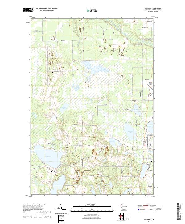 2022 Siren West2022 Print · USGSBurnett County’s lake country is captured here in the early twenty-first century, showing a landscape defined by water and woods. Genealogists can locate family landmarks like Chelmo Cem and Karlsborg Cem or follow the path of the Gandy Dancer State Trl.
End of results
Showing maps 1-4 of 4
Top cities near Daniels
- Grantsburg historical maps
- Frederic historical maps
- Luck historical maps
- Trade Lake historical maps
- Siren historical maps
- Webster historical maps
See more
Top neighborhoods of Daniels
Frequently asked questions
- What are the different types of historical maps available for Daniels?
- What is the oldest map of Daniels?
- Where can I purchase historical maps of Daniels for my home or office?
- Where can I download high-res historical maps of Daniels?
- Are there historical topographic maps available for Daniels?
- Is there historical aerial imagery available for Daniels?
- Where are historical maps of Daniels sourced from?