1970s Maps of Bloomer, Wisconsin
Explore 4 historic maps of Bloomer from the 1970s. These maps offer a rare glimpse into what life looked like during the 1970s — showing old roads, neighborhoods, homes, and landmarks that have changed or disappeared over time.
Whether you're researching your family's past, planning a metal detecting trip, or studying how Bloomer's landscape evolved across the 1970s, these high-resolution maps are a powerful tool for exploring the history of this region.
- Focus on a specific era: All maps on this page are from the 1970s, giving you a focused view of this time period.
- See what’s changed: Compare century-old streets, trails, and buildings to today's modern landscape using overlays and satellite layers.
- Research with precision: Use these maps for genealogy, historical research, land use analysis, or educational projects.
- View, download, or print: Maps are fully viewable online in high resolution, and can be downloaded or printed for your own records.
Start exploring Bloomer's history through authentic maps from the 1970s. This is your window into the past.
Bloomer, WI maps
(4)- 1975 Map of Bloomer, 1978 Print
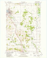 1975 Bloomer1978 Print · USGSBloomer and the surrounding townships of Tilden and Woodmohr are captured here in the mid-seventies, showing a landscape defined by the C & NW rail line. Genealogists can trace family names through sites like Tilden Cem, Eagleton Cem, and Scandinavian Ch.
 - 1975 Map of New Auburn, 1978 Print
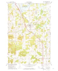 1975 New Auburn1978 Print · USGSWestern Wisconsin life in the mid-seventies centers on the village of New Auburn and its position along the Chicago and North Western railroad. Researchers can locate family sites at the New Auburn Cem, trace Duncan Creek, or explore the wooded Old Maids Bluff.
 - 1975 Map of Como Creek, 1978 Print
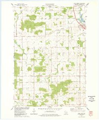 1975 Como Creek1978 Print · USGSChippewa County agriculture and township boundaries are captured here in the mid-1970s. Researchers can trace family roots at Cooks Valley Cem, St Johns Ch, and the settlement of Albert along the banks of Como Lake.
 - 1975 Map of Marsh-Miller Lake, 1978 Print
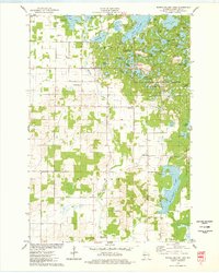 1975 Marsh-Miller Lake1978 Print · USGSChippewa County is captured in the mid-seventies, revealing a glacial landscape defined by the Chippewa Moraine. Search for family roots at Tillinghast Cem or trace the shoreline developments of Marsh-Miller Lake and Long Lake.
End of results
Showing maps 1-4 of 4
Top cities near Bloomer
- Chippewa Falls historical maps
- Bloomer historical maps
- Eagle Point historical maps
- Chetek historical maps
- Anson historical maps
- Tilden historical maps
See more
Frequently asked questions
- What are the different types of historical maps available for Bloomer?
- What is the oldest map of Bloomer?
- Where can I purchase historical maps of Bloomer for my home or office?
- Where can I download high-res historical maps of Bloomer?
- Are there historical topographic maps available for Bloomer?
- Is there historical aerial imagery available for Bloomer?
- Where are historical maps of Bloomer sourced from?