1900s (20th Century) Maps of Cleveland, Wisconsin
Explore 12 historic maps of Cleveland from the 1900s (20th Century). These maps offer a rare glimpse into what life looked like during the 1900s — showing old roads, neighborhoods, homes, and landmarks that have changed or disappeared over time.
Whether you're researching your family's past, planning a metal detecting trip, or studying how Cleveland's landscape evolved across the 1900s, these high-resolution maps are a powerful tool for exploring the history of this region.
- Focus on a specific era: All maps on this page are from the 1900s, giving you a focused view of this time period.
- See what’s changed: Compare century-old streets, trails, and buildings to today's modern landscape using overlays and satellite layers.
- Research with precision: Use these maps for genealogy, historical research, land use analysis, or educational projects.
- View, download, or print: Maps are fully viewable online in high resolution, and can be downloaded or printed for your own records.
Start exploring Cleveland's history through authentic maps from the 1900s. This is your window into the past.
Cleveland, WI maps
(12)- 1949 Map of Bloomer, 1966 Print
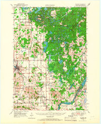 1949 Bloomer1966 Print · USGSThe dairy farms and lake country of northwestern Wisconsin are captured here in the late 1940s. Genealogists can trace rural family roots through numerous local schools and cemeteries, from Mile Corner Sch and Modern Sch to Tillinghast Cem and Rutledge Cem.2 unique versions available
 - 1951 Map of Bloomer
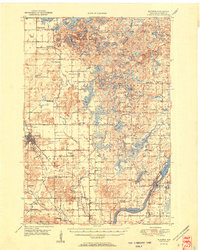 1951 Bloomer1951 Print · USGSPost-war Chippewa County is seen here during a period of rural consolidation across its glaciated lake country. Local researchers can trace family roots through numerous country schools and cemeteries, including Tillinghast Cem, Emanuel Ch, and Larson Sch.2 unique versions available
 - 1951 Map of Cornell, 1953 Print
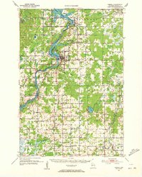 1951 Cornell1953 Print · USGSCentral Chippewa County in the early fifties shows a landscape of river-driven industry and rural community life. Genealogists can trace family roots at Bohemia Cem or St Joseph Cem, and locate numerous schools like Firth Sch (Aband).
 - 1953 Map of Rice Lake, 1967 Print
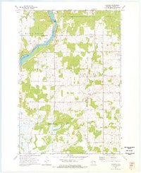
 1953 Rice Lake1967 Print · USGSNorthwest Wisconsin during the mid-fifties reveals a landscape defined by timber, rail, and water. Genealogists and historians can trace the development of river towns like Ladysmith and Rice Lake along the Soo Line and Chicago and North Western railroads.2 unique versions available
 - 1959 Map of Rice Lake
 1959 Rice Lake1959 Print · USGSNorthwest Wisconsin in the late fifties was a land of expanding road networks and deep-seated timber history. Genealogists and historians can trace rail lines like the Soo Line RR and Chicago St Paul Minneapolis and Omaha Ry as they link settlements from Spooner to Medford.
 - 1973 Map of Cornell, 1977 Print
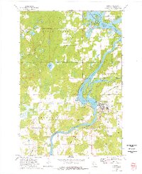 1973 Cornell1977 Print · USGSIn the early seventies, the Chippewa River valley centered around Cornell as a hub of industry and recreation. Local researchers can trace the Chicago and North Western rail line and explore the islands of Brunet Island State Park or the shores of Lake Holcombe.
 - 1973 Map of Crescent, 1977 Print
 1973 Crescent1977 Print · USGSChippewa County in the early seventies remains defined by its winding river valleys and rural crossroads settlements. Researchers can trace the heritage of small communities through landmarks like the Bohemian Cem, Cobban, and the Big Drywood Ch.
 - 1975 Map of Bob Lake, 1978 Print
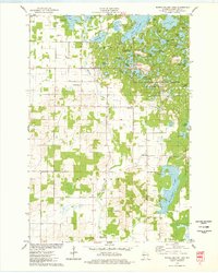
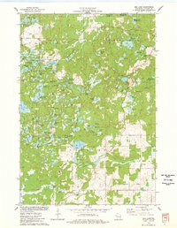 1975 Bob Lake1978 Print · USGSChippewa County is seen here in the mid-seventies, featuring the glacial landforms of the Chippewa Moraine. Researchers can locate community anchors like the Cleveland Cem and Trinity Ch, or trace the winding course of the Rustic Road.
 - 1975 Map of Jim Falls, 1978 Print
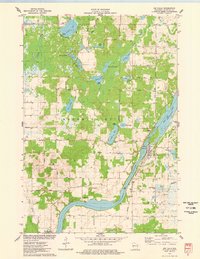 1975 Jim Falls1978 Print · USGSThe Chippewa River valley in the mid-1970s is shown here at its industrial and recreational peak. Local historians can trace the Chicago and North Western rail line and locate landmarks like the Copp Cem and the Substa Powerplant at Jim Falls.
 - 1975 Map of Bloomer, 1978 Print
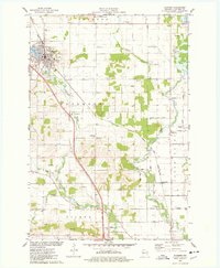 1975 Bloomer1978 Print · USGSBloomer and the surrounding townships of Tilden and Woodmohr are captured here in the mid-seventies, showing a landscape defined by the C & NW rail line. Genealogists can trace family names through sites like Tilden Cem, Eagleton Cem, and Scandinavian Ch.
 - 1975 Map of Marsh-Miller Lake, 1978 Print
 1975 Marsh-Miller Lake1978 Print · USGSChippewa County is captured in the mid-seventies, revealing a glacial landscape defined by the Chippewa Moraine. Search for family roots at Tillinghast Cem or trace the shoreline developments of Marsh-Miller Lake and Long Lake.
 - 1980 Map of Bloomer
 1980 Bloomer1980 Print · USGSNorthwestern Wisconsin at the start of the eighties shows a landscape deeply connected to its rivers and rail lines. Genealogists and historians can trace the growth of Bloomer, Ladysmith, and Chetek or locate local landmarks like Brunet Island State Park and the Soo Line rail corridors.
End of results
Showing maps 1-12 of 12
Top cities near Cleveland
- Chippewa Falls historical maps
- Bloomer historical maps
- Eagle Point historical maps
- Anson historical maps
- Cornell historical maps
- Cadott historical maps
See more
Frequently asked questions
- What are the different types of historical maps available for Cleveland?
- What is the oldest map of Cleveland?
- Where can I purchase historical maps of Cleveland for my home or office?
- Where can I download high-res historical maps of Cleveland?
- Are there historical topographic maps available for Cleveland?
- Is there historical aerial imagery available for Cleveland?
- Where are historical maps of Cleveland sourced from?