2020s Maps of Lake Hallie, Wisconsin
Explore 3 historic maps of Lake Hallie from the 2020s. These maps offer a rare glimpse into what life looked like during the 2020s — showing old roads, neighborhoods, homes, and landmarks that have changed or disappeared over time.
Whether you're researching your family's past, planning a metal detecting trip, or studying how Lake Hallie's landscape evolved across the 2020s, these high-resolution maps are a powerful tool for exploring the history of this region.
- Focus on a specific era: All maps on this page are from the 2020s, giving you a focused view of this time period.
- See what’s changed: Compare century-old streets, trails, and buildings to today's modern landscape using overlays and satellite layers.
- Research with precision: Use these maps for genealogy, historical research, land use analysis, or educational projects.
- View, download, or print: Maps are fully viewable online in high resolution, and can be downloaded or printed for your own records.
Start exploring Lake Hallie's history through authentic maps from the 2020s. This is your window into the past.
Lake Hallie, WI maps
(3)- 2022 Map of Lake Wissota, 2022 Print
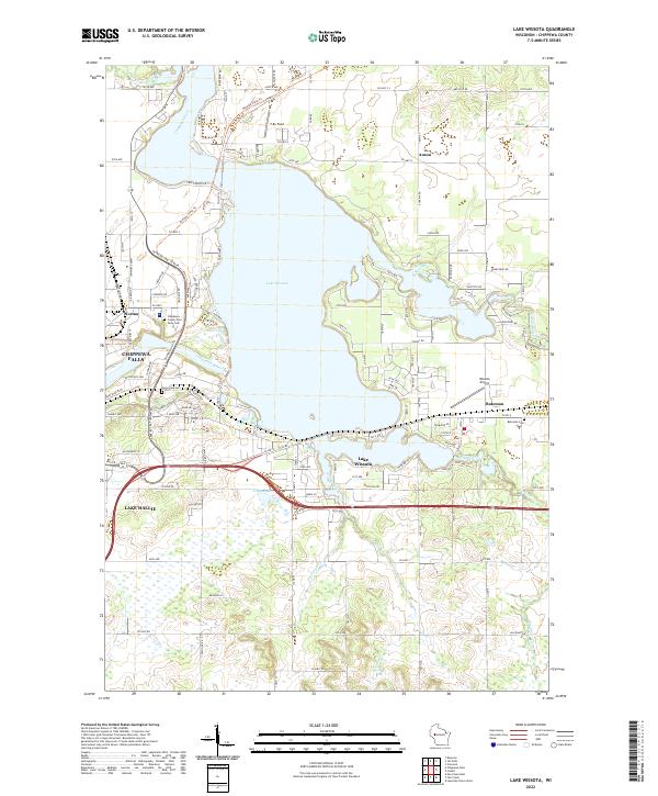 2022 Lake Wissota2022 Print · USGSThe waters of Lake Wissota and the Chippewa River define this region east of Chippewa Falls in the early 21st century. Researchers can trace local history through the Bateman Cem or follow the Old Abe State Trl through Norma.
 - 2022 Map of Eau Claire East, 2022 Print
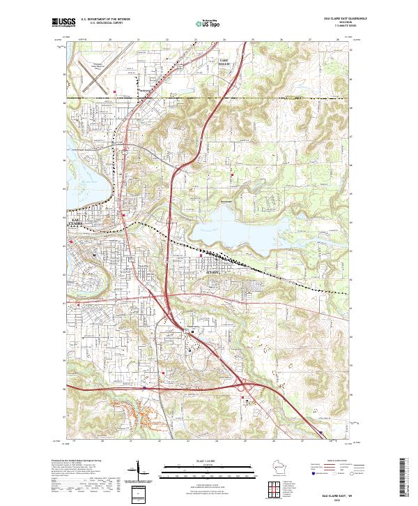 2022 Eau Claire East2022 Print · USGSThe eastern reaches of Eau Claire and the city of Altoona are captured here during a period of significant suburban expansion in the early 2020s. Researchers can trace local landmarks like Mt Tom, the University of Wisconsin-Eau Claire, and historic burial sites such as Forest Hill Cem.
 - 2022 Map of Chippewa Falls, 2022 Print
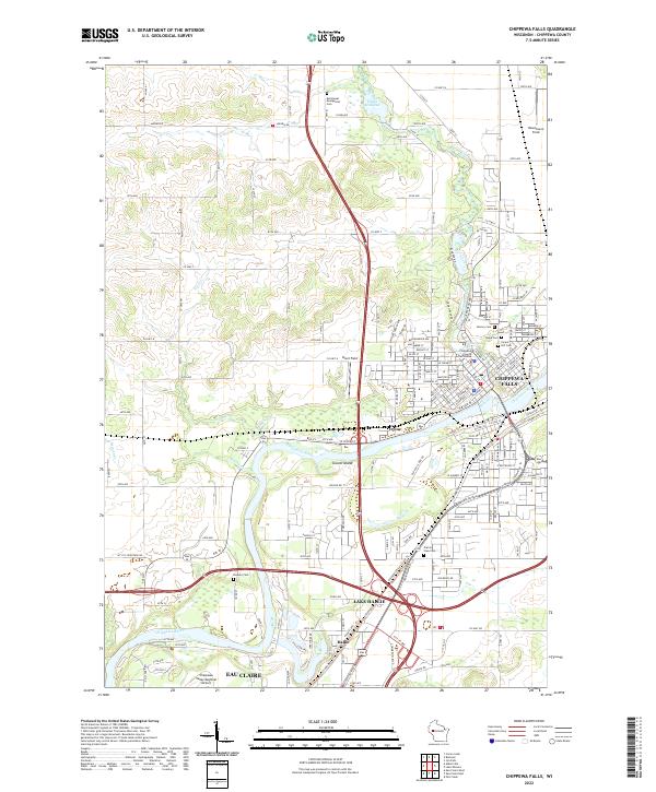 2022 Chippewa Falls2022 Print · USGSThe confluence of the Chippewa River and Duncan Creek anchors this recent look at the Chippewa Valley. Researchers can trace local history through the Chippewa County Courthouse and numerous burial grounds like Prairie View Cem and Forest Hill Cem.
End of results
Showing maps 1-3 of 3
Top cities near Lake Hallie
- Eau Claire historical maps
- Chippewa Falls historical maps
- Altoona historical maps
- Town of Washington historical maps
- Town of Lafayette historical maps
- Bloomer historical maps
See more
Frequently asked questions
- What are the different types of historical maps available for Lake Hallie?
- What is the oldest map of Lake Hallie?
- Where can I purchase historical maps of Lake Hallie for my home or office?
- Where can I download high-res historical maps of Lake Hallie?
- Are there historical topographic maps available for Lake Hallie?
- Is there historical aerial imagery available for Lake Hallie?
- Where are historical maps of Lake Hallie sourced from?