2020s Maps of Lodi, Wisconsin
Explore 4 historic maps of Lodi from the 2020s. These maps offer a rare glimpse into what life looked like during the 2020s — showing old roads, neighborhoods, homes, and landmarks that have changed or disappeared over time.
Whether you're researching your family's past, planning a metal detecting trip, or studying how Lodi's landscape evolved across the 2020s, these high-resolution maps are a powerful tool for exploring the history of this region.
- Focus on a specific era: All maps on this page are from the 2020s, giving you a focused view of this time period.
- See what’s changed: Compare century-old streets, trails, and buildings to today's modern landscape using overlays and satellite layers.
- Research with precision: Use these maps for genealogy, historical research, land use analysis, or educational projects.
- View, download, or print: Maps are fully viewable online in high resolution, and can be downloaded or printed for your own records.
Start exploring Lodi's history through authentic maps from the 2020s. This is your window into the past.
Lodi, WI maps
(4)- 2022 Map of Arlington, 2022 Print
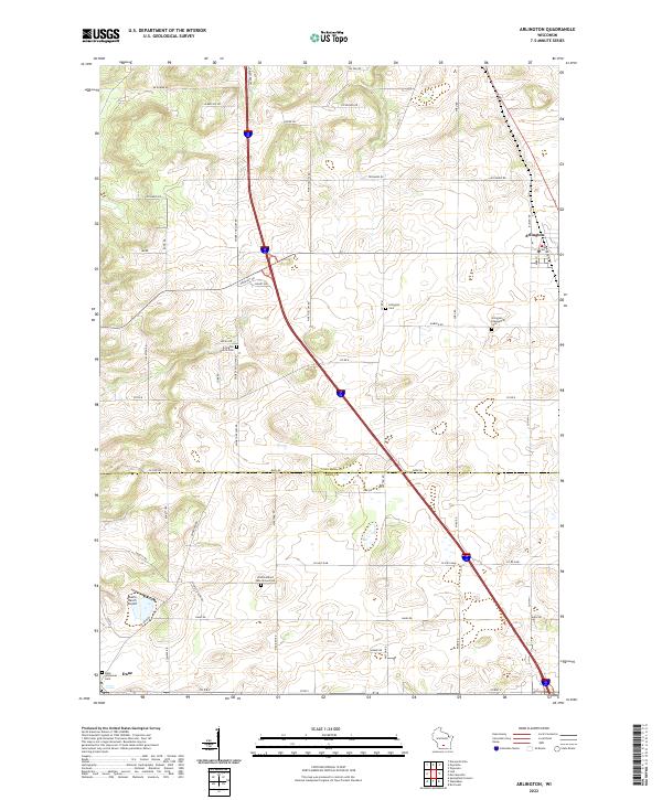 2022 Arlington2022 Print · USGSThe fertile prairie of the Columbia and Dane County border is documented here in the early twenty-first century. Researchers can locate family landmarks such as Arlington Prairie Cem, One Hundred Mile Grove Cem, and the village of Arlington.
 - 2022 Map of Durwards Glen, 2022 Print
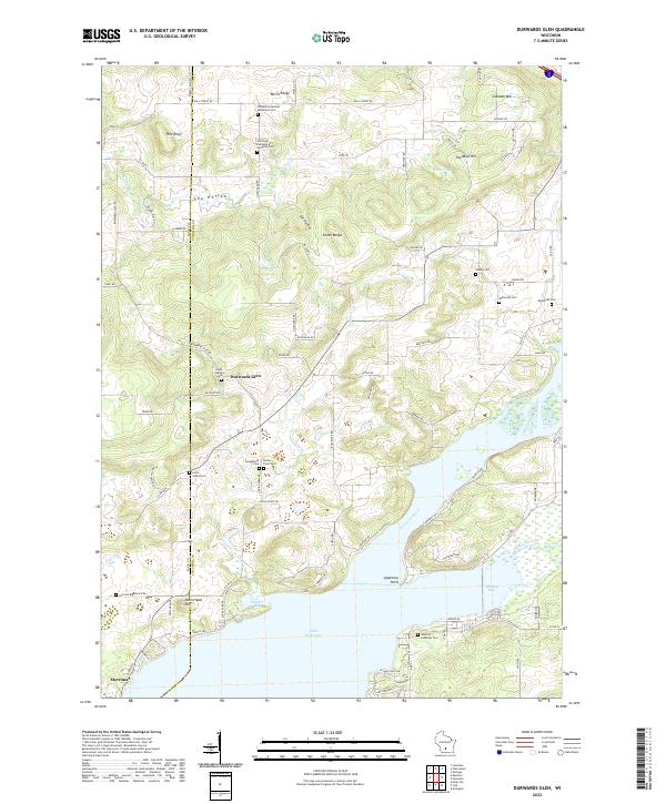 2022 Durwards Glen2022 Print · USGSThe Baraboo Range meets the Wisconsin River in the early 2020s, revealing a landscape where high ridges give way to expansive river bays. Genealogists can trace a remarkable number of rural burial sites, from Indian Farm Cem and Shanks Cem to the Caledonia German Methodist Cem.
 - 2022 Map of Poynette, 2022 Print
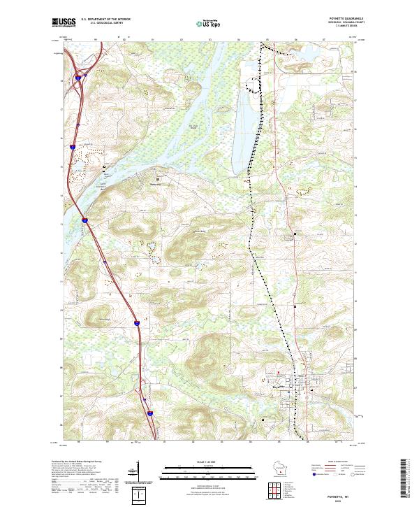 2022 Poynette2022 Print · USGSThe river valley and rail corridor around Poynette are shown in detail in this modern survey. Researchers can trace family history at numerous rural sites including Hillside Cemetery, Dekorra, and the riverfront bluffs near Lib Gross Island.
 - 2022 Map of Lodi, 2022 Print
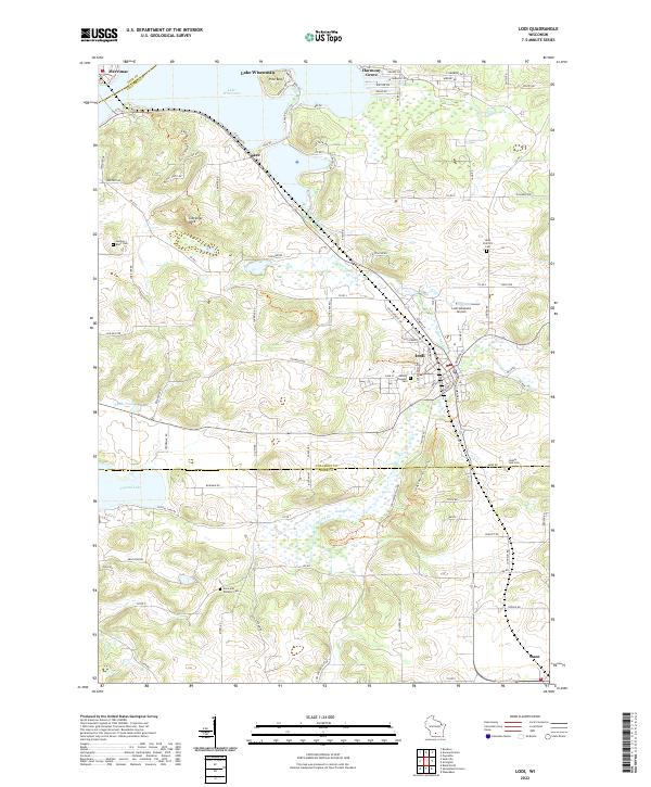 2022 Lodi2022 Print · USGSThe glacier-carved landscape of Columbia and Dane Counties is captured here in the early twenty-first century, centered on the historic river town of Lodi. Genealogists and hikers can trace the Ice Age National Scenic Trl past landmarks like Gibraltar Rock and Saint Patrick's Cem.
End of results
Showing maps 1-4 of 4
Top cities near Lodi
- Madison historical maps
- Middleton historical maps
- Waunakee historical maps
- Baraboo historical maps
- DeForest historical maps
- Portage historical maps
See more
Top neighborhoods of Lodi
Frequently asked questions
- What are the different types of historical maps available for Lodi?
- What is the oldest map of Lodi?
- Where can I purchase historical maps of Lodi for my home or office?
- Where can I download high-res historical maps of Lodi?
- Are there historical topographic maps available for Lodi?
- Is there historical aerial imagery available for Lodi?
- Where are historical maps of Lodi sourced from?