1930s Maps of Crawford County, Wisconsin
Explore 4 historic maps of Crawford County from the 1930s. These maps offer a rare glimpse into what life looked like during the 1930s — showing old roads, neighborhoods, homes, and landmarks that have changed or disappeared over time.
Whether you're researching your family's past, planning a metal detecting trip, or studying how Crawford County's landscape evolved across the 1930s, these high-resolution maps are a powerful tool for exploring the history of this region.
- Focus on a specific era: All maps on this page are from the 1930s, giving you a focused view of this time period.
- See what’s changed: Compare century-old streets, trails, and buildings to today's modern landscape using overlays and satellite layers.
- Research with precision: Use these maps for genealogy, historical research, land use analysis, or educational projects.
- View, download, or print: Maps are fully viewable online in high resolution, and can be downloaded or printed for your own records.
Start exploring Crawford County's history through authentic maps from the 1930s. This is your window into the past.
Crawford County, WI maps
(4)- 1932 Map of Ferryville
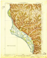 1932 Ferryville1932 Print · USGSThe Mississippi River bottoms and the ridge-and-hollow country of western Wisconsin are captured here in the early 1930s. Genealogists can trace family farm locations near dozens of rural landmarks like Redmound School, Freeman Church, and Battle Slough.
 - 1932 Map of Prairie Du Chien
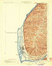 1932 Prairie Du Chien1932 Print · USGSCrawford County at the confluence of the two great rivers in the early thirties shows a landscape of ridge-top schools and bustling riverfront rail towns. Genealogists can trace family footprints at Wrights Ferry, Hazen Corners, or rural outposts like Lamer Ridge Sch.4 unique versions available
 - 1933 Map of Boaz
 1933 Boaz1933 Print · USGSRichland and Vernon counties are shown in the early thirties as a landscape of steep ridges and school-rich valleys. Genealogists can trace family roots through dozens of rural schools and churches, from Rolling Ground and Jimtown to the Dieter Hollow Church.2 unique versions available
 - 1933 Map of Boscobel
 1933 Boscobel1933 Print · USGSThe Driftless Area of Southwest Wisconsin is captured here in the early 1930s, showing the intricate ridge-and-valley landscape of Grant and Richland counties. Researchers can locate dozens of country schools and churches, including Rock Elm School, Steele Cem, and the riverfront village of Port Andrew.2 unique versions available
End of results
Showing maps 1-4 of 4
Top cities of Crawford County
- Prairie du Chien historical maps
- Bridgeport historical maps
- Seneca historical maps
- Wauzeka historical maps
- Soldiers Grove historical maps
- Gays Mills historical maps
See more
Frequently asked questions
- What are the different types of historical maps available for Crawford County?
- What is the oldest map of Crawford County?
- Where can I purchase historical maps of Crawford County for my home or office?
- Where can I download high-res historical maps of Crawford County?
- Are there historical topographic maps available for Crawford County?
- Is there historical aerial imagery available for Crawford County?
- Where are historical maps of Crawford County sourced from?