Old Maps of Crawford County, Wisconsin for Academic Research
Study the evolution of Crawford County with 160 high-resolution historic maps. Whether you're teaching, researching, or modeling changes in land use, these maps provide essential visual documentation of urban, environmental, and geographic change.
- Analyze long-term change: Track patterns in development, transportation, and natural features.
- Ideal for environmental or urban studies: Support academic projects with primary historical map data.
- Use in the classroom or lab: Educators and researchers rely on these maps to bring historical context to life.
These maps are a powerful tool for teaching, research, and visualizing how Crawford County has changed over the decades.
Crawford County, WI maps
(160)- 1902 Map of Elkader
 1902 Elkader1902 Print · USGSNortheast Iowa at the turn of the century is defined by the deep river valleys of the Mississippi, Turkey, and Volga. Genealogists and historians can trace rail lines and early settlements like Elkader, Guttenberg, and Elkport as they appeared in 1898.4 unique versions available
 - 1903 Map of Waukon
 1903 Waukon1903 Print · USGSThe Upper Mississippi River valley comes alive in the early 1900s, showing a landscape of steep bluffs, river landings, and early rail lines. You can trace the path of the Chicago Milwaukee and St. Paul RR to the county seat at Waukon or find old riverfront points like Harpers Ferry and Lansing.5 unique versions available
 - 1924 Map of Gays Mills, 1957 Print
 1924 Gays Mills1957 Print · USGSCrawford County's ridgelands and the Kickapoo River valley are captured in detail during the mid-twenties, showing the region's rural character before modern road realignment. Genealogists can locate dozens of country schoolhouses and churches, from Liberty Pole to the Nash Church, alongside family landmarks like Monument Rock.
 - 1926 Map of Gays Mills
 1926 Gays Mills1926 Print · USGSCrawford and Vernon Counties are captured during the mid-twenties when the Kickapoo River valley was a bustling rail corridor. Genealogists can trace hundreds of family-named features like Helgerson Ridge, McManus Valley, and many rural institutions including Evergreen Cemetery and the Southwest Prairie Church.
 - 1926 Map of Wauzeka
 1926 Wauzeka1926 Print · USGSThe confluence of the Kickapoo and Wisconsin Rivers in the 1920s reveals a landscape of ridge-top schools and valley railroads. Genealogists can trace family locations near Wauzeka, Woodman, and the Crawford County Infirmary, or find old rural sites like Anderson Mills.2 unique versions available
 - 1929 Map of Ferryville, 1957 Print
 1929 Ferryville1957 Print · USGSThe riverfront and ridge-top communities of Crawford and Vernon counties are captured here in the late 1920s before major lock and dam construction. Genealogists can locate family landmarks such as Freeman Church, Redmound School, and the riverside tracks of the Chicago Burlington and Quincy Railroad.2 unique versions available
 - 1929 Map of Prairie Du Chien, 1963 Print
 1929 Prairie Du Chien1963 Print · USGSThe Mississippi River valley of Crawford County at the end of the twenties shows a landscape of complex sloughs and rugged ridges. Genealogists can locate family schoolhouses like Frenchtown Sch and Hazen Corners Sch or trace the early rail lines through Prairie du Chien.
 - 1932 Map of Ferryville
 1932 Ferryville1932 Print · USGSThe Mississippi River bottoms and the ridge-and-hollow country of western Wisconsin are captured here in the early 1930s. Genealogists can trace family farm locations near dozens of rural landmarks like Redmound School, Freeman Church, and Battle Slough.
 - 1932 Map of Prairie Du Chien
 1932 Prairie Du Chien1932 Print · USGSCrawford County at the confluence of the two great rivers in the early thirties shows a landscape of ridge-top schools and bustling riverfront rail towns. Genealogists can trace family footprints at Wrights Ferry, Hazen Corners, or rural outposts like Lamer Ridge Sch.4 unique versions available
 - 1933 Map of Boaz
 1933 Boaz1933 Print · USGSRichland and Vernon counties are shown in the early thirties as a landscape of steep ridges and school-rich valleys. Genealogists can trace family roots through dozens of rural schools and churches, from Rolling Ground and Jimtown to the Dieter Hollow Church.2 unique versions available
 - 1933 Map of Boscobel
 1933 Boscobel1933 Print · USGSThe Driftless Area of Southwest Wisconsin is captured here in the early 1930s, showing the intricate ridge-and-valley landscape of Grant and Richland counties. Researchers can locate dozens of country schools and churches, including Rock Elm School, Steele Cem, and the riverfront village of Port Andrew.2 unique versions available
 - 1958 Map of La Crosse, 1979 Print
 1958 La Crosse1979 Print · USGSThe Driftless Area of Wisconsin and Iowa is captured here during the late seventies, showing the intricate river valleys and ridge-top settlements. Genealogists and historians can trace the rail corridors of the Soo Line or locate landmarks like Grandad Bluff and Effigy Mounds National Monument.2 unique versions available
 - 1959 Map of Dubuque, 1982 Print
 1959 Dubuque1982 Print · USGSThe Tri-State region comes alive in the mid-twentieth century as a hub of river commerce and rail transit. Genealogists and historians can trace the paths of the Illinois Central Gulf through Dubuque or locate the Savanna Ordnance Depot and Lock and Dam No 11.
 - 1961 Map of Dubuque
 1961 Dubuque1961 Print · USGSThe Tri-State region's river-and-rail landscape is captured here during the early sixties, showing the convergence of Iowa, Illinois, and Wisconsin. Trace mid-century rail lines like the Chicago Great Western Ry and explore sites like the Savanna Ordnance Depot and Backbone State Park.
 - 1961 Map of La Crosse
 1961 La Crosse1961 Print · USGSThe Driftless Area at the start of the 1960s reveals a complex network of river towns and rail lines along the Mississippi River. Genealogists and historians can trace old settlements like New Amsterdam and Wyattville or locate major landmarks like Camp McCoy Military Reservation and Effigy Mounds National Monument.
 - 1962 Map of Dubuque
 1962 Dubuque1962 Print · USGSThe Tri-State region's river-and-rail economy is captured here in the early sixties, centered on the Mississippi River bluffs. Genealogists and historians can locate Numerous lead and zinc mines, the New Melleray Abbey Monastery, and rural hubs like Saint Olaf.2 unique versions available
 - 1962 Map of Clayton
 1962 Clayton1962 Print · USGSThe Upper Mississippi riverfront in the early sixties is defined by a dense network of islands and competing rail lines. Genealogists can locate family sites at the Norwegian Ch Cem or Clayton Cem while tracing the old river village of Clayton.3 unique versions available
 - 1962 Map of Bagley, 1964 Print
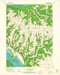 1962 Bagley1964 Print · USGSThe confluence of the Wisconsin and Mississippi Rivers comes to life in the early sixties, showing the vital rail-and-river hub of Grant County. Genealogists can trace the rural landscape near Bagley, Brodtville, and family sites like Lumpkin Cem.
 - 1965 Map of La Crosse
 1965 La Crosse1965 Print · USGSThe Driftless Area and the Upper Mississippi valley are captured here during a period of steady mid-century growth. Researchers can trace the rail lines of the Chicago and North Western or locate riverfront sites like Effigy Mounds National Monument and the Camp McCoy Military Reservation.
 - 1966 Map of Gays Mills, 1968 Print
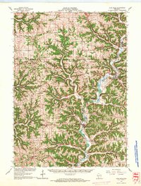 1966 Gays Mills1968 Print · USGSCrawford and Vernon counties in the mid-sixties show a landscape of steep ridges and winding river bottoms. Genealogists and historians can trace family roots through the Southwest Prairie Ch, the Rising Sun Sch, and small settlements like Petersburg and Fargo.
 - 1966 Map of Ferryville, 1968 Print
 1966 Ferryville1968 Print · USGSThe Mississippi River valley in the mid-sixties is shown in detail, capturing the intricate sloughs and ridges along the Wisconsin and Iowa border. Researchers can trace the riverfront rail lines and find small upland landmarks like Red Mound, Retreat, and Walnut Mound Cem.2 unique versions available
 - 1966 Map of Boaz, 1968 Print
 1966 Boaz1968 Print · USGSRichland County's ridge-and-valley landscape is captured here in the mid-1960s, showing a network of rural settlements and family-named hollows. Researchers can trace local history through sites like Kickapoo Center Ch, Rolling Ground, and the Tavera Sch.
 - 1967 Map of Prairie Du Chien, 1969 Print
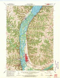 1967 Prairie Du Chien1969 Print · USGSThe river-and-rail hub of the Upper Mississippi comes alive in this late-sixties study of the Wisconsin-Iowa border. Genealogists can locate family names at Campbell Cem and Hazen Corners Cem or trace old rail lines through Harpers Ferry and Marquette.
 - 1967 Map of Boscobel, 1970 Print
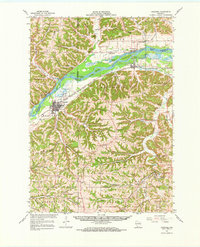 1967 Boscobel1970 Print · USGSWisconsin's Driftless Area in the late sixties shows a landscape of deep hollows and river islands along the Wisconsin River. Genealogists and local historians can trace family locations near rural landmarks like St Patrick Cem, the Wayside Chapel, and the riverside settlement of Blue River.
 - 1967 Map of Wauzeka, 1970 Print
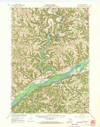 1967 Wauzeka1970 Print · USGSCrawford and Grant Counties are captured here in the late sixties as the river valleys and ridge-top farms maintained their traditional layouts. Trace the paths of the Chicago Milwaukee St Paul and Pacific railroad through Wauzeka or locate rural landmarks like St Lawrence Ch and the Kickapoo Indian Caverns.
Showing maps 1-25 of 160
Top cities of Crawford County
- Prairie du Chien historical maps
- Bridgeport historical maps
- Seneca historical maps
- Wauzeka historical maps
- Soldiers Grove historical maps
- Gays Mills historical maps
See more
Frequently asked questions
- What are the different types of historical maps available for Crawford County?
- What is the oldest map of Crawford County?
- Where can I purchase historical maps of Crawford County for my home or office?
- Where can I download high-res historical maps of Crawford County?
- Are there historical topographic maps available for Crawford County?
- Is there historical aerial imagery available for Crawford County?
- Where are historical maps of Crawford County sourced from?