1980s Maps of Freeman, Wisconsin
Explore 8 historic maps of Freeman from the 1980s. These maps offer a rare glimpse into what life looked like during the 1980s — showing old roads, neighborhoods, homes, and landmarks that have changed or disappeared over time.
Whether you're researching your family's past, planning a metal detecting trip, or studying how Freeman's landscape evolved across the 1980s, these high-resolution maps are a powerful tool for exploring the history of this region.
- Focus on a specific era: All maps on this page are from the 1980s, giving you a focused view of this time period.
- See what’s changed: Compare century-old streets, trails, and buildings to today's modern landscape using overlays and satellite layers.
- Research with precision: Use these maps for genealogy, historical research, land use analysis, or educational projects.
- View, download, or print: Maps are fully viewable online in high resolution, and can be downloaded or printed for your own records.
Start exploring Freeman's history through authentic maps from the 1980s. This is your window into the past.
Freeman, WI maps
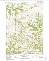
(8)- 1983 Map of Mt. Sterling
 1983 Mt. Sterling1983 Print · USGSHigh ridges and deep coulees dominate the Crawford County landscape in the early eighties. Researchers can trace rural lineages through sites like Evergreen Cem, Utica Ch, and the small settlement of Mt Sterling.
 - 1983 Map of Ferryville
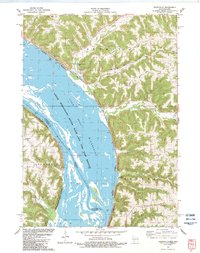 1983 Ferryville1983 Print · USGSThe Mississippi River valley and its high Wisconsin bluffs are captured here in the early eighties. Researchers can trace the riverfront rail lines through Ferryville, locate the Ferryville Cem, and explore the wetlands of Winneshiek Lake.
 - 1983 Map of Rising Sun
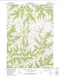
 1983 Rising Sun1983 Print · USGSThe Vernon and Crawford County borderlands come to life in the early 1980s, showing a landscape of ridge-top settlements and winding valley roads. Genealogists and researchers can trace local family landmarks and community centers like St James Ch, Towerville, and Monument Rock.
 - 1983 Map of Retreat
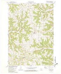
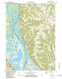
 1983 Retreat1983 Print · USGSThe ridge-and-valley landscape of Vernon County is captured here in the early eighties as a network of rural farmsteads and ridgetop roads. Researchers can trace family history through Retreat, the Freeman Church, and the Walnut Mound Cemetery.
 - 1983 Map of De Soto
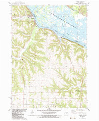
 1983 De Soto1983 Print · USGSThe riverfront settlements of De Soto and Victory sit at the base of dramatic bluffs in the early 1980s. Researchers can trace the dual rail lines of the Burlington Northern and Chicago Milwaukee St Paul and Pacific or find rural landmarks like Lawrence Ridge Cem.
 - 1983 Map of Lansing
 1983 Lansing1983 Print · USGSThe riverfront at Lansing and the bluffs of Allamakee County come alive in this early 1980s portrait of the Mississippi. Researchers can trace rural genealogy at Oak Hill Cem or find local landmarks like Thompson Corner and Wexford.
 - 1985 Map of Decorah
 1985 Decorah1985 Print · USGSNortheast Iowa and western Wisconsin in the mid-eighties show a landscape of high bluffs and river valleys shaped by the Upper Iowa and Mississippi Rivers. Genealogists and historians can trace the paths of the Chicago Milwaukee St Paul and Pacific railroad or locate the National Cemetery and the ancient earthworks at Effigy Mounds National Monument.2 unique versions available
 - 1985 Map of Richland Center, 1991 Print
 1985 Richland Center1991 Print · USGSSouthwest Wisconsin’s driftless landscape in the mid-1980s is defined by its deep river valleys and tight agricultural settlements. Researchers can trace family-named landmarks like Mickelson Ridge or find remote churches and schools near Richland Center and Dodgeville.
End of results
Showing maps 1-8 of 8
Top cities near Freeman
- Viroqua historical maps
- Lansing historical maps
- Seneca historical maps
- Gays Mills historical maps
- New Albin historical maps
- Eastman historical maps
See more
Top neighborhoods of Freeman
Frequently asked questions
- What are the different types of historical maps available for Freeman?
- What is the oldest map of Freeman?
- Where can I purchase historical maps of Freeman for my home or office?
- Where can I download high-res historical maps of Freeman?
- Are there historical topographic maps available for Freeman?
- Is there historical aerial imagery available for Freeman?
- Where are historical maps of Freeman sourced from?