1980s Maps of Dane County, Wisconsin
Explore 10 historic maps of Dane County from the 1980s. These maps offer a rare glimpse into what life looked like during the 1980s — showing old roads, neighborhoods, homes, and landmarks that have changed or disappeared over time.
Whether you're researching your family's past, planning a metal detecting trip, or studying how Dane County's landscape evolved across the 1980s, these high-resolution maps are a powerful tool for exploring the history of this region.
- Focus on a specific era: All maps on this page are from the 1980s, giving you a focused view of this time period.
- See what’s changed: Compare century-old streets, trails, and buildings to today's modern landscape using overlays and satellite layers.
- Research with precision: Use these maps for genealogy, historical research, land use analysis, or educational projects.
- View, download, or print: Maps are fully viewable online in high resolution, and can be downloaded or printed for your own records.
Start exploring Dane County's history through authentic maps from the 1980s. This is your window into the past.
Dane County, WI maps
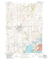
(10)- 1980 Map of North Bristol
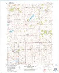
 1980 North Bristol1980 Print · USGSThe agricultural heartland of Columbia and Dane Counties is captured here in the late 1970s. Local researchers can trace family lands and rural landmarks like Hampden Cemetery, the Hampden School, and the winding Crawfish River.
 - 1980 Map of Columbus, 1981 Print
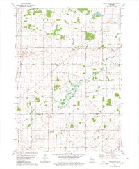
 1980 Columbus1981 Print · USGSColumbus and the surrounding townships thrive along the Crawfish River during the early 1980s, where rail and river define the landscape. Local historians can trace family-named roads and rural sites like North York Cem, Townhall, and the Wisconsin Academy.
 - 1981 Map of Monroe
 1981 Monroe1981 Print · USGSSouthern Wisconsin and the Illinois borderlands come into focus in the early 1980s, showcasing a landscape defined by dairy farming and river valleys. Genealogists can trace family roots through historic hubs like Monroe, Stoughton, and Brodhead, or locate regional landmarks such as Yellowstone Lake and the Sugar River.
 - 1983 Map of Madison East, 1984 Print
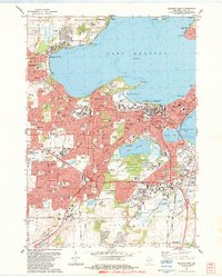
 1983 Madison East1984 Print · USGSMadison and its eastern neighbors are shown at a peak of late-century development amidst the Yahara chain of lakes. Genealogists and researchers can trace local landmarks like Blooming Grove Cem, the McFarland village site, and Truax Field.
 - 1983 Map of Middleton, 1984 Print
 1983 Middleton1984 Print · USGSThe western suburbs of Madison are shown in the early eighties as they expanded into the hills of Dane County. Researchers can trace historical school sites like Kromrey Sch and the rail corridors of the Wisconsin Western and Chicago and North Western.
 - 1983 Map of Waunakee, 1984 Print
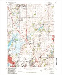
 1983 Waunakee1984 Print · USGSThe north shore of Lake Mendota and the expanding village of Waunakee are captured here in the early eighties. Researchers can trace local lineage through the Vienna Cem and Kingsley Cem, or locate landmarks like the Mendota State Hospital and St. Mary of the Lake Sch.
 - 1983 Map of De Forest, 1984 Print
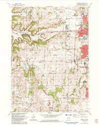
 1983 De Forest1984 Print · USGSThe northern suburbs of Madison are captured here in the early eighties as they expanded toward Windsor and De Forest. Genealogists and local historians can trace family locations near the Hoepker Cem, Norway Grove Ch, and the Pumpkin Hollow Sch.
 - 1983 Map of Madison West, 1984 Print
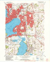
 1983 Madison West1984 Print · USGSThe Madison isthmus and its surrounding lakefronts are shown in detail during the early eighties, from the State Capitol to the growing suburbs of Middleton. Researchers can trace the mid-century city layout, including the University of Wisconsin, Forest Hill Cemetery, and the Arboretum.
 - 1984 Map of Arlington
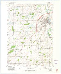
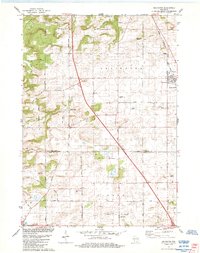 1984 Arlington1984 Print · USGSThe Wisconsin prairie at the border of Columbia and Dane Counties was a thriving rail and agricultural hub in the 1980s. Local researchers can trace family roots at Arlington Prairie Cem and 100 Mile Grove Cem or follow the historic Chicago and North Western rail line.
 - 1984 Map of Morrisonville
 1984 Morrisonville1984 Print · USGSColumbia and Dane counties come into focus in the mid-1980s, showcasing a landscape of established rail lines and agricultural hamlets. Genealogists can trace family roots at North Windsor Church or locate ancestral plots at Greenwood Cemetery and Zion Cemetery.
End of results
Showing maps 1-10 of 10
Top cities of Dane County
- Madison historical maps
- Sun Prairie historical maps
- Fitchburg historical maps
- Middleton historical maps
- Waunakee historical maps
- Stoughton historical maps
See more
Frequently asked questions
- What are the different types of historical maps available for Dane County?
- What is the oldest map of Dane County?
- Where can I purchase historical maps of Dane County for my home or office?
- Where can I download high-res historical maps of Dane County?
- Are there historical topographic maps available for Dane County?
- Is there historical aerial imagery available for Dane County?
- Where are historical maps of Dane County sourced from?