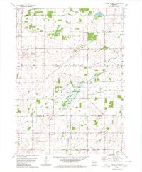
1980 Map of North Bristol
USGS Topo · Published 1980About this map
North Bristol and East Bristol anchor the rural landscape of this southern Wisconsin survey, where the border between Columbia and Dane Counties cuts across a network of established farmsteads and township roads. The drainage of the Crawfish River and Babcock Creek shapes the topography of Hampden and Otsego, while the Maunesha River flows through the southern section in Bristol. This 1980 map preserves the placement of localized community landmarks, such as the Hampden School and Hampden Cemetery, which served the surrounding agricultural families. Numerous family-named thoroughfares, including Monson Road, Conlon Road, and Hasey Road, reveal the enduring footprints of early settlers across the sections. The presence of a Gravel Pit and a centrally located Townhall underscores the local infrastructure supporting these townships as they appeared in the late twentieth century.
Find a feature on this map
38 named features on this map. Tap any name to fly to it.
Don’t see what you’re looking for? This feature index may not catch every label — zoom into the map to look around manually.
Map Details
Editions of this 1980 North Bristol Map
This is the sole edition of this map. No revisions or reprints were ever made.
Other maps of this area

1890 · Madison
USGS Topo · 1:62,500

1890 · Sun Prairie
USGS Topo · 1:62,500

1892 · Madison
USGS Topo · 1:62,500

1896 · Sun Prairie
USGS Topo · 1:62,500

1901 · Poynette
USGS Topo · 1:62,500

1904 · Madison
USGS Topo · 1:62,500

1905 · Sun Prairie
USGS Topo · 1:62,500

1906 · Madison
USGS Topo · 1:62,500

1907 · Sun Prairie
USGS Topo · 1:62,500

1955 · Columbus
USGS Topo · 1:62,500