1960s Maps of Dane County, Wisconsin
Explore 34 historic maps of Dane County from the 1960s. These maps offer a rare glimpse into what life looked like during the 1960s — showing old roads, neighborhoods, homes, and landmarks that have changed or disappeared over time.
Whether you're researching your family's past, planning a metal detecting trip, or studying how Dane County's landscape evolved across the 1960s, these high-resolution maps are a powerful tool for exploring the history of this region.
- Focus on a specific era: All maps on this page are from the 1960s, giving you a focused view of this time period.
- See what’s changed: Compare century-old streets, trails, and buildings to today's modern landscape using overlays and satellite layers.
- Research with precision: Use these maps for genealogy, historical research, land use analysis, or educational projects.
- View, download, or print: Maps are fully viewable online in high resolution, and can be downloaded or printed for your own records.
Start exploring Dane County's history through authentic maps from the 1960s. This is your window into the past.
Dane County, WI maps
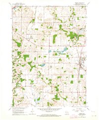
(34)- 1960 Map of Madison
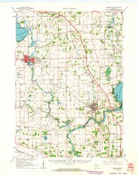
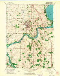
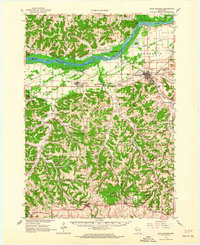
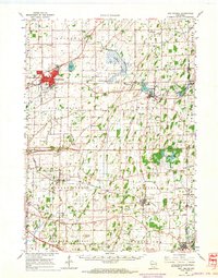
 1960 Madison1960 Print · USGSCentral and Southern Wisconsin are captured in the late fifties, showing the region as its rail-and-river network matured. Trace the paths of the Soo Line RR or locate family roots near Lake Mendota and Horicon National Wildlife Refuge.2 unique versions available
 - 1961 Map of Stoughton, 1963 Print
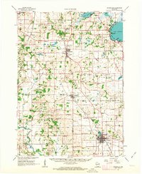
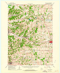
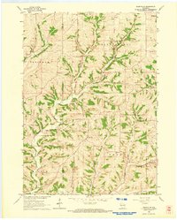
 1961 Stoughton1963 Print · USGSDane and Rock Counties during the early sixties center on the tobacco-processing hubs of the Rock River valley. Genealogists and local researchers can trace family lands near Hanerville, identify remote schools like Bass Lake Sch, or locate historic burials at Jensen Cem and South Porter Cem.2 unique versions available
 - 1961 Map of Evansville, 1963 Print
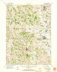
 1961 Evansville1963 Print · USGSThe rural landscape between Madison and Janesville is captured here in the early sixties, showing a robust agricultural economy and well-defined town centers. Genealogists can trace family footprints at Franklin Sch, St Marys Cem, and the crossroads at Butts Corners.2 unique versions available
 - 1961 Map of Evansville, 1964 Print
 1961 Evansville1964 Print · USGSThe Rock County countryside comes alive in the early sixties, centered on the growing community of Evansville. Genealogists and historians can trace the paths between rural settlements like Brooklyn and Union while locating family sites at Graves Cem or Maple Hill Cemetery.3 unique versions available
 - 1961 Map of Attica, 1964 Print
 1961 Attica1964 Print · USGSSouthern Wisconsin farmland at the start of the sixties is defined by the winding Sugar River and the rural townships of Brooklyn and Albany. Genealogists and local historians can trace family sites at Jug Prairie Cem, Oak Grove Sch, and the Peace Ch.2 unique versions available
 - 1961 Map of Oregon, 1964 Print
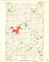
 1961 Oregon1964 Print · USGSSouthern Dane County’s transition from rural farming to mid-century growth is detailed here in the early 1960s. Researchers can trace family roots through Story Cem and Oak Hall, or locate local landmarks like the Wisconsin School for Girls.4 unique versions available
 - 1961 Map of Cooksville, 1964 Print
 1961 Cooksville1964 Print · USGSSouthern Wisconsin farmland is defined by its winding waterways and historic townships in the early sixties. Genealogists and local historians can trace rural school districts like Yahara Sch or find family plots at Ball Tavern Cem and St Michaels Cem.3 unique versions available
 - 1961 Map of Rutland, 1964 Print
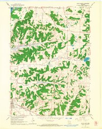
 1961 Rutland1964 Print · USGSThe glacial lakes and wetlands south of Madison are captured here in the early sixties. Genealogists and historians can trace the rural layouts of Rutland and Stone, or find old schoolhouses like Oakside Sch and family-named landmarks like Lunds Point.3 unique versions available
 - 1961 Map of Rockdale, 1964 Print
 1961 Rockdale1964 Print · USGSThe rural landscape of eastern Dane County is captured here in the early 1960s, showing the agricultural heartland between Cambridge and Albion. Researchers can trace the heritage of local families through landmarks like East Koshkonong Cemetery, Smithback School, and the Hickory Hill Girl Scout Camp.2 unique versions available
 - 1961 Map of Stoughton, 1964 Print
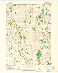
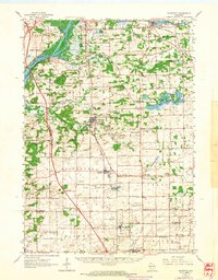
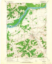
 1961 Stoughton1964 Print · USGSStoughton and the southern Dane County countryside appear in the early sixties as a bustling rail-and-river hub. Researchers can locate local landmarks like the Martin Luther Childrens Home, Nelson Airport, and the Skaalen Cem along the Yahara River.3 unique versions available
 - 1961 Map of Edgerton, 1964 Print
 1961 Edgerton1964 Print · USGSThe tobacco-growing country around the Rock River and Edgerton is captured here during the early sixties. Genealogists and local historians can trace rural schoolhouses like Albion Sch, the rail lines of the Milwaukee Road, and landmarks like Joseph College.2 unique versions available
 - 1962 Map of Cross Plains, 1964 Print
 1962 Cross Plains1964 Print · USGSWestern Dane County in the early sixties shows a landscape of deep valleys and rising ridges between Cross Plains and Mt Horeb. Genealogists and historians can trace family locations through numerous rural sites like St Marys Cem, Richardson Cave, and the Pine Bluff Observatory.2 unique versions available
 - 1962 Map of Sun Prairie, 1964 Print
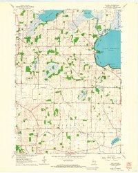
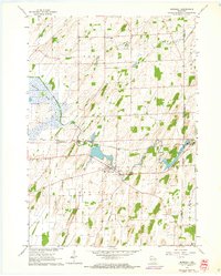
 1962 Sun Prairie1964 Print · USGSDane County farmland surrounds the growing village of Sun Prairie in the early sixties as it develops along the Milwaukee Road railroad. Genealogists and local historians can trace family locations near Pierceville, Bristol Ch, and Brazee Lake.5 unique versions available
 - 1962 Map of New Glarus, 1964 Print
 1962 New Glarus1964 Print · USGSSouthern Wisconsin's driftless terrain and Swiss-settled valleys are captured here in the early sixties, showing the rural character of Green and Dane Counties. Researchers can trace family history through sites like East Blue Mounds Church, Oak Hill Cem, and the Andrew Henry School.2 unique versions available
 - 1962 Map of Blanchardville, 1964 Print
 1962 Blanchardville1964 Print · USGSSouthern Wisconsin's rolling uplands and river valleys are captured here in the early sixties, showing the vital rail-and-river connection at Blanchardville. Researchers can trace rural life through dozens of local landmarks like the Moscow Center School, Yellowstone Church, and the newly created Yellowstone Lake.
 - 1962 Map of Mt. Vernon, 1964 Print
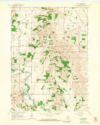
 1962 Mt. Vernon1964 Print · USGSDane County's rolling driftless terrain is captured here in the early sixties as a network of small dairy-farming communities. Researchers can trace rural school locations like Britt Valley Sch or find family history at Primrose Ch and Mt Vernon Cem.2 unique versions available
 - 1962 Map of Daleyville, 1964 Print
 1962 Daleyville1964 Print · USGSWisconsin's rural dairy country in the early sixties is captured here along the border of Iowa and Dane counties. Genealogists can trace family footprints through a dense network of country schools and churches, including Ruste Sch, Hauge Ch, and Forward Sch.
 - 1962 Map of Poynette, 1964 Print
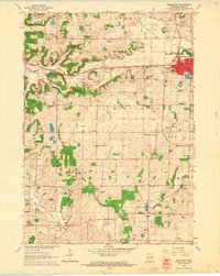
 1962 Poynette1964 Print · USGSIn the early sixties, the farming communities of Columbia and Dane Counties were evolving alongside the new interstate highway. Genealogists can locate family sites and rural landmarks like Hillside Cem, Leeds Center, and the Arlington Prairie Ch.2 unique versions available
 - 1962 Map of Black Earth, 1964 Print
 1962 Black Earth1964 Print · USGSDane County's ridge-and-valley landscape is documented here in the early sixties, showing the rural crossroads and rail corridors of the Driftless Area. You can locate family history at St Johns Ch or trace the old rail line near Black Earth and Table Bluff.2 unique versions available
 - 1962 Map of Springfield Corners, 1964 Print
 1962 Springfield Corners1964 Print · USGSThe rural landscapes of Dane County in the early sixties reveal a network of small farming hamlets and glacial marshlands. Genealogists can trace family names at St Johns Cem and Kohlman Cem or locate the rural Springfield Sch.2 unique versions available
 - 1962 Map of Blue Mounds, 1964 Print
 1962 Blue Mounds1964 Print · USGSThe Wisconsin River valley and the driftless hills of Dane County are captured here in the early sixties. Genealogists and hikers can trace old ridge roads to Little Norway, the White Church Cem, and the underground wonders of Cave of the Mounds.3 unique versions available
 - 1962 Map of Mazomanie, 1964 Print
 1962 Mazomanie1964 Print · USGSThe Wisconsin River valley comes alive in the early sixties, showing the vital rail-and-river connection between local settlements. Genealogists and historians can locate St Barnabas Ch, the Cassell Cem, and the tracks of the Chicago Milwaukee St Paul and Pacific railroad.3 unique versions available
 - 1962 Map of Marshall, 1964 Print
 1962 Marshall1964 Print · USGSThe agricultural heart of Dane County comes into focus in the early sixties, centered on the Maunesha River and the rail-driven town of Marshall. Researchers can trace old family lines through local sites like Deansville Cem and the settlement at York Center.3 unique versions available
 - 1962 Map of Middleton, 1964 Print
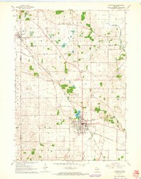
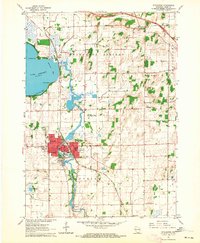
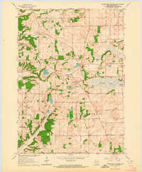
 1962 Middleton1964 Print · USGSDane County underwent a period of significant post-war growth as the town of Middleton expanded along its historic rail lines. Researchers can trace local family history through numerous rural landmarks like St Johns Cem, the Drive-in Theater, and the West Middleton Sch.3 unique versions available
 - 1962 Map of Sun Prairie, 1964 Print
 1962 Sun Prairie1964 Print · USGSEastern Dane County thrives as a rail-connected agricultural region in the early sixties, centered on the growing community of Sun Prairie. Researchers can trace old family roots through numerous landmarks like the Prairie Queen Sch, York Center Ch, and the Liberty Prairie Cem.2 unique versions available
Showing maps 1-25 of 34
Top cities of Dane County
- Madison historical maps
- Sun Prairie historical maps
- Fitchburg historical maps
- Middleton historical maps
- Waunakee historical maps
- Stoughton historical maps
See more
Frequently asked questions
- What are the different types of historical maps available for Dane County?
- What is the oldest map of Dane County?
- Where can I purchase historical maps of Dane County for my home or office?
- Where can I download high-res historical maps of Dane County?
- Are there historical topographic maps available for Dane County?
- Is there historical aerial imagery available for Dane County?
- Where are historical maps of Dane County sourced from?