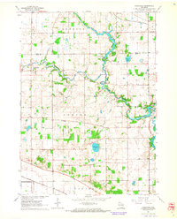
1961 Map of Cooksville
USGS Topo · Published 1964About this map
Yahara River meanders across the landscape, linking the small agricultural communities of Stebbinsville, Cooksville, and Fulton in this early 1960s topographic study. The area is defined by its deep roots in the farming townships of Dunkirk, Albion, and Porter, where the rural infrastructure includes local landmarks like the Yahara Sch and several family or community burial grounds including Ball Tavern Cem and South Porter Cem. Two major rail lines, the Chicago Milwaukee St Paul and Pacific and the Chicago and North Western, traverse the terrain, reflecting the mid-century reliance on rail for transporting local goods. The southern boundary is marked by the confluence of the Yahara and the Rock River, while numerous small lakes like Gibbs Lake and Muskrat Lake punctuate the glacial topography, often flanked by small-scale resource extraction at various Quarry and Sandpit sites.
Find a feature on this map
28 named features on this map. Tap any name to fly to it.
Don’t see what you’re looking for? This feature index may not catch every label — zoom into the map to look around manually.
Map Details
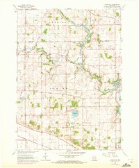
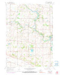
Editions of this 1961 Cooksville Map
3 editions found
Other maps of this area

1889 · Evansville
USGS Topo · 1:62,500

1890 · Stoughton
USGS Topo · 1:62,500

1891 · Janesville
USGS Topo · 1:62,500

1893 · Janesville
USGS Topo · 1:62,500

1893 · Brodhead
USGS Topo · 1:62,500

1894 · Evansville
USGS Topo · 1:62,500

1906 · Evansville
USGS Topo · 1:62,500

1954 · Rockford
USGS Topo · 1:250,000

1955 · Rockford
USGS Topo · 1:250,000

1958 · Rockford
USGS Topo · 1:250,000