1900s (20th Century) Maps of Gibraltar, Wisconsin
Explore 10 historic maps of Gibraltar from the 1900s (20th Century). These maps offer a rare glimpse into what life looked like during the 1900s — showing old roads, neighborhoods, homes, and landmarks that have changed or disappeared over time.
Whether you're researching your family's past, planning a metal detecting trip, or studying how Gibraltar's landscape evolved across the 1900s, these high-resolution maps are a powerful tool for exploring the history of this region.
- Focus on a specific era: All maps on this page are from the 1900s, giving you a focused view of this time period.
- See what’s changed: Compare century-old streets, trails, and buildings to today's modern landscape using overlays and satellite layers.
- Research with precision: Use these maps for genealogy, historical research, land use analysis, or educational projects.
- View, download, or print: Maps are fully viewable online in high resolution, and can be downloaded or printed for your own records.
Start exploring Gibraltar's history through authentic maps from the 1900s. This is your window into the past.
Gibraltar, WI maps
(10)- 1954 Map of Escanaba, 1967 Print
 1954 Escanaba1967 Print · USGSThe Upper Peninsula and Door County shorelines meet here in the mid-fifties, showing the vital maritime and timber networks of the Great Lakes. Researchers can trace historic rail lines, old fire lookouts like the Stonington Fire Tower, and island settlements such as Washington Island.2 unique versions available
 - 1957 Map of Escanaba
 1957 Escanaba1957 Print · USGSThe Upper Peninsula and Door County shorelines meet in the mid-fifties, capturing a landscape of timber, iron, and maritime trade. Genealogists and local historians can trace the Chicago & North Western RR through settlements like Hermansville or locate St Vitals Church and the Potawatome Indian Reservation.
 - 1958 Map of Escanaba
 1958 Escanaba1958 Print · USGSNorthern Lake Michigan maritime commerce and timberlands are captured here in the mid-fifties. Genealogists and historians can trace rail networks like the Escanaba and Lake Superior or locate island settlements such as Detroit Harbor and Fish Creek.
 - 1960 Map of Sister Bay, 1962 Print
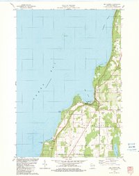
 1960 Sister Bay1962 Print · USGSThe Door Peninsula's mid-century landscape is defined here by its coastal villages and timbered interiors during the 1960s. Researchers can locate local landmarks like the Settlement School, Boynton Chapel, and the historic Cana Island light.2 unique versions available
 - 1961 Map of Chambers Island, 1963 Print
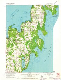
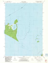
 1961 Chambers Island1963 Print · USGSThe Door Peninsula and its surrounding islands are captured here in the early sixties, showing a maritime landscape of isolated lighthouses and small coastal settlements. Genealogists and local historians can locate St Johns Cem, Sunny Point Sch, and the Chambers Island Lighthouse.2 unique versions available
 - 1981 Map of Marinette, 1982 Print
 1981 Marinette1982 Print · USGSThe Menominee River valley and Door County peninsula are captured here in the early 1980s, showcasing the region's timber and maritime foundations. Researchers can trace historic shorelines from Fish Creek to Deathdoor Bluff or locate inland landmarks like Lake Noquebay and Kangaroo Lake.
 - 1982 Map of Baileys Harbor West, 1983 Print
 1982 Baileys Harbor West1983 Print · USGSThe Door County peninsula in the early eighties shows a landscape of wetlands and thriving local communities. Genealogists and researchers can trace family lands along Juddville Road, locate Zion Ch, or explore the shores of Kangaroo Lake.
 - 1982 Map of Egg Harbor, 1983 Print
 1982 Egg Harbor1983 Print · USGSDoor County's shoreline in the early 1980s showcases a transition from rural farmland to a coastal getaway. Genealogists can trace family names at Egg Harbor Cem and Juddville Cem or locate old homesteads near Horseshoe Bay.
 - 1982 Map of Ephraim, 1983 Print
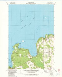 1982 Ephraim1983 Print · USGSDoor County's shoreline thrives in the early eighties as a mix of maritime heritage and vacation life. Researchers can locate historic sites like Blossomburg Cem, the Pioneer Sch, and the Light on Horseshoe Island.
 - 1982 Map of Chambers Island, 1983 Print
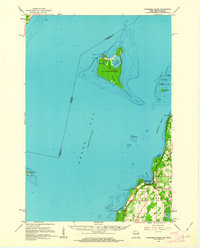
 1982 Chambers Island1983 Print · USGSChambers Island and its surrounding waters in the early eighties show a landscape of secluded retreats and maritime markers. Researchers can trace the layout of the Diocese Retreat, find the northern Lighthouse, and explore the cluster of the Strawberry Islands.2 unique versions available
End of results
Showing maps 1-10 of 10
Top cities near Gibraltar
- Baileys Harbor historical maps
- Sister Bay historical maps
- Jacksonport historical maps
- Ephraim historical maps
- Egg Harbor historical maps
Top neighborhoods of Gibraltar
Frequently asked questions
- What are the different types of historical maps available for Gibraltar?
- What is the oldest map of Gibraltar?
- Where can I purchase historical maps of Gibraltar for my home or office?
- Where can I download high-res historical maps of Gibraltar?
- Are there historical topographic maps available for Gibraltar?
- Is there historical aerial imagery available for Gibraltar?
- Where are historical maps of Gibraltar sourced from?