2020s Maps of Gibraltar, Wisconsin
Explore 5 historic maps of Gibraltar from the 2020s. These maps offer a rare glimpse into what life looked like during the 2020s — showing old roads, neighborhoods, homes, and landmarks that have changed or disappeared over time.
Whether you're researching your family's past, planning a metal detecting trip, or studying how Gibraltar's landscape evolved across the 2020s, these high-resolution maps are a powerful tool for exploring the history of this region.
- Focus on a specific era: All maps on this page are from the 2020s, giving you a focused view of this time period.
- See what’s changed: Compare century-old streets, trails, and buildings to today's modern landscape using overlays and satellite layers.
- Research with precision: Use these maps for genealogy, historical research, land use analysis, or educational projects.
- View, download, or print: Maps are fully viewable online in high resolution, and can be downloaded or printed for your own records.
Start exploring Gibraltar's history through authentic maps from the 2020s. This is your window into the past.
Gibraltar, WI maps
(5)- 2022 Map of Baileys Harbor West, 2022 Print
 2022 Baileys Harbor West2022 Print · USGSDoor County's peninsula geography is captured here in the early 2020s, showing the landscape between the Green Bay and Lake Michigan shores. Researchers can locate local landmarks like Kangaroo Lake or trace family sites at the Saint Paul Lutheran Cem and Baileys Harbor Town Cem.
 - 2022 Map of Chambers Island, 2022 Print
 2022 Chambers Island2022 Print · USGSChambers Island and the surrounding waters of Green Bay are shown in detail as they appeared in 2022. Researchers can trace the layout of the Chambers Island Airport and the small archipelago of the Strawberry Islands.
 - 2022 Map of Ephraim, 2022 Print
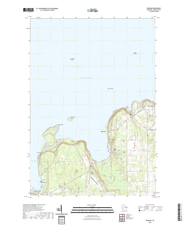 2022 Ephraim2022 Print · USGSThe Door Peninsula shoreline comes into sharp focus in this recent survey of the lands between Ephraim and Sister Bay. Researchers can trace local lineage through several sites like Bethany Lutheran Cem and Little Sister Cem or explore landmarks like Eagle Bluff.
 - 2022 Map of Chambers Island NW, 2022 Print
 2022 Chambers Island NW2022 Print · USGSCoastal Wisconsin and Michigan boundaries meet in these waters during the early twenty-first century, centered on the expanse of Green Bay. Local historians can trace the shoreline of Chambers Island and locate land features like Sand Point and Million Dollar Rd.
 - 2022 Map of Egg Harbor, 2022 Print
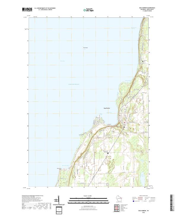 2022 Egg Harbor2022 Print · USGSThe Door County coast is captured here in the early twenty-first century, featuring the village of Egg Harbor and the settlement of Juddville. Trace local heritage through markers like the Juddville Cem, Horseshoe Bay, and the historic Cottage Row shoreline.
End of results
Showing maps 1-5 of 5
Top cities near Gibraltar
- Baileys Harbor historical maps
- Sister Bay historical maps
- Jacksonport historical maps
- Ephraim historical maps
- Egg Harbor historical maps
Top neighborhoods of Gibraltar
Frequently asked questions
- What are the different types of historical maps available for Gibraltar?
- What is the oldest map of Gibraltar?
- Where can I purchase historical maps of Gibraltar for my home or office?
- Where can I download high-res historical maps of Gibraltar?
- Are there historical topographic maps available for Gibraltar?
- Is there historical aerial imagery available for Gibraltar?
- Where are historical maps of Gibraltar sourced from?