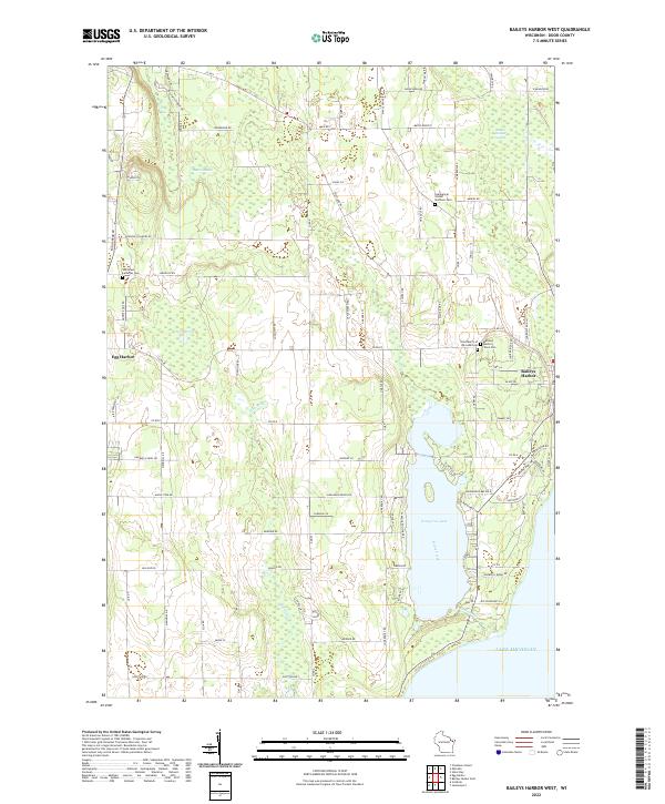
2022 Map of Baileys Harbor West
USGS Topo · Published 2022About this map
Kangaroo Lake dominates the central landscape of this Door County quadrangle, situated between the interior forests and the jagged coastline of Lake Michigan. The map illustrates the geographical transition from the western village of Egg Harbor to the eastern settlement of Baileys Harbor, where the land yields to extensive wetlands like the Baileys Harbor Swamp and Button Marsh. These low-lying areas, fed by waterways such as Hibbard Cr and Heins Creek, provide a detailed look at the peninsula's natural drainage patterns. Genealogists will find several burial grounds documented throughout the area, including Saint Mary's of the Lake Cem, Saint Paul Lutheran Cem, and the Baileys Harbor Town Cem. The road network, from Peninsula Players Rd to Half Mile Bridge Dr, connects family farms and coastal properties during this period of the twenty-first century.
Find a feature on this map
98 named features on this map. Tap any name to fly to it.
Don’t see what you’re looking for? This feature index may not catch every label — zoom into the map to look around manually.
Map Details
Editions of this 2022 Baileys Harbor West Map
This is the sole edition of this map. No revisions or reprints were ever made.
Other maps of this area

1954 · Escanaba
USGS Topo · 1:250,000

1954 · Manitowoc
USGS Topo · 1:250,000

1957 · Escanaba
USGS Topo · 1:250,000

1958 · Escanaba
USGS Topo · 1:250,000

1958 · Manitowoc
USGS Topo · 1:250,000

1960 · Sturgeon Bay
USGS Topo · 1:62,500

1960 · Jacksonport
USGS Topo · 1:62,500

1960 · Sister Bay
USGS Topo · 1:62,500

1961 · Chambers Island
USGS Topo · 1:62,500

1981 · Institute
USGS Topo · 1:24,000