
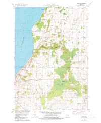
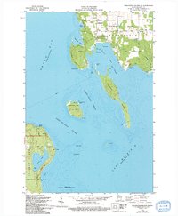
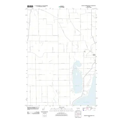
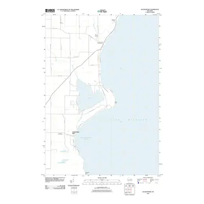
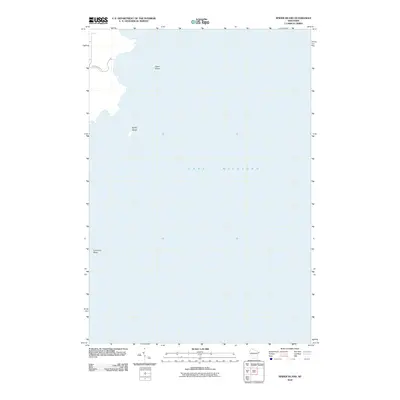
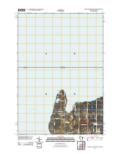
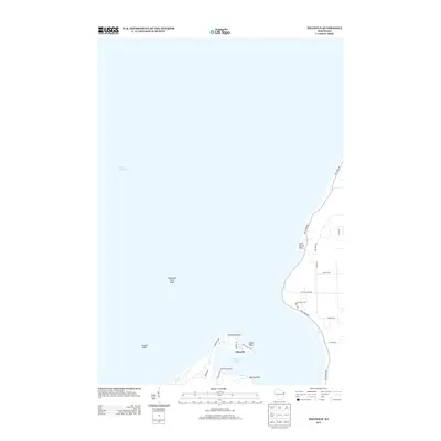
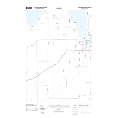
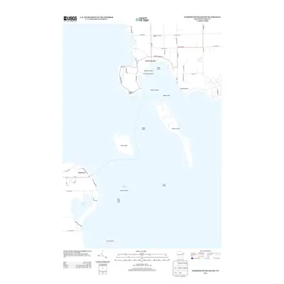
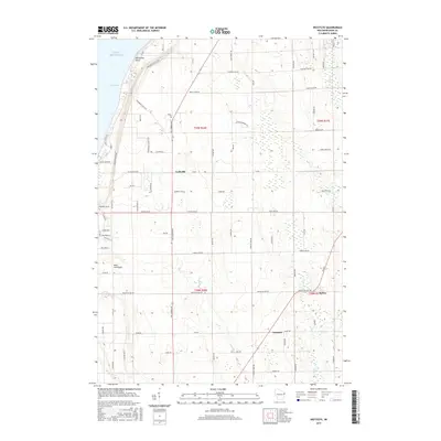
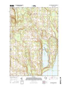
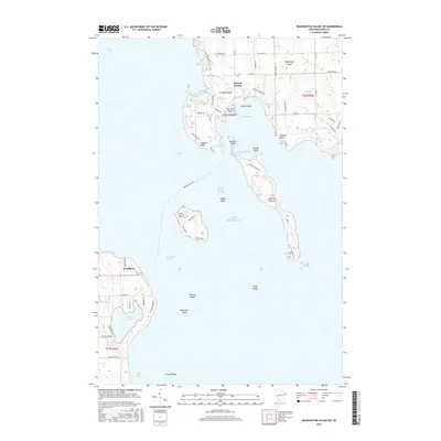
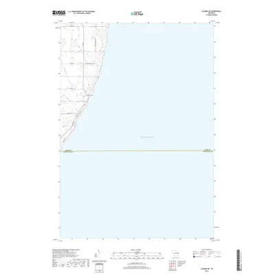
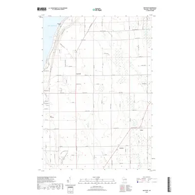
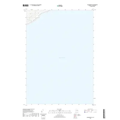
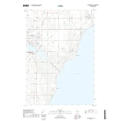
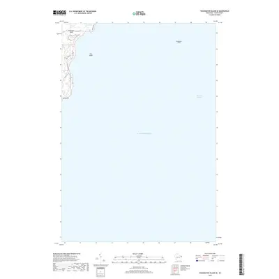
1960 Map of Jacksonport
USGS Topo · Published 1962About this map
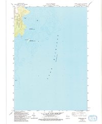
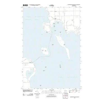
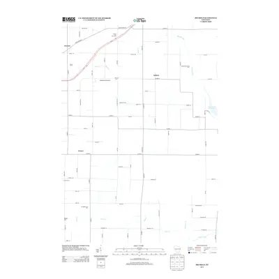
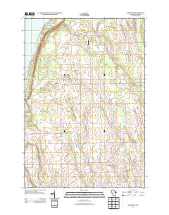
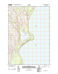
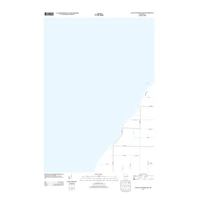
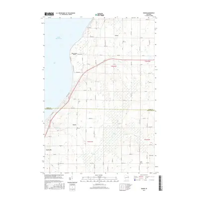
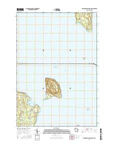
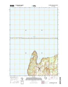
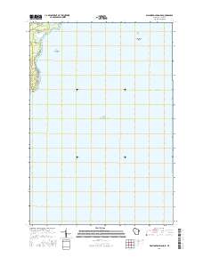
Jacksonport serves as the primary coastal hub on this Lake Michigan shoreline, where the maritime influence of Whitefish Bay meets the inland drainages of Hibbard Creek and Logan Creek. The landscape is defined by its transition from the steep bluffs at Cave Point to the low-lying wetlands surrounding Mud Lake and Schmoke Lake. The distribution of Gravel Pit sites along the main thoroughfares indicates a mid-century period of local infrastructure growth and material extraction.
Find a feature on this map
19 named features on this map. Tap any name to fly to it.
Don’t see what you’re looking for? This feature index may not catch every label — zoom into the map to look around manually.
Map Details
Editions of this 1960 Jacksonport Map
This is the sole edition of this map. No revisions or reprints were ever made.
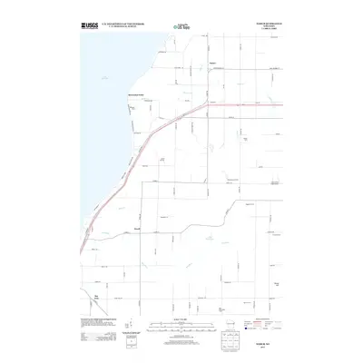
Historical Maps of Jacksonport Through Time
123 maps found
1960 Jacksonport
Door County, WI
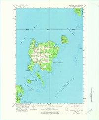
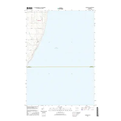
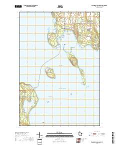
1960 Washington Island
Door County, WI

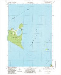
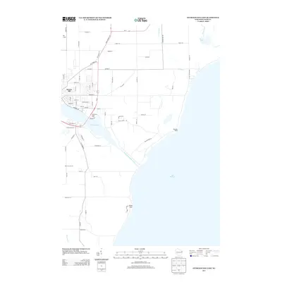
1961 Chambers Island
Door County, WI

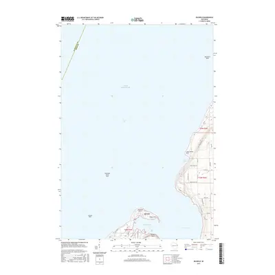
1978 Brussels
Door County, WI
1978 Namur
Door County, WI

1981 Idlewild
Door County, WI

1981 Institute
Door County, WI
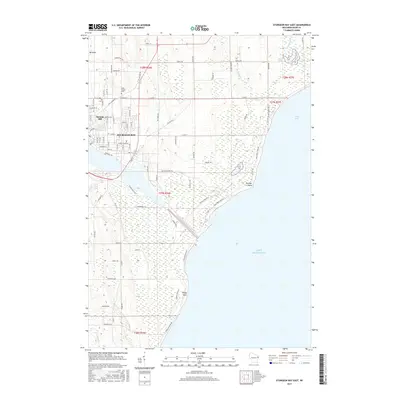
1981 Sturgeon Bay East
Door County, WI

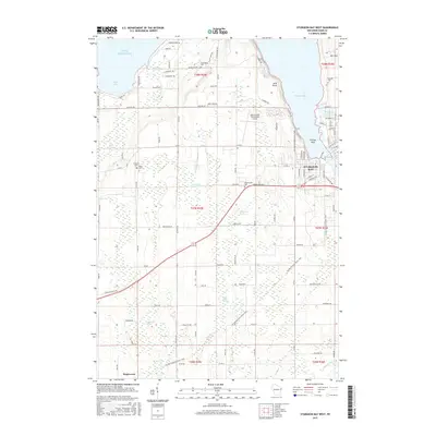
1981 Sturgeon Bay West
Door County, WI

1982 Algoma NE
Door County, WI

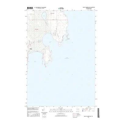
1982 Baileys Harbor East
Door County, WI

1982 Baileys Harbor West
Door County, WI
1982 Chambers Island
Door County, WI

1982 Green Island
Door County, WI

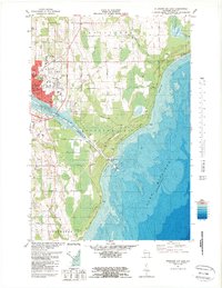
1982 Jacksonport
Door County, WI

1982 Jacksonport SW
Door County, WI

1982 Little Sturgeon SW
Door County, WI
1982 Spider Island
Door County, WI
1982 Washington Island NE
Door County, WI
1982 Washington Island NW
Door County, WI
1982 Washington Island SE
Door County, WI
1982 Washington Island SW
Door County, WI
1984 Washington Island
Door County, WI
2010 Algoma NE
Door County, WI
2010 Baileys Harbor East
Door County, WI
2010 Baileys Harbor West
Door County, WI
2010 Brussels
Door County, WI
2010 Idlewild
Door County, WI
2010 Institute
Door County, WI
2010 Jacksonport
Door County, WI
2010 Jacksonport SW
Door County, WI
2010 Little Sturgeon SW
Door County, WI
2010 Namur
Door County, WI
2010 Spider Island
Door County, WI
2010 Sturgeon Bay East
Door County, WI
2010 Sturgeon Bay West
Door County, WI
2010 Washington Island SE
Door County, WI
2010 Washington Island SW
Door County, WI

2011 Chambers Island
Door County, WI
2011 Chambers Island NW
Door County, WI
2011 Green Island
Door County, WI
2011 Washington Island NE
Door County, WI
2011 Washington Island NW
Door County, WI
2013 Algoma NE
Door County, WI
2013 Baileys Harbor East
Door County, WI
2013 Baileys Harbor West
Door County, WI
2013 Brussels
Door County, WI
2013 Chambers Island
Door County, WI
2013 Chambers Island NW
Door County, WI
2013 Green Island
Door County, WI
2013 Idlewild
Door County, WI
2013 Institute
Door County, WI
2013 Jacksonport
Door County, WI
2013 Jacksonport SW
Door County, WI
2013 Little Sturgeon SW
Door County, WI
2013 Namur
Door County, WI
2013 Spider Island
Door County, WI
2013 Sturgeon Bay East
Door County, WI
2013 Sturgeon Bay West
Door County, WI
2013 Washington Island NE
Door County, WI
2013 Washington Island NW
Door County, WI
2013 Washington Island SE
Door County, WI
2013 Washington Island SW
Door County, WI
2015 Algoma NE
Door County, WI
2015 Brussels
Door County, WI
2015 Idlewild
Door County, WI
2015 Institute
Door County, WI
2015 Jacksonport
Door County, WI
2015 Jacksonport SW
Door County, WI
2015 Little Sturgeon SW
Door County, WI
2015 Namur
Door County, WI
2015 Sturgeon Bay East
Door County, WI
2015 Sturgeon Bay West
Door County, WI
2016 Baileys Harbor East
Door County, WI
2016 Baileys Harbor West
Door County, WI

2016 Chambers Island
Door County, WI
2016 Chambers Island NW
Door County, WI
2016 Green Island
Door County, WI
2016 Spider Island
Door County, WI
2016 Washington Island NE
Door County, WI
2016 Washington Island NW
Door County, WI
2016 Washington Island SE
Door County, WI
2016 Washington Island SW
Door County, WI
2018 Algoma NE
Door County, WI
2018 Baileys Harbor East
Door County, WI
2018 Baileys Harbor West
Door County, WI
2018 Brussels
Door County, WI

2018 Chambers Island
Door County, WI
2018 Chambers Island NW
Door County, WI
2018 Green Island
Door County, WI

2018 Idlewild
Door County, WI
2018 Institute
Door County, WI
2018 Jacksonport
Door County, WI
2018 Jacksonport SW
Door County, WI
2018 Little Sturgeon SW
Door County, WI
2018 Namur
Door County, WI
2018 Spider Island
Door County, WI
2018 Sturgeon Bay East
Door County, WI
2018 Sturgeon Bay West
Door County, WI
2018 Washington Island NE
Door County, WI
2018 Washington Island NW
Door County, WI
2018 Washington Island SE
Door County, WI
2018 Washington Island SW
Door County, WI

2022 Algoma NE
Door County, WI

2022 Baileys Harbor East
Door County, WI

2022 Baileys Harbor West
Door County, WI

2022 Brussels
Door County, WI

2022 Chambers Island
Door County, WI

2022 Chambers Island NW
Door County, WI

2022 Green Island
Door County, WI

2022 Idlewild
Door County, WI

2022 Institute
Door County, WI

2022 Jacksonport
Door County, WI

2022 Jacksonport SW
Door County, WI

2022 Little Sturgeon SW
Door County, WI

2022 Namur
Door County, WI
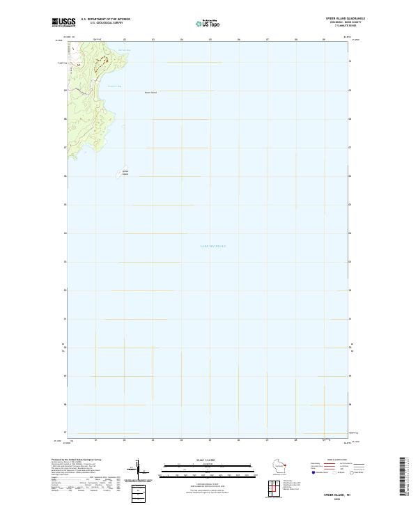
2022 Spider Island
Door County, WI

2022 Sturgeon Bay East
Door County, WI

2022 Sturgeon Bay West
Door County, WI

2022 Washington Island NE
Door County, WI

2022 Washington Island NW
Door County, WI

2022 Washington Island SE
Door County, WI

2022 Washington Island SW
Door County, WI