
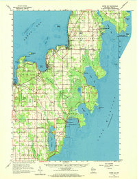
1960 Map of Sister Bay
USGS Topo · Published 1962About this map
The rocky Door Peninsula shoreline is meticulously detailed in this early 1960s study, where the village of Sister Bay and the harbor at Ephraim serve as primary anchors for the region's coastal identity. The landscape is defined by its relationship with both Green Bay and Lake Michigan, showing the development of Peninsula State Park and local aviation at the Ephraim-Fish Creek Airport.
Find a feature on this map
59 named features on this map. Tap any name to fly to it.
Don’t see what you’re looking for? This feature index may not catch every label — zoom into the map to look around manually.
Map Details
Editions of this 1960 Sister Bay Map
2 editions found
Other maps of this area

1954 · Escanaba
USGS Topo · 1:250,000

1954 · Manitowoc
USGS Topo · 1:250,000

1957 · Escanaba
USGS Topo · 1:250,000

1958 · Escanaba
USGS Topo · 1:250,000

1958 · Manitowoc
USGS Topo · 1:250,000

1960 · Sturgeon Bay
USGS Topo · 1:62,500

1960 · Jacksonport
USGS Topo · 1:62,500

1960 · Washington Island
USGS Topo · 1:62,500

1960 · Ellison Bay
USGS Topo · 1:62,500

1961 · Chambers Island
USGS Topo · 1:62,500