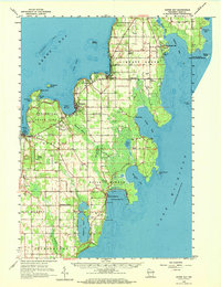
1960 Map of Sister Bay
USGS Topo · Published 1972About this map
Peninsula State Park dominates the western shoreline of this Door County peninsula, where dramatic geography like Eagle Bluff and Weborg Point overlooks the Strawberry Channel. The settlement patterns of the early 1960s are clearly visible in the village of Sister Bay and the coastal community of Ephraim, while the interior remains a landscape of orchards and small farms interspersed with numerous Gravel Pit workings and limestone Quarry sites. Maritime safety is a prominent theme, with the Cana Island Light on the Lake Michigan side and Eagle Bluff Light on Green Bay marking the treacherous surrounding waters.
Find a feature on this map
67 named features on this map. Tap any name to fly to it.
Don’t see what you’re looking for? This feature index may not catch every label — zoom into the map to look around manually.
Map Details
Editions of this 1960 Sister Bay Map
2 editions found
Other maps of this area

1954 · Escanaba
USGS Topo · 1:250,000

1954 · Manitowoc
USGS Topo · 1:250,000

1957 · Escanaba
USGS Topo · 1:250,000

1958 · Escanaba
USGS Topo · 1:250,000

1958 · Manitowoc
USGS Topo · 1:250,000

1960 · Sturgeon Bay
USGS Topo · 1:62,500

1960 · Jacksonport
USGS Topo · 1:62,500

1960 · Washington Island
USGS Topo · 1:62,500

1960 · Sister Bay
USGS Topo · 1:62,500

1960 · Ellison Bay
USGS Topo · 1:62,500