2020s Maps of Eau Galle, Wisconsin
Explore 6 historic maps of Eau Galle from the 2020s. These maps offer a rare glimpse into what life looked like during the 2020s — showing old roads, neighborhoods, homes, and landmarks that have changed or disappeared over time.
Whether you're researching your family's past, planning a metal detecting trip, or studying how Eau Galle's landscape evolved across the 2020s, these high-resolution maps are a powerful tool for exploring the history of this region.
- Focus on a specific era: All maps on this page are from the 2020s, giving you a focused view of this time period.
- See what’s changed: Compare century-old streets, trails, and buildings to today's modern landscape using overlays and satellite layers.
- Research with precision: Use these maps for genealogy, historical research, land use analysis, or educational projects.
- View, download, or print: Maps are fully viewable online in high resolution, and can be downloaded or printed for your own records.
Start exploring Eau Galle's history through authentic maps from the 2020s. This is your window into the past.
Eau Galle, WI maps
(6)- 2022 Map of Menomonie South, 2022 Print
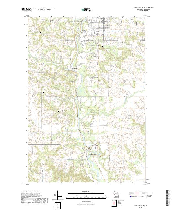 2022 Menomonie South2022 Print · USGSDunn County’s river valley south of Menomonie is shown here as it appears today, centered on the winding Red Cedar River. Researchers can locate several family and church burial sites like Grandview Cem and Saint Johns Cem, or trace the path of the Red Cedar State Trl.
 - 2022 Map of Weston, 2022 Print
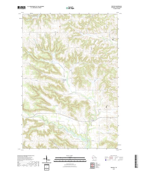 2022 Weston2022 Print · USGSDunn County farmland and steep valley drainages define this western Wisconsin landscape in the early twenty-first century. Researchers can locate Weston, trace the path of the Eau Galle River, and find historic burials at Lower Weston Cem.
 - 2022 Map of Spring Valley, 2022 Print
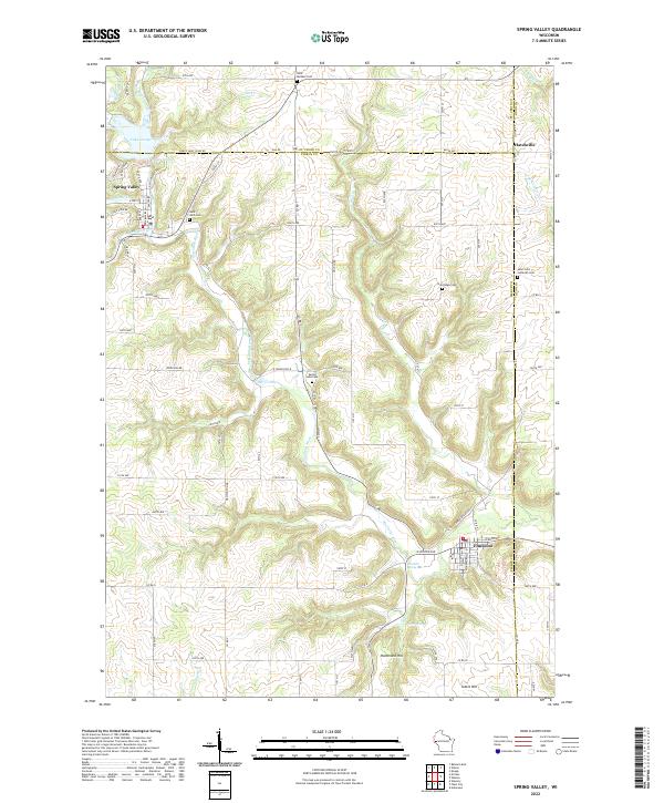 2022 Spring Valley2022 Print · USGSIn western Wisconsin during the early twenty-first century, the river valleys around Spring Valley and Elmwood reveal a landscape of deep-rooted rural communities. Researchers can trace family history through numerous sites like Saint Michael Cem or locate old industrial Mines near the Eau Galle River.
 - 2022 Map of Durand North, 2022 Print
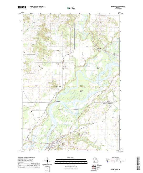 2022 Durand North2022 Print · USGSThe river confluence at the Dunn and Pepin county line shows a landscape shaped by water and former rail lines. Trace local history along the Red Cedar State Trl near Dunnville or locate family sites by Evergreen Cem and Waubeek Mound.
 - 2022 Map of Plum City, 2022 Print
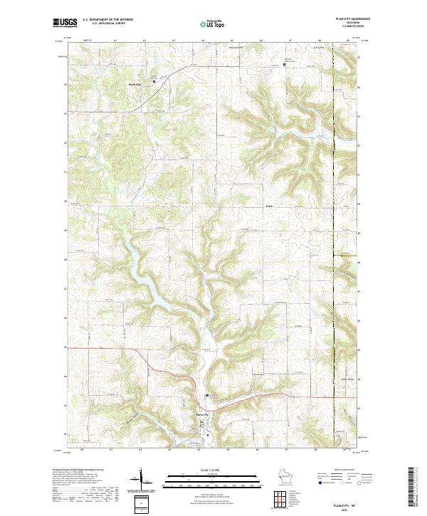 2022 Plum City2022 Print · USGSThe village of Plum City and the surrounding coulee country of Pierce County are shown in fine detail during the early 2020s. Researchers can trace family sites near Poplar Hill Cem, the crossroads at Exile, or the rugged terrain of Wildcat Coulee.
 - 2022 Map of Arkansaw, 2022 Print
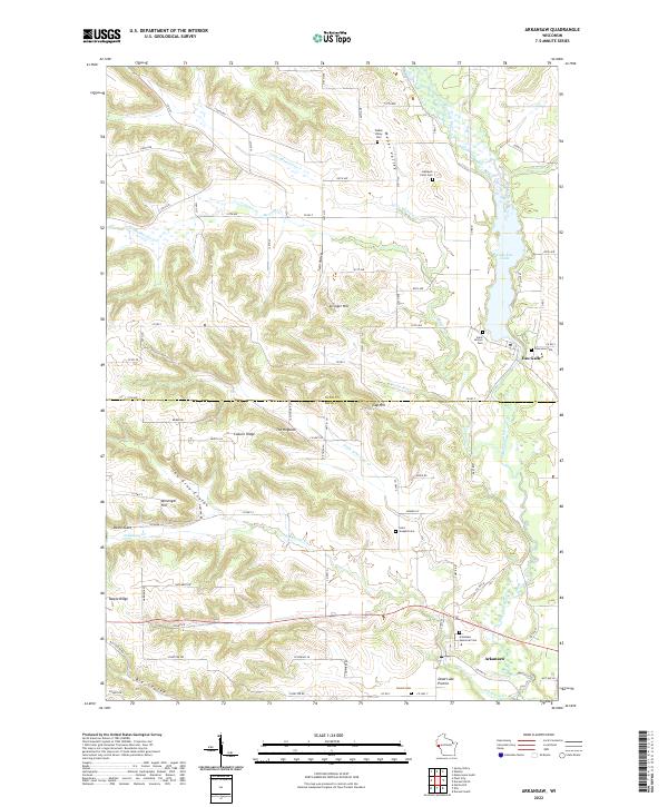 2022 Arkansaw2022 Print · USGSThe borderlands of Pepin and Dunn counties are captured here in a period of quiet rural continuity. Genealogists can locate family sites and small burial grounds like Gasteyer Farm Cem, Saint Henrys Cem, and French Cem along the ridges of Coburn Ridge and the Big Coulee.
End of results
Showing maps 1-6 of 6
Top cities near Eau Galle
- Menomonie historical maps
- Tainter historical maps
- Red Cedar historical maps
- Durand historical maps
- Red Cedar historical maps
- Woodville historical maps
See more
Frequently asked questions
- What are the different types of historical maps available for Eau Galle?
- What is the oldest map of Eau Galle?
- Where can I purchase historical maps of Eau Galle for my home or office?
- Where can I download high-res historical maps of Eau Galle?
- Are there historical topographic maps available for Eau Galle?
- Is there historical aerial imagery available for Eau Galle?
- Where are historical maps of Eau Galle sourced from?