1970s Maps of Sheridan, Wisconsin
Explore 5 historic maps of Sheridan from the 1970s. These maps offer a rare glimpse into what life looked like during the 1970s — showing old roads, neighborhoods, homes, and landmarks that have changed or disappeared over time.
Whether you're researching your family's past, planning a metal detecting trip, or studying how Sheridan's landscape evolved across the 1970s, these high-resolution maps are a powerful tool for exploring the history of this region.
- Focus on a specific era: All maps on this page are from the 1970s, giving you a focused view of this time period.
- See what’s changed: Compare century-old streets, trails, and buildings to today's modern landscape using overlays and satellite layers.
- Research with precision: Use these maps for genealogy, historical research, land use analysis, or educational projects.
- View, download, or print: Maps are fully viewable online in high resolution, and can be downloaded or printed for your own records.
Start exploring Sheridan's history through authentic maps from the 1970s. This is your window into the past.
Sheridan, WI maps
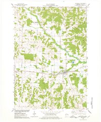
(5)- 1975 Map of Stillwater
 1975 Stillwater1975 Print · USGSThe Twin Cities and the St. Croix Valley are captured in the mid-seventies, showing the urban growth of Minneapolis and St Paul. Researchers can trace old rail corridors of the Northern Pacific RR and locate tribal lands at the Mille Lacs Indian Reservation.2 unique versions available
 - 1975 Map of Connorsville, 1978 Print
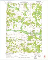
 1975 Connorsville1978 Print · USGSDunn and Barron Counties are captured in the mid-seventies, showing a network of rural hamlets and winding waterways. Genealogists can locate family sites like Akers Cem and New Haven Cem or trace the early paths of Sheridan Rd.
 - 1975 Map of Boyceville, 1978 Print
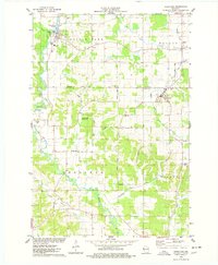
 1975 Boyceville1978 Print · USGSThe rural landscape of Dunn County is captured here in the mid-seventies as the SOO LINE still connects the farming communities. Researchers can trace the village layouts of Boyceville and Downing or locate rural sites like Mound Cem and Holy Trinity Ch.
 - 1975 Map of Wheeler, 1978 Print
 1975 Wheeler1978 Print · USGSDunn County life in the mid-seventies centers on the confluence of the Hay River and the Soo Line railroad. Researchers can trace rural landmarks like Hay River Cem, the Church of the Nazarene, and the small settlement of Dewey.
 - 1975 Map of Ridgeland, 1978 Print
 1975 Ridgeland1978 Print · USGSThe rural border of Barron and Dunn Counties is captured here in the mid-seventies, showing the agricultural and water-powered roots of the region. Researchers can trace family sites near Evergreen Cem, the Old RR Grade, or the Harmon Brothers Landing Strip.
End of results
Showing maps 1-5 of 5
Top cities near Sheridan
- Barron historical maps
- Tainter historical maps
- Town of Tainter historical maps
- Cameron historical maps
- Red Cedar historical maps
- Glenwood City historical maps
See more
Frequently asked questions
- What are the different types of historical maps available for Sheridan?
- What is the oldest map of Sheridan?
- Where can I purchase historical maps of Sheridan for my home or office?
- Where can I download high-res historical maps of Sheridan?
- Are there historical topographic maps available for Sheridan?
- Is there historical aerial imagery available for Sheridan?
- Where are historical maps of Sheridan sourced from?