1970s Maps of Washington, Wisconsin
Explore 6 historic maps of Washington from the 1970s. These maps offer a rare glimpse into what life looked like during the 1970s — showing old roads, neighborhoods, homes, and landmarks that have changed or disappeared over time.
Whether you're researching your family's past, planning a metal detecting trip, or studying how Washington's landscape evolved across the 1970s, these high-resolution maps are a powerful tool for exploring the history of this region.
- Focus on a specific era: All maps on this page are from the 1970s, giving you a focused view of this time period.
- See what’s changed: Compare century-old streets, trails, and buildings to today's modern landscape using overlays and satellite layers.
- Research with precision: Use these maps for genealogy, historical research, land use analysis, or educational projects.
- View, download, or print: Maps are fully viewable online in high resolution, and can be downloaded or printed for your own records.
Start exploring Washington's history through authentic maps from the 1970s. This is your window into the past.
Washington, WI maps
(6)- 1972 Map of Eau Claire West, 1975 Print
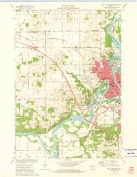 1972 Eau Claire West1975 Print · USGSEau Claire was a bustling river and rail hub in the early seventies, centered around the Chippewa River and its industrial corridors. Researchers can trace historic local sites from the Univ of Wisconsin campus to the Lakeview Cemetery and the old Dells Dam.2 unique versions available
 - 1972 Map of Fall Creek, 1975 Print
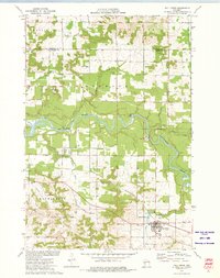 1972 Fall Creek1975 Print · USGSThe Eau Claire River corridor is captured here in the early seventies, showing a landscape shaped by dairy farming and the rail-line economy. Genealogists can trace family footprints near St Bridgets Cem, Seymour Central Sch, and the village of Fall Creek.
 - 1972 Map of Eau Claire East, 1975 Print
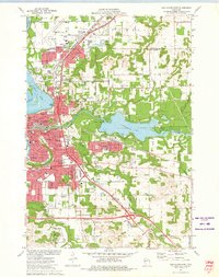 1972 Eau Claire East1975 Print · USGSThe Eau Claire area in the early seventies shows a vibrant university city expanding around the Chippewa River. Genealogists and local historians can trace neighborhood growth through numerous school sites like Davey Sch and cemeteries including Calvary Cem.2 unique versions available
 - 1973 Map of Cleghorn, 1975 Print
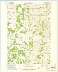 1973 Cleghorn1975 Print · USGSThe rural landscape south of Eau Claire is captured here in the early seventies as farming and local infrastructure defined the valley. Researchers can locate family sites near Hadleyville Cem, Pleasant Valley Ch, and Martinkas Landing Field.
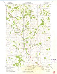
 - 1973 Map of Mondovi NE, 1975 Print
 1973 Mondovi NE1975 Print · USGSEau Claire County townships reveal their rural character in the early seventies, centered on crossroads like Mt Hope Corners. Researchers can locate family landmarks including Anthony Sch, Township Cem, and several country churches.
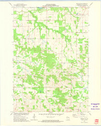
 - 1973 Map of Brackett, 1975 Print
 1973 Brackett1975 Print · USGSSoutheast of Eau Claire in the 1970s, this area reflects a quiet rural landscape of small crossroads and family farms. Genealogists and local historians can trace family-named landmarks and community centers like Brackett Sch, Hale Corner, and the Holy Guardian Angels Cem.
End of results
Showing maps 1-6 of 6
Top cities near Washington
- Eau Claire historical maps
- Chippewa Falls historical maps
- Altoona historical maps
- Lake Hallie historical maps
- Town of Washington historical maps
- Town of Lafayette historical maps
See more
Top neighborhoods of Washington
Frequently asked questions
- What are the different types of historical maps available for Washington?
- What is the oldest map of Washington?
- Where can I purchase historical maps of Washington for my home or office?
- Where can I download high-res historical maps of Washington?
- Are there historical topographic maps available for Washington?
- Is there historical aerial imagery available for Washington?
- Where are historical maps of Washington sourced from?