Old Maps of Arena, Wisconsin
Explore 25 old maps of Arena, spanning from 1905 to today. These high-resolution historic maps reveal how streets, neighborhoods, landmarks, and natural features evolved over time — perfect for genealogy, metal detecting, research, and local history exploration.
What you can do with these maps:
- See how Arena changed over time: Compare historical maps to modern-day views to trace roads, homesites, rail lines & more.
- View detailed metadata: Each map includes creators, publishers, year, scale, and archive source.
- Overlay maps with satellite & LiDAR: Visualize the past alongside modern tools to explore terrain & human change.
- Trusted historical sources: Maps sourced from the USGS, Library of Congress, and other archives.
- Access maps your way: View online, download high-res files, or order prints for personal or research use.
Start exploring old maps of Arena to uncover forgotten places, hidden landmarks, and the deep history beneath your feet.
Arena, WI maps
(25)- 1905 Map of Richland Center
 1905 Richland Center1905 Print · USGSRichland and Sauk Counties at the turn of the century show a landscape defined by the winding Wisconsin River and early rail expansion. Genealogists and historians can trace the foundations of local commerce through early post offices like Beach P.O. and rail hubs at Lone Rock and Richland Center.2 unique versions available
 - 1920 Map of Blue Mounds, 1959 Print
 1920 Blue Mounds1959 Print · USGSThe Driftless Area of Dane and Iowa counties comes to life in the years following the Great War, showing a landscape of ridge-top towns and river-valley rails. Genealogists can locate dozens of rural landmarks, from the Hyde Church to schools like Seitz School and Larsonville School.
 - 1922 Map of Blue Mounds
 1922 Blue Mounds1922 Print · USGSThe Wisconsin River valley and the Driftless Area uplands meet here in the early nineteen-twenties, showing a landscape defined by rail corridors and rural school districts. Researchers can pinpoint historic family landmarks like Hyde Church, the Coon Rock Mill, and Fairview School.3 unique versions available
 - 1957 Map of Madison, 1967 Print
 1957 Madison1967 Print · USGSSouth-central Wisconsin in the mid-fifties reveals a landscape of industrial hubs and glacial lakes linked by a dense rail and highway network. Genealogists and historians can trace the development of lakeside communities and find notable sites like Badger Ordnance Works and the Horicon National Wildlife Refuge.3 unique versions available
 - 1958 Map of La Crosse, 1979 Print
 1958 La Crosse1979 Print · USGSThe Driftless Area of Wisconsin and Iowa is captured here during the late seventies, showing the intricate river valleys and ridge-top settlements. Genealogists and historians can trace the rail corridors of the Soo Line or locate landmarks like Grandad Bluff and Effigy Mounds National Monument.2 unique versions available
 - 1960 Map of Madison
 1960 Madison1960 Print · USGSCentral and Southern Wisconsin are captured in the late fifties, showing the region as its rail-and-river network matured. Trace the paths of the Soo Line RR or locate family roots near Lake Mendota and Horicon National Wildlife Refuge.2 unique versions available
 - 1960 Map of Spring Green, 1962 Print
 1960 Spring Green1962 Print · USGSThe Wisconsin River valley and surrounding Driftless Area uplands are captured here in the early sixties. Researchers can trace rural lineages through numerous country landmarks like Unity Chapel, Gold Mine Sch, and the quiet crossroads at Clyde.2 unique versions available
 - 1961 Map of La Crosse
 1961 La Crosse1961 Print · USGSThe Driftless Area at the start of the 1960s reveals a complex network of river towns and rail lines along the Mississippi River. Genealogists and historians can trace old settlements like New Amsterdam and Wyattville or locate major landmarks like Camp McCoy Military Reservation and Effigy Mounds National Monument.
 - 1962 Map of Blue Mounds, 1964 Print
 1962 Blue Mounds1964 Print · USGSThe Wisconsin River valley and the driftless hills of Dane County are captured here in the early sixties. Genealogists and hikers can trace old ridge roads to Little Norway, the White Church Cem, and the underground wonders of Cave of the Mounds.3 unique versions available
 - 1962 Map of Mazomanie, 1964 Print
 1962 Mazomanie1964 Print · USGSThe Wisconsin River valley comes alive in the early sixties, showing the vital rail-and-river connection between local settlements. Genealogists and historians can locate St Barnabas Ch, the Cassell Cem, and the tracks of the Chicago Milwaukee St Paul and Pacific railroad.3 unique versions available
 - 1962 Map of Arena, 1964 Print
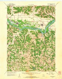
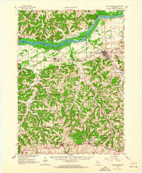
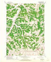
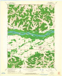 1962 Arena1964 Print · USGSIowa and Sauk Counties are captured in the early sixties as the rail-and-river economy defined local life. Researchers can trace family roots at Arena Cem and Davis Cem or locate old landmarks like Coon Rock Cave and Cassell.2 unique versions available
 - 1962 Map of Barneveld, 1964 Print
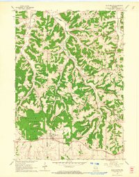
 1962 Barneveld1964 Print · USGSIowa County at the start of the sixties reveals a landscape of high ridges and winding valley farms. Genealogists and local historians can trace family locations through named sites like Jennieton Cem, the Hyde Ch, and the winding Chicago and North Western rail line.2 unique versions available
 - 1962 Map of Blue Mounds, 1964 Print
 1962 Blue Mounds1964 Print · USGSThe high driftless peaks of western Dane County stood at a crossroads of heritage and tourism in the early sixties. Researchers can trace the legacy of early settlements and family landmarks from Little Norway and Deneen Sch to the depths of Cave of the Mounds.3 unique versions available
 - 1965 Map of La Crosse
 1965 La Crosse1965 Print · USGSThe Driftless Area and the Upper Mississippi valley are captured here during a period of steady mid-century growth. Researchers can trace the rail lines of the Chicago and North Western or locate riverfront sites like Effigy Mounds National Monument and the Camp McCoy Military Reservation.
 - 1976 Map of La Crosse
 1976 La Crosse1976 Print · USGSThe Driftless Area and Mississippi River valley are captured here in the mid-seventies, showing a landscape of deep coulees and river commerce. Genealogists can trace family footprints from La Crosse to smaller hamlets like Newburg Corners and Witoka.
 - 1983 Map of Pleasant Ridge
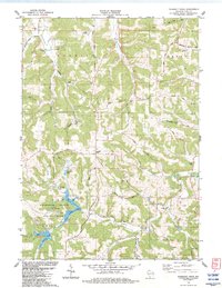 1983 Pleasant Ridge1983 Print · USGSIowa County is shown in the early eighties as a landscape of ridges and valleys transitioning into the recreation lands of the state park. Researchers can trace rural lineages through local landmarks like Rockwell Mills, Wyoming Sch, and the Griffith Cem.
 - 1983 Map of Spring Green
 1983 Spring Green1983 Print · USGSThe Wisconsin River valley in the early eighties shows a landscape defined by braided waterways and cultural landmarks. Genealogists can locate family sites like Old Helena Cem and Big Hollow Cem, or trace the grounds of Taliesin and Hillside Sch.
 - 1985 Map of Richland Center, 1991 Print
 1985 Richland Center1991 Print · USGSSouthwest Wisconsin’s driftless landscape in the mid-1980s is defined by its deep river valleys and tight agricultural settlements. Researchers can trace family-named landmarks like Mickelson Ridge or find remote churches and schools near Richland Center and Dodgeville.
 - 1991 Map of Madison
 1991 Madison1991 Print · USGSMadison and its iconic glacial lakes are captured here during a time of steady urban expansion and regional growth. Researchers can trace the mid-century development of the University of Wisconsin, locate family sites near Forest Hill Cem, or explore the footprint of the Badger Army Ammunition Plant.
 - 2022 Map of Barneveld, 2022 Print
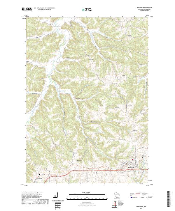 2022 Barneveld2022 Print · USGSIowa County in the early 2020s reflects a landscape of ridge-top settlements and deep-cut valleys. Researchers can trace the Military Ridge State Trl through Barneveld and Ridgeway, while locating rural sites like Jenneton Baptist Cem and Hyde.
 - 2022 Map of Arena, 2022 Print
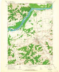
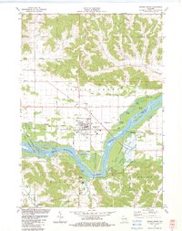
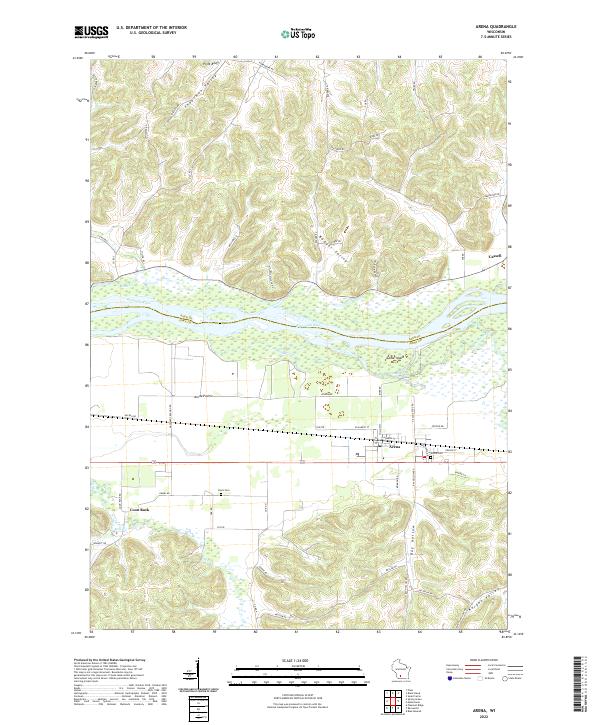 2022 Arena2022 Print · USGSThe Wisconsin River valley comes into sharp focus here as it divides Sauk and Iowa Counties. Researchers can trace the layout of Arena and Cassell, locate family plots at Arena Cem or Davis Cem, and explore landmarks like Coon Rock.
 - 2022 Map of Blue Mounds, 2022 Print
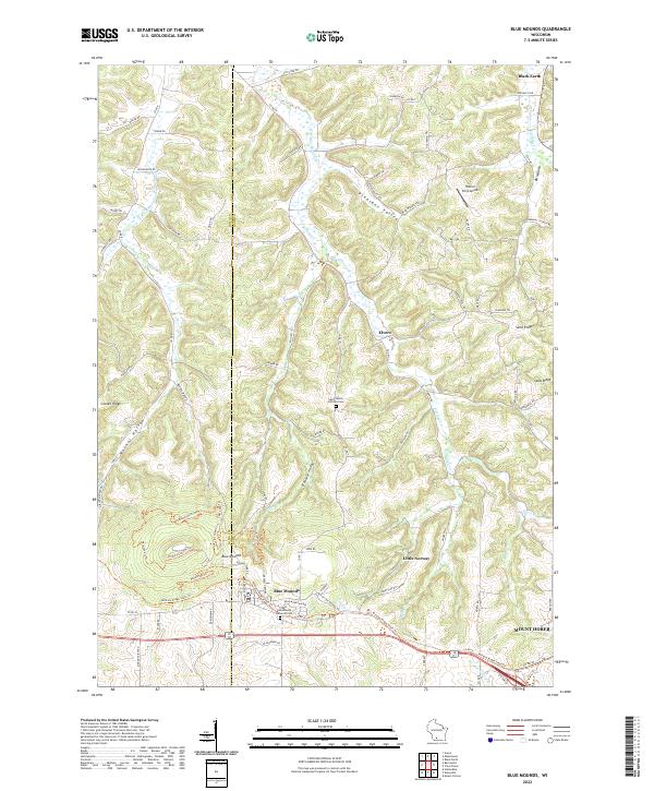 2022 Blue Mounds2022 Print · USGSSouthwestern Wisconsin's high-relief landscape comes alive in this contemporary survey of the Driftless Area. Local researchers can trace family landmarks and historical sites from Blue Mounds to Mount Horeb, including the Saint James Catholic Cem.
 - 2022 Map of Mazomanie, 2022 Print
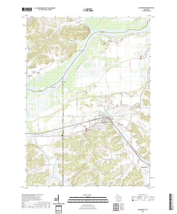 2022 Mazomanie2022 Print · USGSThe Wisconsin River valley and the village of Mazomanie are shown in detail as they appeared in the early 2020s. Researchers can trace local lineage through Saint Barnabas Cem, locate the site of Dover, or explore the terrain of Ferry Bluff.
 - 2022 Map of Pleasant Ridge, 2022 Print
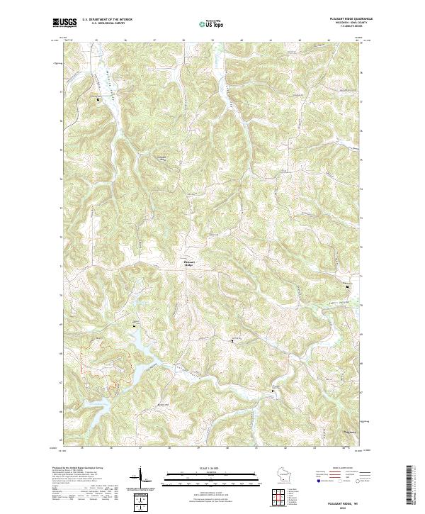 2022 Pleasant Ridge2022 Print · USGSThe Iowa County uplands appear in great detail during the early twenty-first century, showing the rural landscapes around Pleasant Ridge and Ridgeway. Researchers can trace local lineage at Rockwell Mills Cem or explore the water systems of Halverson Lake and Cox Hollow Lake.
 - 2022 Map of Spring Green, 2022 Print
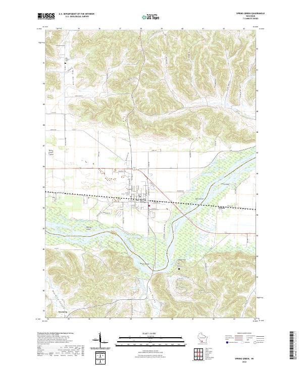 2022 Spring Green2022 Print · USGSThe Wisconsin River valley comes alive in this contemporary record of Sauk and Iowa Counties, showing the complex interaction of water and settlement. Local researchers can trace family landmarks and historical sites from Spring Green to the Old Helena Cem and Big Hollow Cem.
End of results
Showing maps 1-25 of 25
Top cities near Arena
- Mount Horeb historical maps
- Dodgeville historical maps
- Prairie du Sac historical maps
- Sauk City historical maps
- Roxbury historical maps
- Black Earth historical maps
See more
Top neighborhoods of Arena
Frequently asked questions
- What are the different types of historical maps available for Arena?
- What is the oldest map of Arena?
- Where can I purchase historical maps of Arena for my home or office?
- Where can I download high-res historical maps of Arena?
- Are there historical topographic maps available for Arena?
- Is there historical aerial imagery available for Arena?
- Where are historical maps of Arena sourced from?