2020s Maps of Dodgeville, Wisconsin
Explore 4 historic maps of Dodgeville from the 2020s. These maps offer a rare glimpse into what life looked like during the 2020s — showing old roads, neighborhoods, homes, and landmarks that have changed or disappeared over time.
Whether you're researching your family's past, planning a metal detecting trip, or studying how Dodgeville's landscape evolved across the 2020s, these high-resolution maps are a powerful tool for exploring the history of this region.
- Focus on a specific era: All maps on this page are from the 2020s, giving you a focused view of this time period.
- See what’s changed: Compare century-old streets, trails, and buildings to today's modern landscape using overlays and satellite layers.
- Research with precision: Use these maps for genealogy, historical research, land use analysis, or educational projects.
- View, download, or print: Maps are fully viewable online in high resolution, and can be downloaded or printed for your own records.
Start exploring Dodgeville's history through authentic maps from the 2020s. This is your window into the past.
Dodgeville, WI maps
(4)- 2022 Map of Jonesdale, 2022 Print
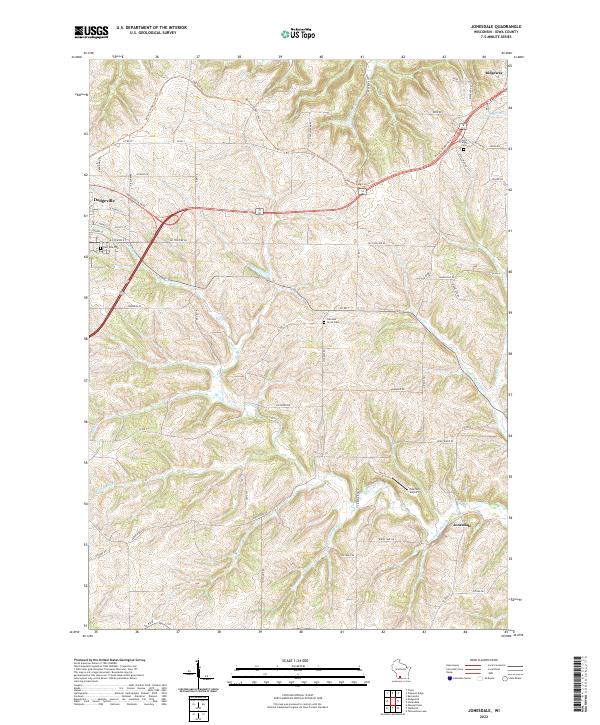 2022 Jonesdale2022 Print · USGSThe rolling hills of Iowa County are documented here in the early 2020s, showcasing the rural transition between Dodgeville and Ridgeway. Researchers can trace old family lands near Garrison Grove Cem, the path of the Military Ridge State Trl, and the small community of Jonesdale.
 - 2022 Map of Dodgeville, 2022 Print
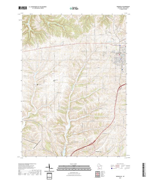 2022 Dodgeville2022 Print · USGSThe Iowa County seat and its rural surroundings are captured in this recent survey. Researchers can trace local heritage through the Iowa County Courthouse, Laxey Cem, and the path of the Military Ridge State Trl.
 - 2022 Map of Clyde, 2022 Print
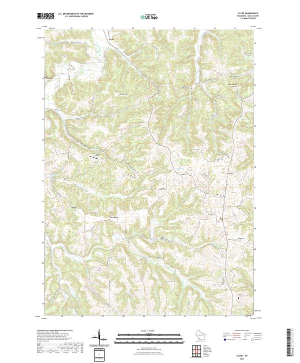 2022 Clyde2022 Print · USGSThe rural highlands of Iowa and Wisconsin are captured in this modern survey, revealing a landscape of deep valleys and ridges. Genealogists and local historians can trace legacy sites like Saint Malachy Cem and Rock Church Cem near the community of Clyde.
 - 2022 Map of Pleasant Ridge, 2022 Print
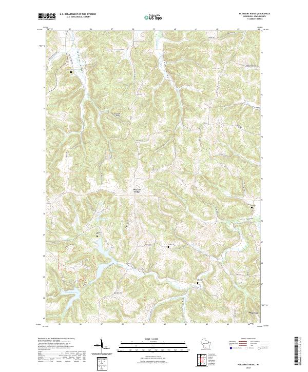 2022 Pleasant Ridge2022 Print · USGSThe Iowa County uplands appear in great detail during the early twenty-first century, showing the rural landscapes around Pleasant Ridge and Ridgeway. Researchers can trace local lineage at Rockwell Mills Cem or explore the water systems of Halverson Lake and Cox Hollow Lake.
End of results
Showing maps 1-4 of 4
Top cities near Dodgeville
- Dodgeville historical maps
- Mineral Point historical maps
- Spring Green historical maps
- Barneveld historical maps
- Lone Rock historical maps
- Arena historical maps
See more
Top neighborhoods of Dodgeville
Frequently asked questions
- What are the different types of historical maps available for Dodgeville?
- What is the oldest map of Dodgeville?
- Where can I purchase historical maps of Dodgeville for my home or office?
- Where can I download high-res historical maps of Dodgeville?
- Are there historical topographic maps available for Dodgeville?
- Is there historical aerial imagery available for Dodgeville?
- Where are historical maps of Dodgeville sourced from?