1900s (20th Century) Maps of Waldwick, Wisconsin
Explore 17 historic maps of Waldwick from the 1900s (20th Century). These maps offer a rare glimpse into what life looked like during the 1900s — showing old roads, neighborhoods, homes, and landmarks that have changed or disappeared over time.
Whether you're researching your family's past, planning a metal detecting trip, or studying how Waldwick's landscape evolved across the 1900s, these high-resolution maps are a powerful tool for exploring the history of this region.
- Focus on a specific era: All maps on this page are from the 1900s, giving you a focused view of this time period.
- See what’s changed: Compare century-old streets, trails, and buildings to today's modern landscape using overlays and satellite layers.
- Research with precision: Use these maps for genealogy, historical research, land use analysis, or educational projects.
- View, download, or print: Maps are fully viewable online in high resolution, and can be downloaded or printed for your own records.
Start exploring Waldwick's history through authentic maps from the 1900s. This is your window into the past.
Waldwick, WI maps
(17)- 1902 Map of Mineral Point
 1902 Mineral Point1902 Print · USGSSouthwest Wisconsin and Northern Illinois are mapped here at the height of the regional mining era. Genealogists and historians can trace the rail lines of the Illinois Central to vanished junctions and local landmarks like Meekers Grove, Calamine, and Elk Grove.4 unique versions available
 - 1923 Map of Blanchardville
 1923 Blanchardville1923 Print · USGSThe Driftless Area of southwest Wisconsin comes alive in the early 1920s, showing a landscape defined by the Pecatonica River and early rail lines. Genealogists can locate dozens of rural landmarks, from the York Churches to schools like Lukken School and Arneson School.2 unique versions available
 - 1954 Map of Rockford
 1954 Rockford1954 Print · USGSThe Rock River valley and the Illinois-Wisconsin borderlands are captured here in the mid-1950s during a period of robust industrial and agricultural activity. Genealogists and historians can trace rail-era corridors like the Illinois Central RR and locate landmarks from Big Foot Prairie to Lake Geneva.
 - 1955 Map of Rockford
 1955 Rockford1955 Print · USGSThe Rock River valley and southern Wisconsin dairy country are shown here in the mid-fifties as the region's manufacturing centers grew. Genealogists and historians can trace the paths of the Chicago and North Western RR and Illinois Central RR through hubs like Rockford and Beloit.
 - 1958 Map of Rockford, 1974 Print
 1958 Rockford1974 Print · USGSNorthern Illinois and southern Wisconsin are shown here in the mid-twentieth century as rail-dependent industrial towns began to interface with growing lakefront communities. Genealogists can trace family roots through settlements like Saylesville and Tess Corners or locate historical landmarks like the Rockford Ordnance Depot.4 unique versions available
 - 1959 Map of Dubuque, 1982 Print
 1959 Dubuque1982 Print · USGSThe Tri-State region comes alive in the mid-twentieth century as a hub of river commerce and rail transit. Genealogists and historians can trace the paths of the Illinois Central Gulf through Dubuque or locate the Savanna Ordnance Depot and Lock and Dam No 11.
 - 1961 Map of Dubuque
 1961 Dubuque1961 Print · USGSThe Tri-State region's river-and-rail landscape is captured here during the early sixties, showing the convergence of Iowa, Illinois, and Wisconsin. Trace mid-century rail lines like the Chicago Great Western Ry and explore sites like the Savanna Ordnance Depot and Backbone State Park.
 - 1962 Map of Dubuque
 1962 Dubuque1962 Print · USGSThe Tri-State region's river-and-rail economy is captured here in the early sixties, centered on the Mississippi River bluffs. Genealogists and historians can locate Numerous lead and zinc mines, the New Melleray Abbey Monastery, and rural hubs like Saint Olaf.2 unique versions available
 - 1962 Map of Blanchardville, 1964 Print
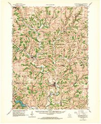 1962 Blanchardville1964 Print · USGSSouthern Wisconsin's rolling uplands and river valleys are captured here in the early sixties, showing the vital rail-and-river connection at Blanchardville. Researchers can trace rural life through dozens of local landmarks like the Moscow Center School, Yellowstone Church, and the newly created Yellowstone Lake.
 - 1962 Map of Jonesdale, 1964 Print
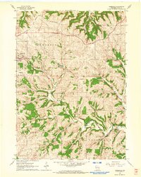 1962 Jonesdale1964 Print · USGSIowa County farmland and steep-sided valleys were still dominated by the rail-and-river network in the early sixties. Genealogists and local historians can locate rural landmarks like Simpson Chapel, the Hollyhead Sch, and St Bridgets Cem.
 - 1962 Map of Waldwick, 1964 Print
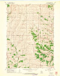 1962 Waldwick1964 Print · USGSThe rural borders of Iowa and Lafayette Counties come alive in this early 1960s survey of the Wisconsin driftless landscape. Researchers can trace the heritage of Waldwick and Fayette, locating historic sites like Jackson Cem and the Broad View Sch.2 unique versions available
 - 1962 Map of Hollandale, 1964 Print
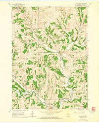 1962 Hollandale1964 Print · USGSWisconsin's Driftless Area near Hollandale and Ridgeway is captured here in the early 1960s, showing a landscape defined by deep valleys and ridge-top farming. Genealogists can locate family sites near Middlebury Ch Cem, Long Valley Cem, and the winding Old Railroad Grade.
 - 1962 Map of Yellowstone Lake, 1964 Print
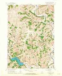 1962 Yellowstone Lake1964 Print · USGSIowa and Lafayette counties in the early 1960s reveal a landscape of rural schools and winding river valleys centered on the recently created Yellowstone Lake. Genealogists and local historians can trace legacy sites like St Michaels Ch, Moscow Center Sch, and the winding Old Railroad Grade.2 unique versions available
 - 1963 Map of Rockford
 1963 Rockford1963 Print · USGSThe mid-century industrial corridor along the Rock River is shown here during a period of rapid post-war growth. Researchers can trace the extensive rail lines of the Chicago and North Western or locate local landmarks like the Rockford Ordnance Depot and Holy Hill.
 - 1976 Map of Dubuque
 1976 Dubuque1976 Print · USGSThe tri-state borderlands of Iowa, Wisconsin, and Illinois come alive during the mid-seventies, showing a region built on river commerce and mining. Genealogists and historians can trace the paths of the Illinois Central railroad or locate heritage sites like the New Melleray Abbey Monastery and Backbone State Park.
 - 1981 Map of Monroe
 1981 Monroe1981 Print · USGSSouthern Wisconsin and the Illinois borderlands come into focus in the early 1980s, showcasing a landscape defined by dairy farming and river valleys. Genealogists can trace family roots through historic hubs like Monroe, Stoughton, and Brodhead, or locate regional landmarks such as Yellowstone Lake and the Sugar River.
 - 1984 Map of Dubuque North, 1985 Print
 1984 Dubuque North1985 Print · USGSThis Tri-State region was a hub of Midwestern mining and river commerce in the mid-eighties. Researchers can trace the legacy of the Lead District through specific sites like Annie Mine or locate early civic centers such as First Capitol State Park.2 unique versions available
End of results
Showing maps 1-17 of 17
Top cities near Waldwick
- Dodgeville historical maps
- Mineral Point historical maps
- Darlington historical maps
- Barneveld historical maps
- Wiota historical maps
- Argyle historical maps
See more
Top neighborhoods of Waldwick
Frequently asked questions
- What are the different types of historical maps available for Waldwick?
- What is the oldest map of Waldwick?
- Where can I purchase historical maps of Waldwick for my home or office?
- Where can I download high-res historical maps of Waldwick?
- Are there historical topographic maps available for Waldwick?
- Is there historical aerial imagery available for Waldwick?
- Where are historical maps of Waldwick sourced from?