Old Maps of Iron County, Wisconsin for Hiking & Exploration
Hike through history with 135 historic maps of Iron County. Explore old trails, ghost towns, and forgotten backroads — perfect for outdoor adventurers and local explorers.
- Rediscover forgotten places: Map out old mining camps, roads, and footpaths that no longer exist on modern maps.
- Layer with modern tools: Combine with LiDAR or satellite views to plan hikes through historical terrain.
- Made for exploration: Popular among hikers, overlanders, and local history lovers.
Use these maps to find adventure and explore the hidden past of Iron County.
Iron County, WI maps
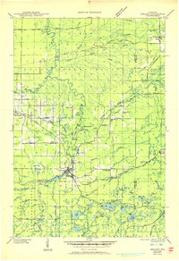
(135)- 1938 Map of Lac Du Flambeau, 1959 Print
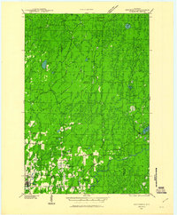
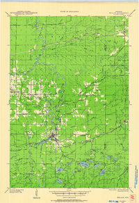
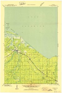
 1938 Lac Du Flambeau1959 Print · USGSThe Wisconsin lake district appears in detail during the late 1930s, showing the early infrastructure of the northern woods. Researchers can trace the Chicago and Northwestern rail line and locate community landmarks like Marlands Sch and the Flambeau Fire Tower.2 unique versions available
 - 1939 Map of Lac Du Flambeau
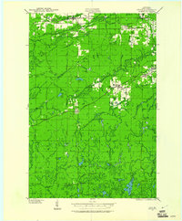
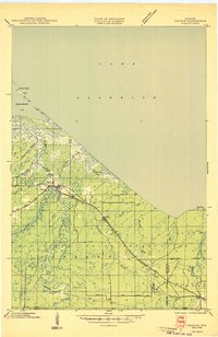
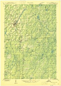
 1939 Lac Du Flambeau1939 Print · USGSWisconsin's lake country is captured here in the late thirties, documenting a landscape defined by the intersection of tribal lands and national forests. Genealogists and historians can trace the early rail stops and rural schoolhouses like Marlands Sch, Hasener, and the Lac du Flambeau Sta.
 - 1939 Map of Winchester
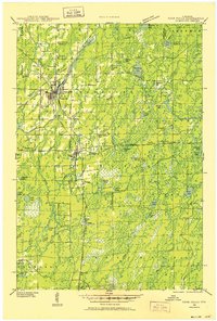
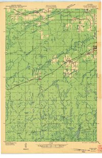
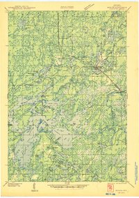
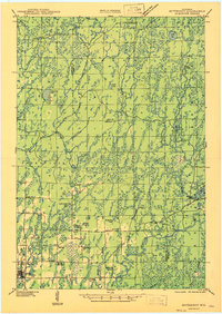
 1939 Winchester1939 Print · USGSWisconsin's lake-strewn Northwoods are documented here in the late thirties as the region transitioned into a destination for conservation and recreation. Researchers can locate Depression-era infrastructure like the CCC Camp or trace family roots near Winchester, Spider Lake Sch, and Powell.2 unique versions available
 - 1940 Map of Mercer, 1953 Print
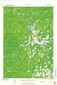
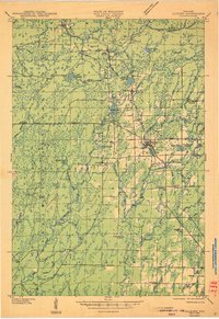
 1940 Mercer1953 Print · USGSIron County’s lake-rich landscape is captured in the early 1940s, showing the early growth of Northwoods tourism and timber management. Researchers can trace the rail corridor of the Chicago and Northwestern, find the rural Springstead Sch, and locate the historic Mercer Fire Tower.
 - 1940 Map of Butternut, 1961 Print
 1940 Butternut1961 Print · USGSAshland and Iron Counties come alive in this wartime-era survey of the Northwoods timber and rail country. Genealogists and historians can trace rural schoolhouses like Otto Sch, the local government at Agenda Town Hall, and the old rail paths of the Soo Line.
 - 1940 Map of Upson, 1961 Print
 1940 Upson1961 Print · USGSIron County’s timber and rail history is captured here at the start of the 1940s, when the northwoods were dotted with logging camps and active sidings. Genealogists and historians can trace family ties at Hillside Cem or locate the distinct footprints of Iron Belt and the remote LeClair Camp.2 unique versions available
 - 1941 Map of Park Falls, 1952 Print
 1941 Park Falls1952 Print · USGSPrice County in the early 1940s is shaped by the river-and-rail economy centered on Park Falls and Fifield. Researchers can trace old rural schoolhouses like Sugarbush Sch and forgotten rail stops at Coolidge and Lugerville.2 unique versions available
 - 1941 Map of Pike Lake, 1952 Print
 1941 Pike Lake1952 Print · USGSPrice County timberland and lake country are captured here at the end of the 1930s as the river-and-rail economy transitioned toward forest management. Genealogists and historians can locate the Riley Creek CCC Camp, the Shady Knoll Sch, and landmarks like the South Fork Fire Tower.3 unique versions available
 - 1942 Map of Pike Lake
 1942 Pike Lake1942 Print · USGSPrice County and the surrounding lake country are documented here in the early 1940s, showing a landscape shaped by timber and early recreation. Researchers can trace the Riley Creek CCC Camp, the Shady Knoll Sch, and landmarks like the South Fork Fire Tower.
 - 1942 Map of Glidden, 1956 Print
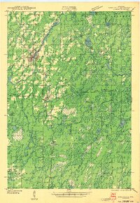
 1942 Glidden1956 Print · USGSAshland and Iron counties come alive in the early 1940s, showing a landscape shaped by the Minneapolis St Paul and Sault Ste Marie RR and the Chequamegon National Forest. Genealogists can locate family landmarks like the Morse Cem or several rural schools, including the Peeksville Sch and Washington Sch.
 - 1942 Map of Mellen, 1959 Print
 1942 Mellen1959 Print · USGSAshland County and the Iron County border come alive in the early 1940s as a landscape of timber, iron rails, and deep Northwoods lakes. Researchers can trace the path of the Minneapolis St Paul and Sault Ste Marie railroad or locate family sites like Sedgwick and the St Johns Cem.
 - 1943 Map of Little Girls Point
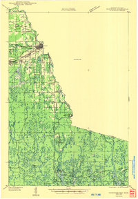
 1943 Little Girls Point1943 Print · USGSThe Lake Superior coast at the Michigan-Wisconsin border appears here in the early 1940s, showing a landscape defined by state lines and iron-range railroads. Trace the routes of the C & N W railroad near Cedar or locate the Lake View Cem in this surveyed borderland.
 - 1943 Map of Upson
 1943 Upson1943 Print · USGSIron County during the early 1940s reveals a landscape shaped by mining, timber, and the railroads that served them. Genealogists and local historians can trace family-named outposts like McIver Camp and LeClair Camp or locate burials at Hillside Cem.2 unique versions available
 - 1943 Map of Ironwood
 1943 Ironwood1943 Print · USGSThe border country between Wisconsin and Michigan comes alive in this wartime survey of the iron range and timberlands. Researchers can trace early rural life through vanished sites like the Mosinee Lumber Camp, the Chicago and Northwestern Line, and local hubs like Buskirk.2 unique versions available
 - 1943 Map of Park Falls
 1943 Park Falls1943 Print · USGSPrice County timber and river life are frozen in time during the early 1940s, showing the early development of Park Falls and Fifield. Genealogists and historians can trace dozens of rural schoolhouses like Divine Rapids Sch and old landmarks like the Fifield Fire Tower.
 - 1943 Map of Little Girl Point
 1943 Little Girl Point1943 Print · USGSThe Lake Superior shoreline at the Wisconsin-Michigan border is shown here as it appeared in the early 1940s. Genealogists and local historians can trace the La Pointe Indian Reservation and the tracks of the Duluth South Shore and Atlantic railroad.
 - 1943 Map of Odanah, 1952 Print
 1943 Odanah1952 Print · USGSNorthern Wisconsin's Lake Superior shoreline and the Bad River delta are captured here during the early 1940s. Genealogists and historians can trace the Chicago and Northwestern rail line and local settlements at Odanah, Birch, and Rufus.
 - 1945 Map of Odanah
 1945 Odanah1945 Print · USGSCoastal Ashland and Iron counties are documented here in the 1940s, highlighting the intricate river systems of the Bad River Indian Reservation. Researchers can trace the Chicago and Northwestern rail line through early settlements like Odanah, Rufus, and Birch.
 - 1945 Map of Mercer
 1945 Mercer1945 Print · USGSIron County in the mid-1940s is defined by its massive flowage systems and transition from rail to highway travel. Genealogists and researchers can trace the rural infrastructure of Mercer via the Springstead Sch, Mercer Fire Tower, and the Chicago and Northwestern tracks.
 - 1945 Map of Glidden
 1945 Glidden1945 Print · USGSThe Northwoods of Ashland County during the mid-forties show a landscape defined by timber history and early highway travel. Researchers can trace the Soo Line rail corridor through Glidden or locate rural landmarks like Shanagolden and the Morse Cem.
 - 1945 Map of Mellen, 1950 Print
 1945 Mellen1950 Print · USGSAshland and Iron Counties come alive in the mid-1940s, showing a rugged landscape of iron-range railways and remote forest schools. Genealogists can trace family landmarks like Coria Sch, St Johns Sch, and the rail junction at Mellen.
 - 1946 Map of Winchester
 1946 Winchester1946 Print · USGSNorthern Wisconsin's lake country was a landscape of remote settlements and timber management during the mid-forties. Genealogists and local historians can trace the footprint of early communities at Winchester and Presque Isle, or locate the Winegar Church and the regional CCC Camp.
 - 1946 Map of Lac Du Flambeau
 1946 Lac Du Flambeau1946 Print · USGSOneida and Vilas counties are seen here in the mid-1940s, a time when the lake country was defined by timber management and rail access. Genealogists can locate the Marlands Sch and Lac du Flambeau Sta along the Chicago and Northwestern line.
 - 1947 Map of Park Falls
 1947 Park Falls1947 Print · USGSThe Northwoods of Price County come alive in the 1940s, centered on the paper-milling hub of Park Falls and the Flambeau River. Genealogists and local historians can trace rural school districts like Sugarbush Sch or locate the site of the Fifield Fire Tower.
 - 1947 Map of Butternut
 1947 Butternut1947 Print · USGSThe village of Butternut and the surrounding timberlands are captured here in the late 1940s. Genealogists and local historians can trace rural schoolhouse locations like Tank Sch and Smart Sch alongside early industry at Teeter Camp.
Showing maps 1-25 of 135
Top cities of Iron County
- Mercer historical maps
- Hurley historical maps
- Montreal historical maps
- Kimball historical maps
- Saxon historical maps
- Gurney historical maps
Frequently asked questions
- What are the different types of historical maps available for Iron County?
- What is the oldest map of Iron County?
- Where can I purchase historical maps of Iron County for my home or office?
- Where can I download high-res historical maps of Iron County?
- Are there historical topographic maps available for Iron County?
- Is there historical aerial imagery available for Iron County?
- Where are historical maps of Iron County sourced from?