
1941 Map of Pike Lake
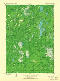
USGS Topo · Published 1952This historical map portrays the area of Pike Lake in 1941, primarily covering Price County as well as portions of Oneida County, Vilas County, and Iron County. Featuring a scale of 1:48000, this map provides a highly detailed snapshot of the terrain, roads, buildings, counties, and historical landmarks in the Pike Lake region at the time. Published in 1952, it is one of 3 known editions of this map due to revisions or reprints.
Find a feature on this map
82 named features on this map. Tap any name to fly to it.
Don’t see what you’re looking for? This feature index may not catch every label — zoom into the map to look around manually.
Map Details
Editions of this 1941 Pike Lake Map
3 editions found
Historical Maps of Iron County Through Time
39 maps found

1941 Brantwood
Price County, WI

1941 Kennedy
Price County, WI

1941 Pike Lake
Price County, WI

1942 Pike Lake
Price County, WI

1943 Brantwood
Price County, WI

1945 Kennedy
Price County, WI

1950 Pike Lake
Price County, WI

1968 Park Falls NE
Price County, WI

1968 Park Falls SE
Price County, WI

1970 Butternut Lake
Price County, WI

1970 Jump River Fire Tower NE
Price County, WI

1970 Lugerville
Price County, WI

1970 Ogema NW
Price County, WI

1971 Lac Sault Dore
Price County, WI

1971 Pike Lake NW
Price County, WI

1971 Pike Lake
Price County, WI

1971 Pike Lake SE
Price County, WI

1971 Pike Lake SW
Price County, WI

1979 Big Briens Lake
Price County, WI

1979 Brantwood
Price County, WI

1979 Dover
Price County, WI

1979 Spirit
Price County, WI

1979 Timms Hill
Price County, WI

1980 Thunder Creek
Price County, WI

1984 Blockhouse Lake
Price County, WI

1984 Cranberry Lake
Price County, WI

1984 Gates Lake
Price County, WI

1984 Pennington
Price County, WI

1984 Priest Lake
Price County, WI

2005 Blockhouse Lake
Price County, WI

2005 Dover
Price County, WI

2005 Gates Lake
Price County, WI

2005 Jump River Fire Tower NE
Price County, WI

2005 Ogema NW
Price County, WI

2005 Pike Lake NW
Price County, WI

2005 Pike Lake
Price County, WI

2005 Pike Lake SE
Price County, WI

2005 Pike Lake SW
Price County, WI

2005 Thunder Creek
Price County, WI