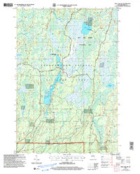
2005 Map of Pike Lake SW
USGS Topo · Published 2006About this map
Chequamegon-Nicolet National Forest dominates this Price County landscape, defining a region where water management and wilderness preservation overlap. Centered on the sprawling Wilson Flowage, the map reveals an intricate network of marshes and tributaries, including Popple Creek and Glover Creek, that feed the Elk River basin. The area is heavily compartmentalized into conservation zones, such as the Wilson Flowage Wildlife Management Area and the Popple Creek Wetland Habitat Area, reflecting modern ecological priorities.
Find a feature on this map
21 named features on this map. Tap any name to fly to it.
Don’t see what you’re looking for? This feature index may not catch every label — zoom into the map to look around manually.
Map Details
Editions of this 2005 Pike Lake SW Map
This is the sole edition of this map. No revisions or reprints were ever made.
Other maps of this area

1941 · Park Falls
USGS Topo · 1:48,000

1941 · Pike Lake
USGS Topo · 1:48,000

1941 · Phillips
USGS Topo · 1:48,000

1941 · Brantwood
USGS Topo · 1:48,000

1942 · Pike Lake
USGS Topo · 1:48,000

1943 · Park Falls
USGS Topo · 1:48,000

1943 · Philliips
USGS Topo · 1:48,000

1943 · Brantwood
USGS Topo · 1:48,000

1947 · Park Falls
USGS Topo · 1:48,000

1950 · Pike Lake
USGS Topo · 1:48,000