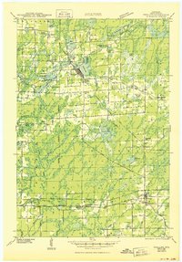
1941 Map of Phillips
USGS Topo · Published 1967About this map
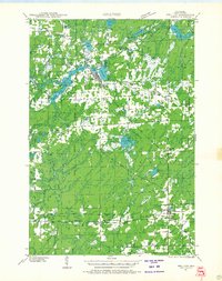
Phillips and Prentice anchor this 1941 landscape, which is defined by the intersection of the Elk River and the sprawling Minneapolis St Paul and Sault Ste Marie railroad network. The area shows a dense distribution of rural educational centers such as the Kerr Slashing Sch and Crane and Chase Sch, reflecting a time of dispersed agricultural and timber-based settlements in Price County. Significant water features like Solberg Lake and Cranberry Lake are central to the terrain, punctuated by the industrial presence of rail lines through Worcester and Pennington. Local history is preserved in the location of the Hackett Cem and numerous small country churches like Little Elk Ch, which provided social structure to the timberlands. The map reveals an intricate network of township boundaries, including Flambeau and Hackett, during an era of transition for northern Wisconsin's inland waterways and forest roads.
Find a feature on this map
68 named features on this map. Tap any name to fly to it.
Don’t see what you’re looking for? This feature index may not catch every label — zoom into the map to look around manually.
Map Details
Editions of this 1941 Phillips Map
This is the sole edition of this map. No revisions or reprints were ever made.
Historical Maps of Worcester Through Time
5 maps found