
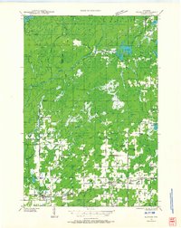
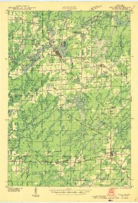
1941 Map of Kennan
USGS Topo · Published 1952About this map
The Minneapolis St Paul and Sault Ste Marie railroad defines the southern industrial corridor of this 1941 survey, connecting the timber and farming settlements of Hawkins, Kennan, and Catawba. This landscape is deeply shaped by the South Fork Flambeau River and its numerous tributaries, including Skinner Creek and Jump River, which move through a mosaic of woodlots and clearings. The distribution of rural education is a primary feature of the era, marked by one-room schoolhouses like Fairview Sch, South Fork Sch, and Four Corners Sch.
Find a feature on this map
53 named features on this map. Tap any name to fly to it.
Don’t see what you’re looking for? This feature index may not catch every label — zoom into the map to look around manually.
Map Details
Editions of this 1941 Kennan Map
2 editions found
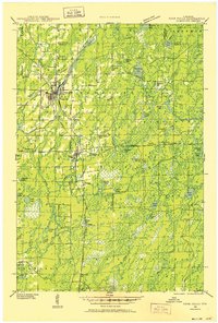
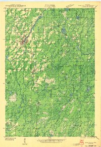
Other maps of this area
1941 · Park Falls
USGS Topo · 1:48,000

1941 · Kennedy
USGS Topo · 1:48,000
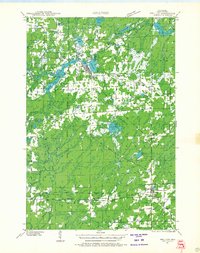
1941 · Phillips
USGS Topo · 1:48,000
1943 · Park Falls
USGS Topo · 1:48,000
1943 · Philliips
USGS Topo · 1:48,000

1944 · Ogema
USGS Topo · 1:48,000

1944 · Draper
USGS Topo · 1:48,000
1945 · Kennedy
USGS Topo · 1:48,000

1945 · Kennan
USGS Topo · 1:48,000

1945 · Black River
USGS Topo · 1:48,000