
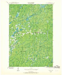
1944 Map of Draper
USGS Topo · Published 1952About this map
Logging camps and fire watchtowers define this northern Wisconsin landscape as it appeared during the 1940s. The neighboring settlements of Loretta and Draper serve as the primary hubs along the Minneapolis St Paul and Sault Ste Marie Railway, which cuts a horizontal path through the timberlands. The map reveals the region's industrial and forestry roots through numerous named sites such as Old Le May Camp, Old Koshack Camp, and an Abandoned CCC Camp, illustrating the era's reliance on organized labor in the woods.
Find a feature on this map
51 named features on this map. Tap any name to fly to it.
Don’t see what you’re looking for? This feature index may not catch every label — zoom into the map to look around manually.
Map Details
Editions of this 1944 Draper Map
2 editions found
Other maps of this area

1941 · Kennan
USGS Topo · 1:48,000

1941 · Kennedy
USGS Topo · 1:48,000

1942 · Glidden
USGS Topo · 1:48,000

1942 · Clam Lake
USGS Topo · 1:48,000

1943 · Namekagon Lake
USGS Topo · 1:48,000

1944 · Exeland
USGS Topo · 1:48,000

1944 · Radisson
USGS Topo · 1:48,000

1945 · Kennedy
USGS Topo · 1:48,000

1945 · Namekagon Lake
USGS Topo · 1:48,000

1945 · Clam Lake
USGS Topo · 1:48,000