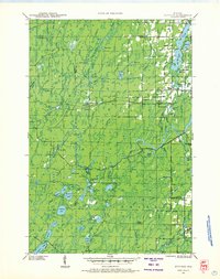
1941 Map of Kennedy
USGS Topo · Published 1968About this map
Butternut Lake and the dense woodlands of the Chequamegon National Forest dominate this landscape during the early 1940s. The settlement of Kennedy serves as a central point along the Chicago and Northwestern railroad line, which cuts through the timber-rich terrain of Price, Sawyer, and Ashland counties. Further south, the community of Lugerville sits near the banks of the Flambeau River, anchored by the Lugerville Fire Tower and the Old Mill Dam.
Find a feature on this map
80 named features on this map. Tap any name to fly to it.
Don’t see what you’re looking for? This feature index may not catch every label — zoom into the map to look around manually.
Map Details
Editions of this 1941 Kennedy Map
2 editions found
Other maps of this area

1940 · Butternut
USGS Topo · 1:48,000

1941 · Park Falls
USGS Topo · 1:48,000

1941 · Kennan
USGS Topo · 1:48,000

1941 · Kennedy
USGS Topo · 1:48,000

1941 · Phillips
USGS Topo · 1:48,000

1942 · Glidden
USGS Topo · 1:48,000

1942 · Clam Lake
USGS Topo · 1:48,000

1943 · Park Falls
USGS Topo · 1:48,000

1943 · Philliips
USGS Topo · 1:48,000

1944 · Draper
USGS Topo · 1:48,000