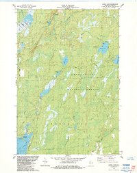
1984 Map of Gates Lake
USGS Topo · Published 1984About this map
Chequamegon National Forest dominates this Price County landscape, preserving a wilderness character defined by complex hydrology and timberland. The boundary between the townships of Fifield and Worcester cuts across a terrain saturated with glacial features, including the Hogsback Springs and numerous isolated basins. This 1984 survey highlights the developed recreational aspects of the forest, specifically at Sailor Lake and Solberg Lake, where established campgrounds, picnic areas, and boat ramps facilitate access to these Northwoods waters.
Find a feature on this map
29 named features on this map. Tap any name to fly to it.
Don’t see what you’re looking for? This feature index may not catch every label — zoom into the map to look around manually.
Map Details
Editions of this 1984 Gates Lake Map
This is the sole edition of this map. No revisions or reprints were ever made.
Other maps of this area

1941 · Park Falls
USGS Topo · 1:48,000

1941 · Pike Lake
USGS Topo · 1:48,000

1941 · Phillips
USGS Topo · 1:48,000

1941 · Brantwood
USGS Topo · 1:48,000

1942 · Pike Lake
USGS Topo · 1:48,000

1943 · Park Falls
USGS Topo · 1:48,000

1943 · Philliips
USGS Topo · 1:48,000

1943 · Brantwood
USGS Topo · 1:48,000

1947 · Park Falls
USGS Topo · 1:48,000

1950 · Pike Lake
USGS Topo · 1:48,000