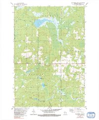
1979 Map of Big Briens Lake
USGS Topo · Published 1991About this map
The South Fork Jump River winds through the northern portion of this landscape, carving through the townships of Hackett, Prentice, and Knox. This 1970s topography reveals a region defined by its hydrology and timber-era transport networks, with Big Briens Lake and Little Briens Lake serving as central landmarks. Local family names and early settlement patterns are preserved in the road network, including Nyberg Hill Road, Goetzke Road, and the descriptive Mail Route Road.
Find a feature on this map
19 named features on this map. Tap any name to fly to it.
Don’t see what you’re looking for? This feature index may not catch every label — zoom into the map to look around manually.
Map Details
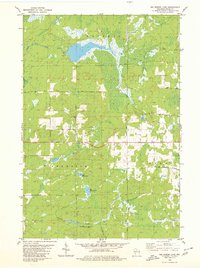
Editions of this 1979 Big Briens Lake Map
2 editions found
Other maps of this area

1941 · Phillips
USGS Topo · 1:48,000

1941 · Brantwood
USGS Topo · 1:48,000

1943 · Philliips
USGS Topo · 1:48,000

1943 · Brantwood
USGS Topo · 1:48,000

1944 · Ogema
USGS Topo · 1:48,000

1945 · Rib Lake
USGS Topo · 1:48,000

1947 · Rib Lake
USGS Topo · 1:48,000

1947 · Ogema
USGS Topo · 1:48,000

1949 · Ogema
USGS Topo · 1:48,000

1949 · Rib Lake
USGS Topo · 1:48,000