1980s Maps of Sherman, Wisconsin
Explore 6 historic maps of Sherman from the 1980s. These maps offer a rare glimpse into what life looked like during the 1980s — showing old roads, neighborhoods, homes, and landmarks that have changed or disappeared over time.
Whether you're researching your family's past, planning a metal detecting trip, or studying how Sherman's landscape evolved across the 1980s, these high-resolution maps are a powerful tool for exploring the history of this region.
- Focus on a specific era: All maps on this page are from the 1980s, giving you a focused view of this time period.
- See what’s changed: Compare century-old streets, trails, and buildings to today's modern landscape using overlays and satellite layers.
- Research with precision: Use these maps for genealogy, historical research, land use analysis, or educational projects.
- View, download, or print: Maps are fully viewable online in high resolution, and can be downloaded or printed for your own records.
Start exploring Sherman's history through authentic maps from the 1980s. This is your window into the past.
Sherman, WI maps
(6)- 1980 Map of Ironwood
 1980 Ironwood1980 Print · USGSThe Michigan-Wisconsin borderlands appear in the late twentieth century as a landscape defined by iron mining and deep forests. Researchers can trace the rail-and-river economy through the Soo Line and Chicago and North Western tracks connecting Mellen, Glidden, and Hurley.
 - 1980 Map of Park Falls
 1980 Park Falls1980 Print · USGSNorthern Wisconsin's timber and rail corridor is meticulously detailed here in the early eighties. Researchers can trace the Soo Line through forest-bound towns like Park Falls, Phillips, and Lugerville while exploring the vast Chequamegon National Forest.
 - 1981 Map of Powell, 1982 Print
 1981 Powell1982 Print · USGSIron and Vilas counties are seen here in the early 1980s, where the Northwoods landscape is shaped by the Chicago and North Western railroad. Trace the small settlements of Powell and Powell No 2 alongside the sprawling Powell Marsh State Public Hunting Grounds.
 - 1984 Map of Blockhouse Lake
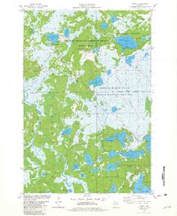
 1984 Blockhouse Lake1984 Print · USGSNorthern Wisconsin's timberlands and river systems are shown in great detail during the 1980s. You can trace the winding South Fork Flambeau River past Sugarbush Dam and locate secluded camps near Blockhouse Lake and Iodine Lake.
 - 1984 Map of Hay Creek Flowage
 1984 Hay Creek Flowage1984 Print · USGSThe northern Wisconsin wilderness comes into focus in the 1980s, centered on the complex river systems of the Ashland and Iron County line. You can trace the rocky navigation of the Flambeau River past Bear Skull Rock, Stubbs Rapids, and Petes Landing.
 - 1989 Map of Rhinelander, 1990 Print
 1989 Rhinelander1990 Print · USGSThe Wisconsin Northwoods are captured here in the late eighties, showing a landscape defined by water and timber management. Researchers can trace the Soo Line rail corridors and find local landmarks like Rainbow Flowage, Pelican Lake, and the Rhinelander-Oneida Co Airport.
End of results
Showing maps 1-6 of 6
Top cities near Sherman
- Minocqua historical maps
- Lac du Flambeau historical maps
- Mercer historical maps
- Fifield historical maps
- Manitowish Waters historical maps
- Winchester historical maps
Top neighborhoods of Sherman
Frequently asked questions
- What are the different types of historical maps available for Sherman?
- What is the oldest map of Sherman?
- Where can I purchase historical maps of Sherman for my home or office?
- Where can I download high-res historical maps of Sherman?
- Are there historical topographic maps available for Sherman?
- Is there historical aerial imagery available for Sherman?
- Where are historical maps of Sherman sourced from?